Showing posts with label Sandpit Lane. Show all posts

Wednesday, 12 July 2023

After 78 years


The Beaumonts estate as first laid out. Much of Beaumonts Wood has gone to provide ground for the schools and their playing fields. The broken orange lines never saw the light of day – a short stub of the extended Central Drive is now Oakwood School's entrance drive.


This map was surveyed in 1939.  The Central Drive/Oakwood Drive corner
is on the far right.  It would have been a cross-roads.  A swathe of wooded
ground has already been carved out to make the extension of Oakwood
Drive towards Sandpit Lane, which never happened. There are
other roads with no homes yet behind them. They would appear after WW2.

The final tranche of land belonging to Beaumonts Farm was offered for sale in 1929 and was acquired by holding company Watford Land. The company set out the road plan which would connect with Sandpit Lane, Beaumont Avenue and Hatfield Road, and at subsequent auctions plots were purchased by a number of mainly local house-building companies.  Two spine roads, Beechwood Avenue and Oakwood Drive, were to connect Hatfield Road with Sandpit Lane.  A third one had already existed, and had done so for centuries, Beaumont Avenue.  Beechwood Avenue had been aligned  with the agreement of the council, to connect with Marshalswick Lane as part of what was then known as the Circle Road (ring road).

Three connecting roads also appeared on the development map: Elm Drive, Central Drive and Chestnut Drive. None was completed to their finished lengths.  For the next ten years house building continued, working from Hatfield Road and the southern end of the estate, until in 1940 everything halted because of the war. Most of Beechwood and Elm had been completed. So too had the southern end of Woodland.  Hazelwood south was largely finished on one side and Oakwood had almost reached the future Central Drive.

Oakwood Drive looking towards the corner with Central Drive and in the direction of Sandpit Lane (not, of course, visible).  The (cream) house straight ahead would make such an extension impossible
today.

But restarting such a development after hostilities had finished would financially and logistically be a challenge; many pre-war housebuilding firms did not survive the interregnum, and the post-war license system limited how much building each could carry out.  In part the council came to the rescue by purchasing the swathe of ground from Woodland Drive to the school playing fields boundary.  A revised road layout was devised which took the boundary up to the playing field fence, which would then prevent Oakland Drive from continuing from the Central Drive junction as far as Sandpit Lane. Which later enabled number 51 Central Drive to be constructed in the space of the redundant road line.

The council then built a number of houses for rental in Woodland Drive and Hazelwood Drive north.

Of course, since our home area was effectively a huge building site children of the 1940s and 50s were able to take the short route from Oakwood Drive to Sandpit Lane by walking along the western side of the chain link fence erected by the County Education Department; and once the Hazelwood houses were in build it was easy enough to hop over the fence and follow the same line along the inside edge of the school field.  You could wonder how the author knows that odd fact if you like!  You could even wonder how much is known about the oak tree part way along that walked path close to where the Verulam School's pavilion is located.

Blue circle: Oakwood/Central corner. Red circle: approximate location of oak tree near Verulam School changing rooms. Yellow circle: beginning of path along Eagle Way. Green broken line: intended path
from Eagle Way to Central Drive. Green dotted lines: informal pathways worn by children in the 1950s.

Almost as soon as we had climbed over that fence we were able to nip across the field to Oaklands Wood, still there behind Oakwood School's site but now much depleted.  The woodland wasn't in any sense public; we knew that because there was a large sign fixed to a tree which informed us to KEEP OUT.  But we ventured there anyway.

I have reached this far in the post to reach the connection between the 1950s and a decision made recently...

Standing out against the sky at Oaklands Grange.

... in the 21st century and at the new housing on the edge of  land belonging to Oaklands, called Oaklands Grange.  Now that the homes are largely all out of the ground an increasing number of people have become familiar with Oaklands Grange and its access to Sandpit Lane not far from the opposite driveway from Newgates, a former mini farm, and the access drive from the Verulam School field.

To leave the Oaklands Grange development residents must walk first to Sandpit Lane – ah ha, so quite close to the old informal route youngsters walked in the 1940s and 50s; seventy-eight years or so after a certain number of those young children found their own way between Sandpit Lane and Central Drive.  If they weren't going to build the extension road, we'll find our own way.  So, an informal path was gradually worn in.   

The future path begins.

The path from Eagle Way skirts outside the boundary of Oakwood School towards
Central Drive.

Children living today at Oaklands Grange are to be given an alternative to the walk along Sandpit Lane, Beechwood Avenue and Central Drive to reach their schools.  They will be able to take a short cut.  The formal start of the path is already prepared at the southern end of Eagle Way.  Pass a few trees westwards and you will reach the former KEEP OUT sign and pass to the outside of the Oakwood School boundary, now itself wooded to reach the school entrance at Central Drive.

Two informal footpaths worn by 1950s children not trying very hard to keep out of trouble, now become part of the 2020s story of families finding their way between home and school along almost the same footpath.  There is little doubt that the child evacuees who came to be part of Beaumont Schools during the 1940s also adventured along these two routes to reach Sandpit Lane and to explore Oaklands Wood and its KEEP OUT sign.

We will look out for the official opening of the new link path, hopefully soon. 


Monday, 26 June 2023

The Little Books 3

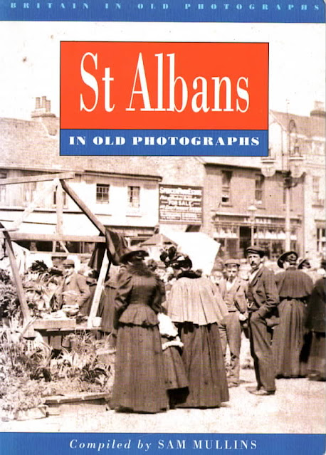
 This week's book takes a step up with the number of photographs laid out, and even selects a few leading images spread across its double pages. The title is St Albans in Old Photographs by Sam Mullins, published in 1994 (ISBN0750901209) within a series under the umbrella of Britain in Old Photographs.  As with previous books in the series we are exploring SAinOP appears not to be in print; however two copies are currently advertised for sale on Abe (www.abebooks.co.uk).


St Albans in Old Photographs not only has a more expansive  selection of images than in the previous two publications, but its division into twelve distinct sections gives more scope for presenting a larger number of themed scenes, recognisable locations, small groups and even individual St Albans' residents. Remembering that our inquiry centres on whether the Eastern districts are fairly represented in the total collection, we should first define those boundaries: any part of the city (the current District) which is east of the Midland Railway.  In the books St Albans' Own East End the historical boundary was the parish of St Peter, but if the author's brief was strictly related to the city boundary this extended to Oaklands and Hill End for the period under review.

Among the sections chosen were A Tour of St Albans, St Albans Abbey, Farming, St Albans Pageant 1907, Roman Verulamium, and Lost St Albans, the latter showing buildings no longer standing, although there are plenty of these among other sections of the book as well.

The first section is titled Market Day, including a super cover image; so the market provides a consistent connection between all three books so far surveyed.


You can almost smell the freshness of Clarence Park – fresh paint, new creosote; the pavilion in the background; the park keeper's lodge with an early sales point for refreshment.

The pavilion may be complete, but finishing groundworks are ongoing, ahead of its 1894 opening.

One section is given over to Clarence Park, so we should be able to tick off all of its contents as being East End based.  There are nine images, of which four feature the pavilion, the most impressive being the completed – and still empty – structure probably taken before the crowds set foot on the place at the very wet opening ceremony.

Of the seven pictures of farming scenes five have captions identifying the locations as St Germains and Verulam Hills, in other words Verulamium.  The two unidentified examples are also likely to be from the same collection.

A footpath has been laid along this view of Sandpit Lane, with the occasional opening onto the lane
from the south side.  On an original print can be detected a large board on posts.  The view
eastwards is from approximately Clarence Road, rising in the distance towards Hall Heath.

Rural Sandpit Lane features in the Lost St Albans section with the oft seen picture of two figures walking along the road space, ignoring  the recently laid footpath. The grounds of Marshalswick House hide on the left, with the future Spencer estate laying in wait beyond the trees on the right.

One photograph, said to have been taken in the Haymarket, London, shows two loaded carts which the caption informs us had been driven there from Butterwick Farm.

A collection of churches is included, of which St Paul's is featured while it is still scaffolded – and fortunately showing off the corner of a paved and metalled Hatfield Road and an all too rare gas street lamp.

The view of Alexandra House, Hatfield Road can be dated to between 1912 and 1914.  Fox's
chemist opened around 1912 and Barclays Bank is first listed in 1914 and may have opened
for business a short time before this.

Finally, the rather impressive Alexandra House at the corner of Hatfield Road and Clarence Road which, when first completed housed a chemist and a branch of Barclays Bank at the Crown corner.

The compiler was provided with a wide range of photographs at his disposal and few of these have appeared in other volumes, and so, as a set, the book contains an impressive collection.

But the fact remains that of 164 photographs of "old St Albans" only 12 could be confirmed as being located in the eastern districts (9 in Clarence Park, and one each from the Crown, St Pauls Church and Sandpit Lane.  A thirteenth was actually a central London view, not a Butterwick view.

While we love Verulamium, the Cathedral and the market, oh, and the city centre shops of course, rather more balance would have been helpful.  So the search is still on to find a Little Book which achieves that balance.

The sources are probably, in the main, from St Albans Museums and HALS.  If not we would be pleased to acknowledge.

Tuesday, 21 February 2023

Marsh

 If you have ever walked along Sandpit Lane – all of it from Sandridge Road to Coopers Green Lane – you will have made at least one observation, that the lane is remarkably straight, in the same way we vision a Roman road to have been straight.  Today, we are pausing close to the roundabout which gives access to the Jersey Farm residential district.  Before the houses came you walked a narrow lane towards the farm and onwards to Sandridge.  But for the moment we will stop at the roundabout.

The couple of hundred metres of House Lane did not exist exactly here before the houses arrived.  Most of the original line of House Lane can still be seen, but it meets Sandpit Lane obliquely behind the three cottages known as Ardens Marsh.

A section of the 1840 tithe map showing the location of Ardens Marsh.
COURTESY HALS


The cottages are revealed on both the 1879 and 1896 surveys (this is 1896).
COURTESY NATIONAL LIBRARY OF SCOTLAND

Sandpit Lane follows the bottom edge of the photo.  An upgraded House Lane skirts the modern
housing to a new junction with Sandpit Lane; the former section of House Lane now remains to the north of the cottages.  Some of the houses are built within Ardens Marsh; those on the extreme left in 
the former Ardens Marsh Field.
COURTESY GOOGLE EARTH.

The 1840 tithe map identifies this junction clearly.  We need to look for field number 246.  The map here is very close to the parish boundary, and since it is essentially a parish map nothing of the land north of the broken line – that of Sandridge St Leonard – is shown.  As usual the tithe maps are not oriented northwards but have been moved a quarter turn for a best fit.  Sandpit Lane crosses the lower part of the map before turning towards Smallford.  Today its name is changed to Oaklands Lane after the Coopers Green Lane junction.

Field 246 is different from others on the map in that it is unfenced on the two sides where Sandpit and House lanes pass.  House Lane, incidentally, was at one time known as Hatfield Lane, but possibly not at this end.  The field was named Ardens Marsh, and the rectangular field to its west Ardens Marsh Field.  In the second half of the 19th century these two fields were combined.

View towards Sandpit Lane; the edge of Ardens Marsh.


Ardens Marsh cottages.


The name Ardens is obscure, and has been alternatively known as Hardings – the comparison is logical.  But the Marsh in the name is not as obscure as all that.  This locality lies low in the chalky landscape, a fact made clear as anyone climbing northwards along Coopers Lane will testify.  North along the line of Sandpit Lane, when the water table was significantly higher, have historically appeared a number of springs.  Only Ellenbrook and Boggy Mead Spring remain as surface streams today.  Ardens Marsh was still grass in the 1840s, and even today the roadside ditches are often water filled.

House lane as it was in the early 1900s looking southwards from Sandridge.  This section was known as Hatfield Road or Hatfield Lane.

Between the roundabout and the stub of House Lane which no longer provides access to Sandpit Lane, are the three attached cottages which are collectively called Ardens Marsh.  They didn't exist in 1840 but do appear on the 1879 survey.  Other nearby farm employee cottages were built during the same period: Freelands in Coopers Green Lane, Newgates in Sandpit Lane, Hall Heath also in Sandpit Lane and Beaumonts in Beaumont Avenue.  The need to accommodate key workers and improve on earlier and highly unsuitable arrangements of temporary accommodation within the conglomeration of inadequate farm buildings.  Ardens Marsh cottages were erected and owned by Thomas F Gape, who also owned the nearby Oak Farm.  His land extended to the western end of Ardens Marsh Field, abutting the small and narrow Newgates Farm.

Ardens Way is this locality's connection with the past.

Ardens Marsh carries its name forward to the future as well, for a residential road branching off Barnfield Road has been named Ardens Way.

Monday, 24 October 2022

Absent Photo: Smallford Tollhouse

 You might be surprised to note the location of this week's absent picture, convinced you have viewed a photo of this building on this very blog and on the SAOEE website itself.  You would, of course be correct – and to prove it here it is below.  Undoubtedly one key reason for its survival was the building's survival, thought to have been the early 1950s, which gave it a better chance of being photographed. In fact by the Herts Advertiser in 1935 when the demolition proposal, for road widening, was first announced; but the war intervened.


A press photo taken in 1935 when it was anticipated the cross roads junction would be widened
with the consequential demolition of the toll house (left), which we eventually lost in the early
post-war period.  Hatfield Road facing east towards Hatfield. Station Road on the right and, 
mainly hidden Sandpit Lane (now renamed Oaklands Lane) on the left.
COURTESY HERTS ADVERTISER

Many readers will already be aware that the HA, several years ago, destroyed its entire photographic library in order to save space.  So the version shown here is a low grade photographic copy taken directly from a paper copy of the HA at Hertford.  The result is therefore unique.  I say unique, unless other good images taken, perhaps, post war come to light.

OS map published 1898 after the closure of the turnpike, but the toll building remains, circled in
red.  The house faces both St Albans and Station Road.  This is the first edition of the map
which identifies a telephone call box (TCB) at the Three Horseshoes PH.
COURTESY NATIONAL LIBRARY OF SCOTLAND


Let's therefore investigate what our image shows, and therefore work out what it does not reveal.  The context was an event, as mentioned above, about to take place in which the highways department of Hertfordshire County Council was to widen a section of Hatfield Road at what was then known as Smallford Crossroads.  The photographer captured the scene which would shortly change.  The road shown is Hatfield Road facing eastwards a short distance before its name changes to St Albans Road West. On the right is the entry to Station Road, but the fourth road, which we now know as Oaklands Lane and which then was still called Sandpit Lane, is almost completely hidden from view.  Its entrance is just visible in front of the corner building.

It is the corner building which was the toll house, a much more substantial building than others in the locality, such as the Hut Toll in Colney Heath Lane, or the Rats' Castle Toll (see Absent Photo series two posts back).  For a start it was built of brick, had a tiled roof and substantial chimneys.  We therefore assume it served as a headquarters for the eastern half of the 51-mile turnpike, possibly as far as Rickmansworth or Chorley Wood (as then written).  It was occupied until c1880 after which the turnpike was disbanded and became a county road.  It is probable that ownership of the toll house transferred to the County Council but there is no evidence that the premises were occupied during the period until 1935.  In fact there is no reference to the toll house, or former toll house in any of the following four census returns. Its condition is likely therefore to have deteriorated, although the image gives the impression of being in perky condition.

The thicket of trees on the north side of the roundabout marks the location of the former toll house.
Its front boundary on Hatfield Road would lie below the present road surface; however it is
thought the whole of the Sandpit Lane arm of the house is below that road.
COURTESY GOOGLE EARTH


If we are able to see an image of the eighteenth century tollhouse; is that not sufficient?  Well, certainly it is a help and does inform us of the architectural style.  But there is no clue about the extent of the two wings, nor therefore the number of rooms, which a photo taken from the entrance of Station Road would do, or from Sandpit Lane/ Oaklands Lane.  An earlier image, say c1900, may have captured the location of the gate or gates.  The main gate crossed the Hatfield road, but there would have been two side gates for traffic entering the turnpike towards St Albans.  All of these features are a matter of guesswork and assumptions without  photographic evidence, or from an artist's brush or pencil. 

It is thought this boundary fence was part of the rear boundary of the plot on which the toll house
hat been constructed.  The paddock beyond is the same one shown on the 1898 map.


As with previous absent photos, the toll house was as much about people as its structure.  In 1851 married couple William and Elizabeth Berry lived here and were responsible for collecting the payments.  No doubt they both engaged in casual work in the hamlet even though it is likely to have been a busy spot, especially as a public house, farrier and rooms were nearby.

An earlier generation photo which shows the Hatfield Road elevation of the toll
house.  The building beyond is the Four Horseshoes Beer House which was eventually
demolished in the same road widening operation.  Today's bus lay-by is behind here.
COURTESY SMALLFORD STATION & ALBAN WAY HERITAGE SOCIETY


John and Rebecca Simpkins had replaced the Berrys by 1861, and they remained at least to the 1871 census; but by 1881 the house was empty – this was the first full year after the turnpike had closed.  No job, so no home.  A family needs to move on; fortunately John was able to take casual work and Rebecca transferred her labour to the Three Horseshoes public house across the road.  So, for these, and maybe other families and boarders, the toll house had been a home, but became an empty building of memories for them.

If we were searching piles of pictures, hoping to discover a further – and better – photograph of the Smallford tollhouse, we could be assured of identifying a building a distinctive design. Just look at it! Might we be successful?  Who knows, but at least we can try.

Monday, 27 December 2021

Ten Years

 Although this blog had begun life a couple of years earlier, the current Blogspot format was launched in 2012 with the aspiration of publishing about three posts each month.  There was no intention to reach a ten-year lifespan, or in fact any set target, but here we are, ten years later and SAOEE blog is still going strong.  While the last year in which the target of thirty-six posts in a calendar year was reached was in 2014, I am pleased to have reached this total again in 2021.  Further, this post is number 350 in the current series.  I'll raise a glass to that on New Year's Eve.

I've chosen to look back at the festive period in the 1970s, to re-discover what events were making the news in our East End during that decade.  None of those selected recorded public celebratory events, so there was no reference to Christmas trees or other street decorations – we left that to the city centre – although many of the shops did create their own special display windows with little lights, cotton wool snow and Happy Christmas signs, and exhorted via signs invitations to purchase festive food, do-it-yourself decorations, and small trees and holly stems.

But the following all occurred in December and would have added an extra dimension to the local scene.

1970: A supermarket (a newish term in everyday use) was slated to open at Whitecroft, London Road, right on the edge of our patch. Named Downsway, its warehouse was owned by T W Downs which  had opened on the Butterwick Industrial estate a few years previously.  This small group later bought out another small chain, but later in the 1970s found itself selling to one of the big guys: Fine Fare.

1971: A postbox standing on the corner of Ely and Cambridge roads for many decades, suddenly became a headache because of its position – on private land – and the owner now wanted it moved from the space in front of the corner shop and onto public space. St Albans Council and GPO jointly agreed to it residing on the footpath a few yards away, where it remains today.

1972: Now that there was no land left on which to farm, the barn next to Cunningham Hill Farm homestead was being converted into two houses, one four-bedroomed and the other five-bedroomed (above).  A feature article in the Herts Advertiser stated the barn had been acquired by Michael Hunter from a Watford contracting firm, but had previously belonged to James Baum, of the last farming family at Cunningham. The barn was estimated to be 400 years old.  The existing roof tiles were retained and two-century-old bricks were brought from a Southwark church to fill the framework sections.

1973: In one of those subsidence alerts which occasionally come to light – and the holes sometimes produced – the end of the year brought the worrying news that a house in Sandpit Lane, the last to be finished just before the Second World War, was to be shored up because of unstable ground.  In testing the ground conditions there appeared to be a space between 15 and 80 feet depth.  The Herts Advertiser stated that other nearby homes were also affected.  An "unsettling" time for the house owners affected.  And just before Christmas.

1974: A decision had been made by Hertfordshire County Council that both the Girls' Grammar School and Boy's Grammar School were to be extended, in both buildings and pupil numbers, were to become all ability schools, and would, from the following September, change their names.  The boys' school in Brampton Road would henceforth be renamed Verulam School, while the Girls' School nominally removed the word Grammar, reducing its initials from STAGGS to STAGS.  The Girls' School had occupied today's Fleetville Juniors buildings until 1952.

1975: The extension of residential housing in Hatfield Road had strangely prompted a proposal to increase the road's speed limit from 30 to 40mph between Colney Heath Lane and Ryecroft Court.  After a period of intensive community lobbying, the speed upgrade did not take place, and the existing limits apply to this day.

1976: Hertfordshire County Council applied for planning consent for a new 40-place nursery unit at Fleetville Infants School, a year after the move of the Junior section to larger accommodation at the former Sandfield Road School.  The new unit, including development on the site of the closed police houses, which were also owned by the County Council, allowed for the closure of the temporary and inadequate Day Nursery erected in 1942 on the Recreation Ground. Fifty-five years later this temporary building is still in occupation by Fleetville Community Centre.

1977: From the 1920s until 1977 the St Albans Bypass was a three-lane single carriageway, although sufficient land had been purchased for dual three lane roads. One section had been dualled in the mid-1950s, but in December 1977 it was announced work would begin on converting two further sections to dual two lane carriageways: Noke to Park Street and London Colney to Colney Heath.  This work would greatly ease congestion throughout, but as we have some to experience capacity has been reached once more, especially at the roundabouts, and the benefits which once derived between Hatfield and St Albans are now behind us.

1978: Cllr Ronald Wheeldon was helping Fleetville bid for cash towards making the area a General Improvement Area (GIA), including a traffic management scheme.  Fleetville had been the subject of a scathing report by the Labour Party three years previously.  Castle, Cape, Sutton and Burleigh roads were assessed as being the most needy in the ward.

1979: In the ongoing tussle between the Council and St Albans Cooperative Society, another building design was submitted for the Society's proposed supermarket (on today's Morrison's site).  A number of Fleetville traders were concerned about their future livelihoods and a number of residents looked forward to improved shopping experiences, though many were greatly supportive of existing grocers and greengrocers.

So, in those years there was much to look forward to, as well as hopes for battles in progress.  As always, changes affect people in different ways; commercial takeovers may risk employment, especially worrying at the end of a year.  And many residents would continue to wait a long time for improvements to their living conditions.

Sunday, 24 January 2021

St John's and Lane End

 A message received this week stated "In my endeavours to discover the history of St John's Court I most happily came across your site ..."  The editor very much appreciates that you did, Rebecca, as the north end of Beaumont Avenue is often recalled; the former Beaumonts farm workers' cottages on one side, and two large houses on the other.

A substantial acreage of Beaumonts farm was disposed of for development in 1899, the remainder in 1929.  In this context it included land between the west of Beaumont Avenue and the former stream course at the foot of the hill (where Salisbury Avenue meets Eaton Road).  The first house to be erected after the 1899 sale was St John's Lodge, first occupied by 1905 and possibly a little earlier.  The first name applied to this address was Avenue House.

There is a connection between the former owning family of the farm and the owner of Avenue House (later St John's Lodge).  The Kinder family had been farmers and brewers since at least 1737, and in addition to Beaumonts Farm Kinder either owned or rented fields to grow oats and barley for the brewing trade.  He also had interests in the highly successful brewery, the business of Stephen Adey and Samuel White in Chequer Street (where The Maltings shops are today and in the first half of the 20th century had been the Chequers Cinema and the Central Car Park).

The houses Bramhall, Lane End and St John's Lodge consumed an estimated
five acres at the north end of Beaumont Avenue. Ordnance Survey 1939.
COURTESY NATIONAL LIBRARY OF SCOTLAND


Harold Adey had been living in a villa in Verulam Road, but was the first to acquire a strategically positioned plot in the newly laid out development land of The Avenue and Salisbury Avenue.  Was it just coincidence that Harold Adey purchased his new house here?  After all in 1900 Thomas Kinder had been dead for nearly two decades.  But there might have been a provision in Kinder's will.  His trust was empowered to sell assets over a period of time to ensure his wife and daughters had solid futures.  Nevertheless it had previously been  Kinder's former brewery,  and here was current owner Harold Adey building his own house on part of the Kinder estate!

Only four other homes were built in the Avenue during the next fifteen years.  And next door at the very end of the avenue the variously named The Grange, Stoodley and Lane End appeared for a Miss Hough. Meanwhile Avenue House changed its name to St John's Lodge.  Both properties had a footprint of around two acres each.

In the 1920s the Misses Blackwood began a small private school from their St John's Lodge home, which by the mid 1930s had moved as a "prep school" to the eastern end of Jennings Road.

St Albans Councillor William Bird made St Johns Lodge his home from c1937, before moving on to The Park in the 1950s.

This pair of neighbouring houses were the location of Conservative Association fund-raising garden parties during the fifties.  Mr Williams at Lane End was an extensive rose grower, and it is said that he had over 1,500 rose bushes in his garden.  On garden party  days, visitors were able to use a gate between the two homes and, maybe, for a small surcharge could walk around the Lane End gardens to enjoy the flowers.

The three houses were in the area marked in green above.  Today nearly seventy homes
occupy the same space.
COURTESY GOOGLE EARTH


They may have continued to provide homes for future owners, but there was also interest by developers searching for house building land.  By 1960 the end had come for both homes.  They were demolished, together with the Sandpit Lane-facing Bramhall and by 1966 permission had been given for a new development of 69 homes, collectively taking the name St John's Court.  A new future for the northern end of Beaumont Avenue lay in wait.

It would be great to find photographs of either or both of these houses to illustrate just how impressive they were in their day. Meanwhile, there are probably many readers who have other recollections of these houses.

Meanwhile, the following memory has been received, and it seems appropriate to add it to the above post.

"I spent lovely afternoons playing [at Lane End].  A friend and I were invited by Mrs Williams to tea.  We were sent in our best frocks, but Mrs Williams told us to come in clothes suitable for play the next times we visited. It was a wonderful garden, huge, with a little bridge and big trees to climb.  Roses galore, and we played croquet too.  The house was beautiful, and attics to explore and a green marble bathroom.  Mrs Williams was a kind lady.  I'm not sure if she had children, but we had such happy times there.  I was dismayed when Lane End was sold and that such a lovely house was demolished.  My father was most unimpressed with the new development."

Saturday, 10 August 2019

Idyllic Dell

The Sandpit Lane boundary of the former St Peter's Farm remained much as it had done for centuries until the sale of the farm in the 1890s.  One imagines a hedge beside the lane between what today is Clarence Road and Woodstock Road north.  There were fields for grazing cattle, but one little area was always fenced against cattle intrusion and as early as the 1841 tithe map this pocket-sized copse was named The Dell, an apt label given that it was a depression in the landscape.  Today it is a fully mature circular area of mixed woodland.

Might it have been a growing medieval pit for sand extraction?  Or – and this will surely be on your mind – the result of a sink hole?  Whatever its cause, once trees had begun to grow a distinct ecosystem thrived.  There are sporadic reports that access by the public might have been granted to appreciate what had clearly been acknowledged as a very special environment.

Following the sale of the farm it did not take long before Thomas Grimwood purchased a substantial plot of land between the road and The Dell to build himself a house, appropriately named The Dell.  Whether or not Mr Grimwood realised at the time this was the one location along Sandpit Lane where the Wastes were absent with no additional permissions required to gain access to his plot of land.  The plot was in a commanding position right on the edge of the heath.

Before the 1930s Sear & Carter used the lower part of the plot beyond the house and gardens as one of their trial grounds supporting the Ninefields Nursery, now St Paul's Place.

Before and after the First World War others constructed their homes along this part of the lane.  Mr Grimwood sold The Dell  to Mr Fletcher, and he in turn passed it onto Mr Sykes.

Housing had crept closer to The Dell in the 1930s, but not from the lane.  Jennings Road and Churchill Road had been laid out, and eventually the rear gardens of a few of the resulting homes touched the edge of The Dell from the south and west.

But something different occurred in 1965.  The Dell and The Dell became a development opportunity.  Michael Meacher & Partners, architects, and Watford's Kebbell Developments produced plans for groups of flats and houses on the site.  There was never any intention to develop The Dell itself or its approaches.  This may have been for the laudable reason of open space protection in an environmentally special part of the site, but it was also convenient that The Dell was somewhat below the level of the district's sewer and drainage network, with the practicalities of making homes work in those part of the site difficult, if not impossible.


A later phase consisted of two ranges of two-storey homes, although three storey houses had been originally planned.  So the three-bed flats fronting the lane are the only three storey accommodations.

The two open areas are the treescape which can be seen along Sandpit Lane, and The Dell itself, although buildings press hard against its boundary.

Naturally, many nearby residents formally objected to the development scheme.  Perhaps they imagined something hideous, noisy, unsightly or unsuitable for the location.  Certainly the site, as with almost everywhere else in this part of the city, is far more intensively used than when Mr Grimwood was in residence, The Dell is in tact, and therefore the habitat enjoyed. by birds and mammals.  Just as in the centuries when it was part of a farm.


Friday, 28 June 2019

Avoiding Hatfield Road

At times it can seem like a conundrum with no easy solution, but the question of avoiding driving along Hatfield Road, can be countered by the equally exasperating how to avoid Sandpit Lane, and even how to avoid the bypass.

When traffic flows smoothly on all three roads between Hatfield and St Albans there is no issue, and at least on two of the roads the resulting extended travelling times are, hopefully, temporary.

In Hatfield Road, readers may recall, a few months ago gas pipe replacement work was undertaken in St Albans Road West, between Smallford and Ellenbrook.  For the next two months similar work is to start between Smallford and Oaklands with the inevitable one-way working using temporary traffic signals.  This is a busy section at the best of times and two new permanent signal sets have been installed at Oaklands College (pedestrian controlled) and at Kingsbury Gardens.  The former is near the uncontrolled  junctions of  Colney Heath Lane and South Drive, but so far the interruption to flow has been minimal.  But in a foretaste of what is to come temporary signals in three phases arrived recently near Oakwood Drive and Longacres.  Standing traffic queued back as far as Smallford roundabout.

Junction improvements in Sandpit Lane.
So, if that is not to your liking you could try driving westwards via Sandpit Lane, but you are likely to be queuing soon after the House Lane roundabout.  The reason here is road surfacing, new junction, footpaths and roundabout at Oaklands Grange, near Barnfield Road.  Work has been ongoing for several months, and the recent difficulties have probably resulted from some drivers trying to avoid the Hatfield Road works – which are about to get even worse.

Of course, once clear of Newgates the next queue is at the Beechwood Avenue lights, where there seem to be more vehicles than usual turning left to return to Hatfield or Ashley roads, but no doubt a proportion of drivers continue west to find alternative routes nearer the city.  And I have noticed a small increase in cars and vans turning north into House Lane, no doubt heading for Marshalswick and the fiveways junction at the King William IV.

So, let's try the bypass.  You might join it at the Roe Green interchange and westwards you may have a fairly easy journey as far as London Colney's congested roundabout – though continuing further west to avoid the city you could join a long queue on the approach to Park Street.  

Normally, travelling eastwards takes time on approaching Roe Green, although we might be applying the brakes anywhere back to Sleapshyde Lane, but once this junction has been negotiated, on the green as it were, you are buoyed at the prospect of a swift journey through the tunnel, except that recently eastbound traffic has sometimes been stationary underneath the Galleria and very slow moving as it leaves the A1(M) on the approach to the former Jack Olding's junction.

I can find no obvious cause except for the usual "weight of traffic", but travelling between Hatfield and St Albans is presently fraught with problems and therefore expensive on fuel and time.  Best to leave a generous amount of time for your journey and stock up with some extra patience!

Sunday, 26 August 2018

Was It That Long Ago?

Earlier this month I began a review of 1968 – fifty years ago – and promised to continue recollections of that year in the East End of St Albans in the autumn.  Realising that September onwards will be very busy, with the anticipated new St Albans' Own East End website, I should probably complete the 1968 review earlier rather than later.  So here it is!

Marshalswick was blessed with two bus routes, 354 and 341.  The latter arrived via Sandridge Road and Pondfield Crescent, terminating at a stop near Kingshill Avenue in Sherwood Avenue.  However, with the newly opened Sherwood recreation ground, the terminating bus stop was seen to be a potential danger.  The Herts Advertiser gave no explanation of the potential danger, but the bus was changed to terminate one stop back – but it still presumably passed the entrance to the rec on its return journey via Kingshill Avenue.

St Albans Rural District Council engaged Belfrey Building Systems to construct 151 homes and flats for the elderly in The Ridgeway and Chiltern Road, near to the former Marshalswick School.  Part of this development has already been replaced, probably making it first second generation property in Marshalswick estate.

de la Rue, already well known for its security and currency services in Porters Wood, now opened a third building in Lyon Way for currency counting machines and cash issuing systems.

New bridge approach in Sandpit Lane.
COURTESY ST ALBANS MUSEUMS
July brought some confusion to motorists with the complete closure of Sandpit Lane bridge for rebuilding.  An emergency weight limit had been in place.  Pedestrians were able to cross the railway on a temporary structure – the first time they had protection, for the old bridge was too narrow for footpaths.

It was announced that there is a severe shortage of teaching space at Marshalswick School.  Not surprising given that only half a school was constructed in the first place, 1959, due to shortage of funds.

Ronald George with one of his works at Arlow Gallery.
PHOTO COURTESY HERTS ADVERTISER
Ronald George, a former pupil of Beaumont and Marshalswick schools, presented an exhibition of his work at Arlow Gallery, George Street.

Marshalswick Free Baptist Church opened in Sherwood Avenue.  The church had previously occupied The Tabernacle in Victoria Street, from which it had brought its original organ, suitably adapted and rebuilt.  The building was designed and built by Johnson Fuller Ltd.  The church was full for its first service.

Traffic signals at the Five Ways junction between Beech Road and Marshalswick Lane have been installed.  To make the junction working more straightforward Marshals Drive was severed from the junction and diverted onto Marshalswick Lane opposite Gurney Court Road.  That leaves the other Five Ways junction – The Crown – still without lights.

The Lyon Way company of Tractor Shafts has won a silver award for its automatic potato planting machine.

Much needed remodelling and new buildings have been completed at Oaklands Agricultural College, which is responsible for three farms (Oaklands, Hill End and Bayfordbury) totalling over 700 acres.  There are now 100 residential students and over 300 part-time students on day release and evening courses.