Monday 27 September 2021

Growing Around Us and From Within

 A regular pedestrian in the 1860s completed her visit to St Albans market and began her return home.  She left behind new houses along Hatfield Road and reached the works taking place on the outskirts for the new railway. Passing the fete field, now part of Clarence Park, the next two buildings were the little turnpike toll house at what is now The Crown and St Peter's Farm, and in the far distance the Rats' Castle toll house.  Nothing but fields were passed by our pedestrian carrying her market purchases.  And nothing more until The Horseshoes (Smallford), although a peep through the trees would have revealed Oaklands Mansion.  Built up St Albans had not even reached Lemsford Road.

The turnpike toll house at the entrance to Colney Heath Lane, fully a mile from the housing limit
when the railway arrived in the 1860s.  Only two further toll houses and a farm were closer along
Hatfield Roads at that date.
COURTESY ST ALBANS MUSEUMS
One hundred and sixty years later hardly a field remains before we become enclosed by the homes of Ellenbrook and the hum of Hatfield.  In the intervening period roads, estates and districts have sprung up to plant homes in the fields, and many of us now live our lives in these once new developments.  At every turn house builders have been led by demand, in some cases jobs brought newcomers to the expanding city; in others grown-up children wished to remain in St Albans in homes of their own to bring up their own families.

Since the Second World War the majority of workshops and factories have been replaced by 
residential properties, both houses and flats.  The former dairy in Burleigh Road.

Local authorities have been set targets by governments for the numbers of new homes published in their latest district plans or local plans.  There was a time when we were largely unaware of expansion plans until workers appeared on site.  Today there are four huge controversies linked to every potential development, even for groups of perhaps five or six dwellings.  The first has been with us since the early post-war period: the Metropolitan Green Belt, land which is now under severe stress from development.  Secondly, the housing targets themselves. Authorities are often constrained from making effective representations against proposals by developers if they genuinely feel land should be protected.  And there are two reasons for this: any development ensures the council is nearer to meeting its government target; and the fear of a developer appealing to government above the council's head and therefore incurring some cost to the authority.

Thirdly, as existing residents, we all feel more empowered today to press our point of view and many of us "within the castle" as it were, wish to protect the view or space around us.  Many of us feel a need, perhaps a right, to retain an open view from our own windows, even if that right does not exist.

Finally, the more expansion is invited, the greater is the expectation that, through taxes, we will have to support infrastructure costs, whether it is for the road network, health and education facilities, retail, parking, leisure and open space.

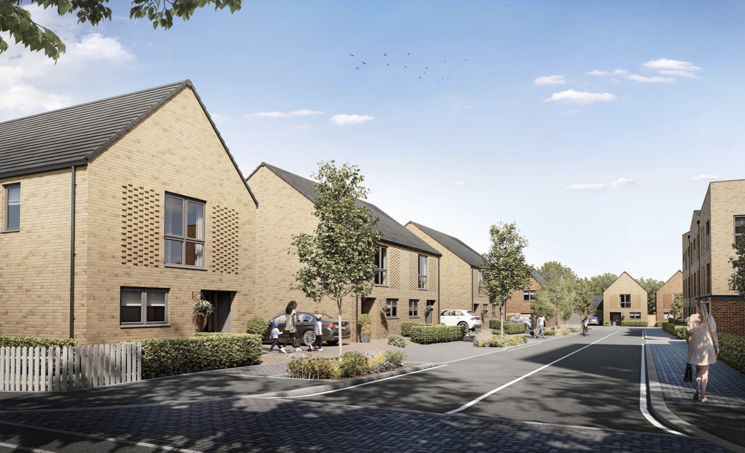
A proposed development of 45 homes in Perham Way, London Colney, and intended to be marketed
as the Carriage Quarter.
COURTESY HERTS ADVERTISER


The London Colney site in Perham Way and close to the playing field of London Colney
Primary School.
COURTESY GOOGLE EARTH


Two recently announced proposals both affect London Colney.  The first is a development on County Council land and named the Carriage Quarter.  A forty-five mix of houses and flats on land next to London Colney Primary School playing field in Perham Road has been matched on the other side of the High Street by an already completed replacement and enlarged Summerfield Health Centre, located adjacent to the Caledon Community Centre and Library.  This is the smaller of the two developments affecting the village.

The proposed site of the New Settlement in Hertsmere is bounded in yellow.  London Colney is
centre left; Tyttenhanger village is top left; north-west of the New Settlement is the 
Tyttenhanger Park estate and Willows lakes.
COURTESY HERTSMERE BOROUGH COUNCIL

The larger by a significant margin is proposed by next-door Hertsmere District Council but will have a considerable impact on London Colney and the village of Tyttenhanger.  Hertsmere's District Plan includes proposals for up to 12,000 new homes spread around the borough, but fully half of that number will be built in a single development currently named The New Settlement.  Its growth will be in a number of phases up to 2050, but the first phase is intended to be complete by 2030.  Included are a number of primary schools, at least one secondary school and a number of other community facilities.  For this size of settlement infrastructure will be critical, especially as its spread is estimated to be twice that of London Colney.

Bringing into one place perhaps 25,000 more people – twice that number in the district as a whole – there will be significant impact on the road network, including M25, M1, A1, as well as St Albans Bypass (North Orbital) outside of the borough but very important to London Colney.  Three mainline rail stations are within the district but none conveniently close to the New Settlement, and of course London Colney has no rail link at all.  No doubt the New Settlement will be well planned but 25,000 people are 25,000 residents, so the proposed community will have to work well with as much attention given to London Colney and the southern and eastern districts of St Albans.

One final point.  One million pounds is a huge amount of money.  This is the current price of many homes on the market in St Albans; a result of the shortage of available homes and the city's frequent presence at the top of so many top ten lists.  And the million pounds headline is not just for large detached properties in so-called desirable districts.  As has been pointed out recently we are at the tipping point of reaching the million for a semi-detached house in quite ordinary suburban east end roads, and that threshold may already have been breached.  Next will come a million for a mid-terrace home.  Anywhere within a hundred or so metres of an OFSTED rated "outstanding" school has the effect of producing a bidding war the moment a homeowner decides it's time to move on.

Many a job has to be turned down as the price of living here is too great.

Such are these challenging times for moving house and deciding just where we all want (and can afford) to live and settle down.

Sunday 19 September 2021

Off to Camp

 In the previous post we finished with a pint at The Crown. Yet the series which has taken us along the south side of Hatfield Road westwards to the Crown doesn't have a clean finish.  For a start, there are shops not yet visited.  We also referred to the little turnpike toll house without providing any detail.  And the Cavendish estate has been extensively referred to without so much as a mention of the houses down the hill in Camp Road; these too are part of the Cavendish estate.

The triangular shaped green space has not yet been built on to provide the homes in
lower Clarence Road (top of map).  Camp Lane (here named Camp Road on the
1898 map) is on a hill leading down to the branch railway and a former stream.
The open space, lower left, is the Breakspear estate, formerly Gaol Field.
COURTESY NATIONAL LIBRARY OF SCOTLAND


The Stanhope Road shops as seen c2012.

The shops and other businesses we have already visited on the corners of Cavendish and Albion roads were the only local ones even after the building of the Stanhope Road villas.  Of those on the north side of Hatfield Road, although built before 1900, many remained houses with tiny front gardens for a few years.  The four shops at the lower end of Stanhope Road were completed in 1901, and provided services for boot repairs, hairdressing, stationery & confectionery, and cycle repairs.  The shop prominently facing the junction, now Chilli Raj , opened in 1905 as a grocery and, later, combining a post office; the latter providing the postal services which were at the height of their social importance.  It is undoubtedly for this reason the red post box came to be placed outside. Before the Second World War the location came to be known as Cure's Corner after one of the shop's owners.  The unit behind this shop, a butchery, was a late arriver from around 1930; previously it had been the garage in the garden of the post office premises.

The former general store and post office.  This is the location of the earlier turnpike toll house
(see small pink building on the map in the previous post).  Stanhope Road, opened in the 1880s,
is on the left and Hatfield Road, onto which Camp Lane opened, is on the extreme right.


The garage built behind the shop was subsequently adapted as a butcher's shop and occupied for many years by Mr Holdham

The general store may well have been constructed at the same time as the villas on the north side of Stanhope Road, had it not taken some time for permission to be granted for the demolition of the tiny turnpike toll house, which was referred to in the previous post – the little pink building on the Hatfield Road curve.  So, how tiny was it?  Difficult to say, but probably a "one up one down", with the ground floor doubling as a private room and a duty room for collecting tolls from vehicle drivers and animal drovers as they arrived from the Camp hill and before they turned onto the Hatfield Road.  Unfortunately the distance covered by the payment took users only as far as the Peacock PH, from whence no further payment was necessary through the city.

There were other side road toll houses at Colney Heath Lane and the Rats' Castle, both of which were small and with thatched roofs; it is therefore probable that the Camp Lane toll house was similarly roofed, although no photograph or drawing of the house has been discovered.

During the lifetime of the turnpike road (Hatfield Road) a number of  road users had discovered a short cut across what is now part of the Breakspear estate onto the later-named Victoria Road and therefore avoided the toll payment altogether.  It is therefore doubtful if there was always a permanent toll keeper; for a time the keeper lived in the St Peter's Farm cottage and walked across the green to the toll house when needed to remove the chain barring access to Hatfield Road.  The final tolls were collected in 1881, coinciding with the development of the surrounding land, which had been an impediment to house building along Hatfield and Stanhope roads.

The view of The Crown PH from Camp Road.


The terraces of Cavendish estate on the Camp Road frontage.  Until the 1920s the land on the left
was an open field and by 1930 was largely built-up.

Homes from the Cavendish estate also lined the hill from The Crown down to Cecil Road on what was then known as Camp Lane until the footpath was laid with the city's typical engineering bricks. Residents living on the lane, as well as those walking from more outlying areas, regularly complained how poor the road surface was, and twenty years later, at the turn of the century, travellers were still complaining.  The terraces and semi-detached homes from The Crown, numbering 18 small properties, hardly reached the junction of Cecil Road, the lower ones having rear gardens reaching Albion Road behind, there being insufficient space for a full row of homes in Albion Road itself.  The front rooms of the terraces of Camp Lane all had a view across to the Gaol Field which climbed uphill towards the path connecting with Grimston Road.  This field was finally developed in around 1930 and known as the Breakspear estate.

In the space of fifty years development had enveloped The Crown, swept uphill towards the prison and towards the new railway station; and flowed downhill beyond the branch railway bridge and along Campfields.  St Albans has hardly paused in its expansion since.

Sunday 12 September 2021

The Crown that Moved

 When the Cavendish estate was first built there was a pair of shops west of Albion Road, although by the time they had opened most of the nearby homes were occupied; so too were the villas of Stanhope Road, soon to be followed by the homes of Clarence Park Road.

The photos below show the two shops in their early days; both were owned by Edward Hanley whose home was in Lemsford Road.  On the corner was Aberdeen House, a butchery managed by various specialists, including Mr Steabben, followed by Harry Patience of Popefield Farm.  At the foot of Cavendish Road was a small abattoir which if the building had still extant would be within the curtilage of Ss Alban & Stephen Junior School.

The name of Harry Patience only appeared above the door of Aberdeen House for a very short time,
in the early 1920s.  It is presumed Mr Patience is one of the two gentlemen at the door.
OWNER OF PHOTO UNKNOWN

Next door was the Park Stores owned by E Hanley.  Both shops had projecting display windows
in the early period.  The picture below shows the early interior of the Park Stores.
OWNER OF PHOTO UNKNOWN

Next to Aberdeen House was Park Stores, which had the name E Hanley above the door.  But that did not mean that he put in a full shift behind the counter.  Mr Hanley owned several shops, including three in Fleetville, and installed a manager for each one, while he organised the ordering of stock.  Where a manager did not require the upstairs flat, Edward Hanley rented that out.  In the period before shops arrived on the north side of Hatfield Road, Mr Hanley's shops very much complemented those at the lower end of Stanhope Road, even though they had opened rather later.

If you have passed by this part of Hatfield Road recently you may have noticed that the former Hanley's Stores is now a shop no longer and the conversion to domestic accommodation has been achieved sympathetically.  Menspire and the refurbished house and its railings frontage has created a welcome improvement to this corner.

Above: the pair of shops in around 1910
Below: the current street presentation of these two properties COURTESY GOOGLE STRRETVIEW


The street view of the above pair of shops in 1964, the pair of Charlton Villas, and the former 
coachman's accommodation of the Crown Hotel converted into Martell's coal business.
COURTESY ST ALBANS MUSEUMS

Next along the road is a pair of homes called Charlton Villas, erected at the same time as the adjacent shops, for Samuel Collins.  Both number 150 and 148 have always been residential, although for fifty years Arthur Evans ran his plumbing and decorating business from number 148. 

A recent view of the Crown Public House, although the two gabled sections are now paint washed
over the bricks.

The Crown Hotel c1914 with the roundabout in front and surviving tree from the site's nursery days.
COURTESY ST ALBANS MUSEUMS

The remainder of the block as far as Camp Road is taken up by the substantial buildings of The Crown Hotel and public house.  The licensing of this house was made possible by the acquisition of the license of the Rose & Crown in Holywell Hill; today the Abbey Flats are on that site.  In fact there was an occasional slip-up in reporting which referred to the new Hatfield Road establishment as the Rose & Crown.  The business was taken on by Luton Ampthill company Morris & Company, and rather helpfully its name has been added to the 1912 revision of the Ordnance Survey map.  However, it seems that the plot had first been acquired by John Green of Bedford.

The 1872 Ordnance Survey shows the bend near St Peter's Farm and Camp Lane meeting it
from the bottom of the map and passing the tiny toll house – the small pink building – with Ninedells Nursery to its right.
COURTESY NATIONAL LIBRARY OF SCOTLAND

To understand the placement of the Hotel in relation to the road layout we need to refer to the 1872 Ordnance Survey.  As we walk past the hotel's former stables and groom's quarters – later converted into Martell's Coal Sales and now private accommodation – the footpath deviates to line up with Stanhope Road ahead.  Such a property boundary dates from the sale of the former Ninedells Nursery and the sale of Hatfield Road Field for the development of Stanhope Road.  Before that time, as shown on the 1872 map, Hatfield Road's notorious bend to the right had the junction with Camp Lane shortly after the turnpike chain toll point.  This is the small pink building near the letters TP on the map.  Until the nursery was sold its boundary met the Hatfield road at the bend.  It is likely that the large tree shown in front of the c1914 photograph is a boundary survivor of that nursery.  To enable vehicles travelling westwards to access Stanhope Road a slip lane was made in front of the hotel.  In effect this created a roundabout.  Although it is not clear when this was closed off it was probably with the growth of motor traffic in the 1920s.  

Along with this great photograph it is worth pondering on two further points.  Unfortunately hidden by the tree, the original hotel name was displayed above the ridge tiling and between chimney stacks.  Such a position demonstrated the prominence of the hotel's position along the main road.  Secondly, on the edge of the roundabout is a cabinet with the city crest on the front.  Place there c1908 it was an early electrical connection box from the supply cable laid from the generation works in Campfield Road.

Now the Crown Public House, we can rest with a pint in the beer garden, and join regulars on televised football evenings.  It is the last pub eastwards along this road until the Rats' Castle.