Thursday 28 December 2023

Remembering This Year

 The first blog of 2023 looked back, not to 2022, but a full one hundred years to 1922.  That was a fascinating year that was.  I'll jump back to 1923 next time, but for now I will modestly roll back to the beginning of this year and will probably grasp how swiftly the months of this year have flown by – so quickly sometimes I have managed to record just two posts in an entire month, reaching the usual average of 36 this year.  But there has been an increase in series posts, so I will begin with these.

One of five titles in the series of little books about St Albans, and presented as a sequence of photographs, mainly taken between c1880 and the Second World War.

In the summer I felt it desirable to alert readers to a number of books about St Albans which are often neglected – I've called them The Little Books – slim volumes, small page sizes, a minimum of text, but the main feature is their prominence of photographs.  We are allowed the pleasure of focusing on one page at a time.  I covered five such books and assessed what proportion of the images shown were photographed in our east end.

With the publication of the city's Green District Plan there followed a short series of posts about some of the East End's green open spaces, including pocket spaces and forgotten places which, nevertheless, can inspire us or help us to collect our thoughts.

Opportunities to relax in the district's open spaces were explored after the publication of the District's Green District Plan.

A more recent series which I'll return to occasionally, are visits to individual roads or lanes; how and why they first appeared and what might have made them special.  This series began with Shirley road where, it appears, few of us have heard of.  And this road came about in the series because I wanted to highlight an unusual building along Shirley Road whose main function few had seen, and now it is too late.  It was the local equivalent of a British Restaurant which we. in St Albans, knew as a Civic Restaurant.  The restaurant building was finally removed from the scene c1975. So far you can read about the roads of the Breakspear estate, Coach Mews, Sutton Road, Royal Road and Princes Road; others will appear during the course of 2024.

Another short series reminded us of the old names by which fields were once known, and had been remembered for possibly hundreds of years.  One collection of fields was, and is still remembered as, The Nine Fields, between Brampton Road and Sandpit Lane.  And nine appears in the names of other east end fields too.

SAOEE Blog has not been without controversy in its reporting this year.  St Albans City Football Club had applied for an entertainment and music license – or rather a substantial extension to the existing control.  Which, naturally, drew the attention of the Clarence Park Residents' Association and Protect Clarence Park Campaign Group. 

The Blog also helped to celebrate the centenary of the appearance, on maps and signs, of the road classification system which help us to navigate ourselves around the road network, by letter, number and of course by colour.

Among the thousands of children who were evacuated to the city between 1939 and 1945
was a contingent from Ore School, Hastings, whose host school was the now-closed
Priory Park School.

Two contrasting blogs, both published in the summer and both engaged the attentions of the majority of the population in their times. The first in this year of 2023 when the Coronation of Charles III was celebrated, with its street parties, decorations and other special events. When we might have been tugged down with more difficult daily circumstances the Coronation was a short relief of positive buoyancy to bring a few days of light relief.  Contrast that with almost exactly eighty years earlier when it seemed like half of the nation's population appeared to have been on the move, or in some theatre of war.  And a part of this was the movement of children from the large cities to places of comparative safety in the towns and villages of "reception areas".  They faced new temporary lives without their parents; and the millions of adult hosts who accepted them into their homes faced new responsibilities and pressures in looking after their child and/or adult guests.

What a year!

To all my readers of the SAOEE Blog I wish you a very Happy New Year.


Tuesday 12 December 2023

Princes Road

 The naming of roads is often intriguing; last week, for instance I explored Royal Road, which probably would have received a rather different name, connected with Fleet Ville's new housing  development, part of the Fleet Printing Works.  Except, that is, Queen Victoria's jubilee was soon followed by her death, and all sorts of royal-related features sprouted around the town.  

The original c1900 development plan from Messrs Hassell and Tomlinson.  The two
coloured blocks show the higher value dwellings to be built (light mauve on the right;
the larger pink block were for lower values. Note, the partnership also built the first
pair of houses in Brampton Road south.  However, the map completely
ignores the presence of Burnham Road being built by rival developer, Mr Horace
Slade.


Princes Road and connections.
COURTESY, OPEN STREET MAP CONTRIBUTORS

So, in addition to Royal Road, Princes Road was added to the street scene.  So, to set the context, George V succeeded Victoria and thus launched the House of Windsor.  George and Mary had four sons, as well as a daughter (Mary, named after her mother). Regrettably daughters were not recognised with the same importance. The princes were Edward, Albert, Henry George, and later came John.  So our Princes Road references four – or if you include latecomer John, five royal princes.

If you were going to announce where this new road came to be located  in the Fleet Ville landscape, it may appear as a minor disappointment to say it filled in a gap!  But that is what happened. A long straight roadway split into two, the first was a trackway beginning at the Marshalls Wick House Drive (now Marshals Drive), would in future become Homewood Road.  An equally straight roadway then continued parallel to the east boundary of the Spencer estate, which was initially called Woodside Road, reaching the top of a steep slope before petering out.

Taken c1914 Princes Road crosses ahead from left to right.  Eaton Road is complete and the
slopes beyond will later become Salisbury Avenue.  Sheppard's bakers are already established
in the district.
COURTESY HALS

From Hatfield Road one of the three Fleet Ville roads was laid for a couple of hundred yards until it reached the footpath between Hatfield Road, Beaumont and St Peter's Church across the fields.  Tess Road stopped at the footpath because that was the boundary of the field printing works owner Thomas Smith had purchased.  

So between Woodside Road (from 1906 renamed Woodstock Road and from 1948 Woodstock Road North) and Tess Road was a road of nothing!  Tantalisingly, other roads were also in build; Brampton Road, and roughly in the middle of the gap to the west was Burnham Road, both being Mr Horace Slade's building estate and both stopping well short of the gap.  Then there was, to the east, the distant line of Beaumont Avenue and a prepared new road called Salisbury Avenue.

 A building partnership of Edward Hansell and Thomas Tomlinson eyed this irregular potential building site with its multiple connections to other roads, acquired it and started construction.  Instead of retaining the names Tess or Woodside, and because a royal opportunity was too good to miss in 1900, the partnership went for Princes Road.  Nearly half a century later these were the homes which would have to be renumbered as Princes gave way to Woodstock South.

Tomlinson and Hassell were only successful in their bid to build houses because St Albans Corporation had considered purchasing the same field a full two decades earlier to use as a cemetery, but decided it would be too small and too far away from St Albans, settling on the present cemetery location instead.

View southwards from the hop of the hill at Woodstock Road north.


Princes Road west with the Brampton Road junction to the right.

The street plate shows the demarcation between Woodstock Road North on the left,
and the northern-most homes of former Princes Road (now Woodstock Road South)
on the right.

View from the houses north of Burnham Road towards Brampton Road (see the second view in
this series.

Finally, the homes between Burnham Road right) and the tree-lined playground of
Fleetville Infant and Nursery School.
SERIES COURTESY GOOGLE STREET VIEW

The estate may have been small in size, but it welcomed residents and passers through from many directions.  In the post WW2 era Princes Road also brought buses (354 Fleetville Circular) from Woodstock Road North to Hatfield Road, and from Brampton Road to Woodstock Road North.  And you could not have been much closer to a local school.

In case you might have thought so compact a development could have been completed quickly, the first two pairs of homes, opposite each other, were completed c1902, but four homes adjacent to Brampton Road and four homes adjacent to Eaton Road remained unbuilt land until after 1910.

At least Princes Road remained remarkably free of flooding, a regular feature of the Eaton Road arm of the estate, but the road's even numbered houses were probably beset by some soggy rear gardens as a result of the proximity of same stream which crossed Eaton Road.


Saturday 2 December 2023

Royal Road


Fleetville Schools (now Fleetville Infants & Nursery) and four of the semi-detached homes
on the east site of Royal Road.
COURTESY GOOGLE STREET VIEW

 When we refer to Fleetville these days we keep in our mind a much wider area than was originally planned, a tightly packed community of three roads on the north side of Hatfield Road and an associated printing works (now redeveloped as Morrison's on the south side).  For a few short years there remained fields on all sides.  And the name Fleet Ville took its name from the the T E Smith printing company's London headquarters just off Fleet Street – the name of the printing factory locally being named Fleet Works.

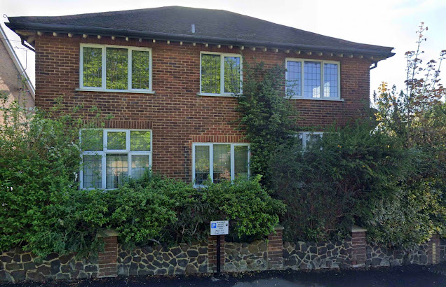
Fleet House, now flatted.  The original front porch and door observed by the central
cleaner brickwork. The original gateway was to the right of the parking sign.

As with many speculative developments Fleet Ville was not completed.  Arthur Road was finished, and Tess Road (now Woodstock Road South) was partly complete, although most of its west side was purchased for use as a school and a police station.  Royal Road was barely begun.  We will recognise the three semi-detached pairs of cottages built in the early 1900s, and the Fleetville Schools building whose plot spread Royal Road and Tess Road. A detached property, Fleet House, had nothing to do with the  Printing Works and was not added to the corner plot until the 1930s, becoming the home and practice of Dr F Smyth who had previously occupied an apartment at Bycullah Terrace. Currently the building is in the middle of yet another transformation into flats.

The west side of Royal Road remained unbuilt and passed to Mr T E Smith's son after his death in 1904.  The imperative to complete the housing plan begun by his father, Mr Smith jnr recognised there was no real need to complete the company housing accommodation given the fast-growing building estates between Royal Road and The Crown.

We will never know how Mr Smith's estate would have been laid out as no plans have made it into the public domain.  We assume the west side of the road would have been completed, with a cul-de-sac parallel to Hatfield Road to abutt the boundary of the Slade estate at the eastern end of the Harlesden Road rear gardens.  

The north end of the road with a newly built house at the end of a Burnham Road plot.
The original intention was to keep the roadway open into Burnham Road.
COURTESY GOOGLE STREET VIEW


Later homes built across the intended road junction.
COURTESY GOOGLE EARTH

The northern end of Royal Road was left open, as were the plots intended for Burnham Road behind.  Connecting agreements were not made and after 1910 three additional houses were constructed to the Burnham Road frontage.  Royal Road therefore became a permanent "dead end" and access to Burnham Road was limited to its two end points, Harlesden Road and Princes Road (Woodstock Road South)*

A pre-WW2 photo taken from where the present community centre is now located, and
showing the original railings along the Royal Road frontage.
COURTESY FLEETVILLE INFANTS SCHOOL & NURSERY ARCHIVE

Charles Woollam, a generous benefactor to the city's communities, acquired the remainder of the Smith land and, in 1913, gifted it to the city for the free use of the people of Fleetville as a "pleasure ground"; generations of Fleetville people have identified it as Fleetville Recreation Ground (the rec.) and today many of us know it as Fleetville Park.  That year the city council came close to using the ground for emergency allotments, but instead seeded the soil, gifted us with a set of swings, and installed metal railings on all four sides with gates to Hatfield Road, where Beech Tree Cafe is, and opposite the boundary between the school and house number 12.  Interestingly, gates were installed at the end of the rear gardens of the Burnham Road houses, giving direct access to the Pleasure Ground.

The WW2 underground shelters, still entombed on the recreation ground.  The 
emergency exits are still visible and quite clear in hot dry summers

In 1938 open zig-zag trenches were dug close to the rear of the Burnham Road gardens (perhaps that was when their gates were installed?) and close to the Royal Road gate.  By the war outbreak these trenches were deepened, widened, interconnected, capped and with emergency exits installed – the latter still identifiable in hot dry summers.  An emergency water tank was constructed close to where the zip wire is today.

The temporary nursery brought to the recreation ground in 1942, and still in use as 
Fleetville Community Centre.  A replacement building is planned – finally!

In 1942 a temporary concrete and block building, pre-formed in Hoddesdon, was brought to this site to serve as a nursery for the mothers working at the munitions factory (site redeveloped as Morrison's).  Temporary it might have been, but the same building is still in daily use as Fleetville's Community Centre.

In the early 1950s part of the west side of Royal Road was marked out and signposted as the district's first street parking zone.  Today, it is all but impossible to find a spare parking spot anywhere in the road!

Finally we return to the name by which the road is named.  The plans were being prepared in the period up to 1900; Queen Victoria had celebrated her jubilee, the royal accession and the royal princes topped newspaper stories.  So it was not a surprise for this little cul-de-sac to be awarded a royal association.

* It should be clarified that Tess Road only extended to the entrance of the public footpath, known locally as The Alley.  Between this point and the mouth of Brampton Road was separately developed as a road named Princes Road.  These two roads retained their separate names until 1948 when they were renumbered and given a common name: Woodstock Road South.