 |
| Fleetville Schools (now Fleetville Infants & Nursery) and four of the semi-detached homes on the east site of Royal Road. COURTESY GOOGLE STREET VIEW |
When we refer to Fleetville these days we keep in our mind a much wider area than was originally planned, a tightly packed community of three roads on the north side of Hatfield Road and an associated printing works (now redeveloped as Morrison's on the south side). For a few short years there remained fields on all sides. And the name Fleet Ville took its name from the the T E Smith printing company's London headquarters just off Fleet Street – the name of the printing factory locally being named Fleet Works.
 |
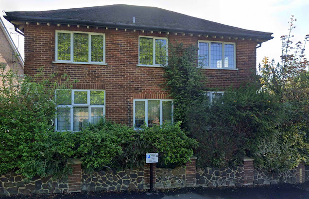
| Fleet House, now flatted. The original front porch and door observed by the central cleaner brickwork. The original gateway was to the right of the parking sign. |
The west side of Royal Road remained unbuilt and passed to Mr T E Smith's son after his death in 1904. The imperative to complete the housing plan begun by his father, Mr Smith jnr recognised there was no real need to complete the company housing accommodation given the fast-growing building estates between Royal Road and The Crown.
We will never know how Mr Smith's estate would have been laid out as no plans have made it into the public domain. We assume the west side of the road would have been completed, with a cul-de-sac parallel to Hatfield Road to abutt the boundary of the Slade estate at the eastern end of the Harlesden Road rear gardens.
 |
| The north end of the road with a newly built house at the end of a Burnham Road plot. The original intention was to keep the roadway open into Burnham Road. COURTESY GOOGLE STREET VIEW |
 |
| Later homes built across the intended road junction. COURTESY GOOGLE EARTH |
 |
| A pre-WW2 photo taken from where the present community centre is now located, and showing the original railings along the Royal Road frontage. COURTESY FLEETVILLE INFANTS SCHOOL & NURSERY ARCHIVE |
 |
| The WW2 underground shelters, still entombed on the recreation ground. The emergency exits are still visible and quite clear in hot dry summers |
 |
| The temporary nursery brought to the recreation ground in 1942, and still in use as Fleetville Community Centre. A replacement building is planned – finally! |
In the early 1950s part of the west side of Royal Road was marked out and signposted as the district's first street parking zone. Today, it is all but impossible to find a spare parking spot anywhere in the road!
Finally we return to the name by which the road is named. The plans were being prepared in the period up to 1900; Queen Victoria had celebrated her jubilee, the royal accession and the royal princes topped newspaper stories. So it was not a surprise for this little cul-de-sac to be awarded a royal association.
* It should be clarified that Tess Road only extended to the entrance of the public footpath, known locally as The Alley. Between this point and the mouth of Brampton Road was separately developed as a road named Princes Road. These two roads retained their separate names until 1948 when they were renumbered and given a common name: Woodstock Road South.

No comments:
Post a Comment