Wednesday 20 October 2021

Granville and Stanhope

 The two previous posts have drawn our attention to Conservation Areas (CA) in localities within our eastern districts –  Clarence Park and nearby residential roads, and Sleapshyde.  Perhaps a number of readers have or will take the opportunity to explore these streets and the buildings which lie along them.  It is usually only when we are walking that we are afforded the opportunity to notice details along a street. This week the third and final Conservation Area is Granville and Stanhope roads, where two of the three roads are busy thoroughfares in their own right.

Clarence Park is at the top; Station Way on the left; the trianglular 
space in the middle is formed of Granville and Stanhope roads; the two
houses in Grimston Road are on their own at the bottom; St Peter's
Farm homestead is on the top right.
COURTESY ST ALBANS DISTRICT COUNCIL
This week's Conservation Area is bounded by Hatfield Road (between the Midland Railway and Crown junction), Station Way, Grimston Road, and the rear boundaries of homes on the south side of Stanhope Road.  

Stanhope Road looking east before WW1. A tree-lined street with
The Crown PH at the lower far end.
COURTESY HALS

It is believed Stanhope Road was named after Philip Henry Stanhope (1781-1837), one-time president of the Medico-Botanical Society of London, who bred 55 species of orchid within the Stanhopea genus. I am less certain of the naming of Granville Road, although an individual of this surname is reported to have received bequests from Sarah, Duchess of Marlborough.  Grimston Road is, of course from Earl of Verulam, James Grimston (1809-1895) whose base was at  Gorhambury.

The CA comprises entirely of a single development estate, which was formerly a field, known as Hatfield Road Field or "the field next to the chain bar" (of the Reading & Hatfield Turnpike at the top of Camp Lane), owned by Earl Spencer and worked by Thomas Kinder for his company's brewing business.  Its transfer for development (or at least that part not required for the railway) was part of Kinder's retirement from business plan and the owner's opportunity c1880 to build homes for users of the railway, some of our early commuters.  Also included in the Conservation area are the buildings of St Peter's Farm, The Crown PH and the Hatfield Road frontage buildings between the Crown PH and Albion Road.

Shops were added to the eastern end of Stanhope Road and are included as locally Listed.

All of the villas on the south side of Stanhope Road are locally listed; mainly built between 1886 and c1914, and most are detached with bays or semi-detached with double bays, offering a satisfying variety to the streetscape.  Just a small number of more modern homes use plots not sold during the main construction period, and at the lower end were built four shops during the main development period.  These, together with the former post office, Alexandra House and corner shops at the front of the Cavendish estate provided the local shops for the development's early occupiers. All of the houses and shops on the south side are locally Listed, even those which are modern.

The northern end of Granville Road containing locally Listed villas.

Regrettably the street trees planted at the road edge in the 1880s were removed in the 1920s when buses began to use Stanhope Road to reach the station.  Whether they were suitable species for roadside planting I don't know, but the restricted width for a main road and inevitable street parking for most of the villas – despite a wide footpath – results today in a harder streetscape.

The north side of Granville Road is lined with villas for half of its length from the Grimston Road end, but development eventually slowed down.  Some ground was left unbuilt and the remainder became an infill industrial building, both of which have been replaced by modern blocks of apartments in keeping with the rest of the street: The Maples and Ashtree Court.  All of the properties on the north side border a modern road, Station Way, which is busy with buses and station-bound cars.

The villas between Granville Road and The Crown along Hatfield Road were replaced by this 
Neo-Georgian style factory building for W O Peak.  This was itself replace in the 1980s.
COURTESY DIANA DEVEREUX


Number 108 Hatfield Road next to Station Way which is the only house in the group not to be
locally Listed.
COURTESY GOOGLE STREETVIEW

Hatfield Road, facing Clarence Park, was developed with two and three-storeyed villas.  While those remain at the station end, the homes below Granville Road were gradually replaced by extensions to the former W O Peake coat factory, and have been replaced for a second time with modern residential flats and offices.  Photos exist for the neo-Georgian factory, but extensive searches have failed to reveal images of the range of villa terraces that preceded it, which is very disappointing.  Above Granville Road the gradient of the bridge embankment of the 1860s becomes evident as the homes built on the original field level have allowed for a lower-ground floor to be designed in.  All except the house nearest Station Way are locally Listed.  This exception is not explained in the document other than not to mention number 108.  Yet this house is shown, along with the others, on the 1897 OS map and appears to be the original building.

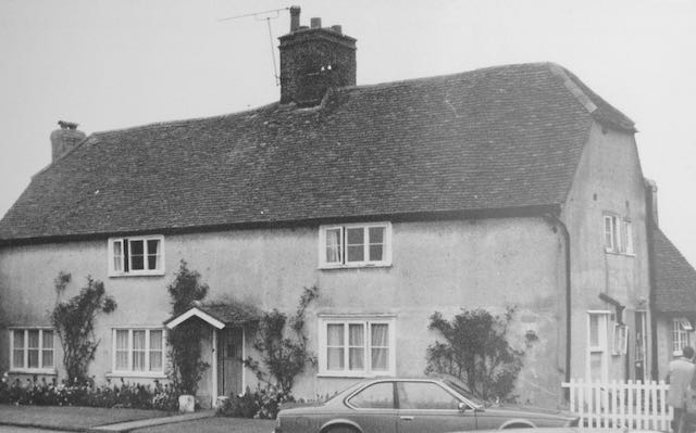
A pair of houses in Grimston Road is included in the Conservation Area and are locally Listed.
COURTESY GOOGLE STREETVIEW

In addition to the houses mentioned in the three above roads is a pair of more modest houses in Grimston Road.  The space for these was created by shortening the plots of the properties in adjacent Stanhope Road.

The deNovo Place apartments at the northern end of Stanhope Road where previously had
stood St Peter's Mission Church and then St Albans' Adult Schools.


On the island side of Granville Road is the Spiritualist Meeting Room which opened in 1910.


Seven villas were built on the lower end of the north side of Stanhope Road.  The rest of this
side was occupied by the Grand Palace (later renamed Gaumont) cinema. The Chatsworth 
apartment development has replaced the cinema.


The island section, between Granville and Stanhope roads, contain seven villas on the Stanhope (north) side, again, locally Listed.  The apex of the triangle is now on its third incarnation, having begun with the tin church of St Peter's Mission Church, then the Adult Schools once St Paul's Church had opened; today is a modern style of residential apartments, deNovo Place.  In 1922 the remainder became the cinema (Grand Palace, which changed its name to Gaumont) and its car park.  Today the cinema has gone and Chatsworth Court, the name giving a nod to the Dukes of Devonshire, has replaced it.

Finally, a compact plot in the triangle was used from 1910 as a spiritualist meeting house, and its usage for this purpose continues today.  The meeting house is also locally Listed.

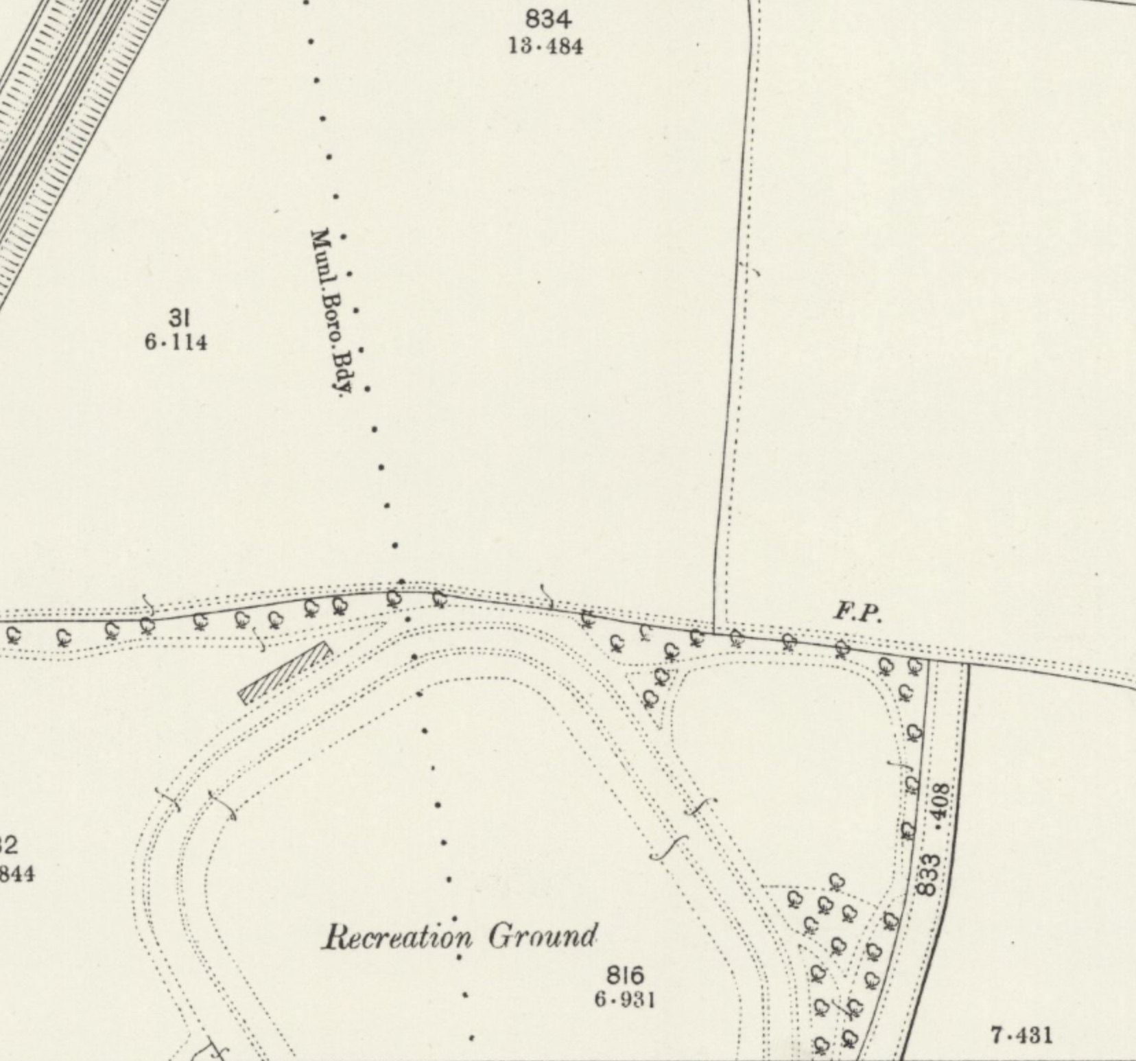
Readers may perhaps agree with me that a fourth CA might be appropriate in the eastern districts: the heart of Fleetville, encompassing Bycullah Terrace, Woodstock Road south (formerly Tess Road), Royal Road, the recreation ground, Arthur Road, 
 
including the former Printing Works Institute and the Rats' Castle, and possibly Burnham Road and Eaton Road.  Fleetville Infants School might also form part of the group.


Thursday 14 October 2021

Clarence Conservation

The previous post highlighted the details of Sleapshyde's Conservation Area and Character Statement, which is one of only three in the eastern districts out of 27 within the St Albans District.

The Midland railway marks the western boundary of the Clarence
Road Conservation Area and Clarence Road winds its way north-
south on the eastern side.  The houses which are coloured green
are locally listed.
COURTESY ST ALBANS DISTRICT COUNCIL


Today I am turning my attention to the Clarence Park Conservation Area (CA) and Character Statement (CS).  The zone is bounded by the Midland Railway, Hatfield Road, the rear of properties on the eastern side of Clarence Road (both lower and upper), and Sandpit Lane.  Many of us enjoy spending time in Clarence Park itself and we will often catch glimpses of houses which line Clarence and York roads, though we may be less familiar with Blenheim Road, upper Jennings Road and Gainsborough Avenue – although the latter contains no locally listed houses to form part of the collection.  Finally, there are four identified structures within Clarence Park, although one of these, Verdi's restaurant, is technically not within the park, a point I will briefly return to later.

The 1897 OS map shows the recently laid-out Clarence Park together with lower Clarence Road
prepared as far as what will shortly become York Road along the line of the footpath (FP).
At this point no work has begun on the Spencer estate, nor Brampton Road.
COURTESY NATIONAL LIBRARY OF SCOTLAND

The Statement briefly confirms the area's history as land belonging to St Peter's Farm which had been owned by William Cotton (who was not referred to) before being partly taken for railway construction and the remainder acquired by Earl Spencer.  The park was formed from two tranches of land: the former fete field, which became the pleasure park and is the area adjacent to Hatfield Road; and the section purchased by Sir John Blundell Maple specifically for a cricket field and other active pursuits.  Only the latter is referred to in the CS, but the fete field was used by members of the public long before the formation of the park in 1894.  Lower Clarence Road and York Road were adapted road layouts which, together with the railway and Hatfield Road, were intended to envelope the park.  Earl Spencer added to this his residential estate reaching Sandpit Lane, the western part of which lies in the northern part of the CA.

The freshly laid-out pleasure park, the former fete field, with the drinking fountain donated by
Lady Maple, the first bandstand, and, in the background is shown the park keeper's lodge.
COURTESY ST ALBANS LIBRARIES (HALS)


The cricket pavilion and changing rooms.

Probably the main reason the park remains within this CA is its largely unaltered layout.  It is heralded as an untouched Edwardian open space with the lodge and cricket pavilion both recognised in the CA as original features; also the later-added pay kiosks and earliest football club rooms, the water fountain donated by Lady Maple which was installed soon after the park's opening; all are identified as locally listed.

The only structure which does not fall into the above categories is the building, formerly public toilets for The Crown local area, used today as Verdi's restaurant.  This is no longer in the park as the boundary fence was moved northwards in 1928 to provide extra visibility to avoid a potentially dangerous blind spot for vehicles emerging from Clarence Road. A short time later public toilets were built in this space which reduced some of the visibility earlier gained!

A group of the houses overlooking the park at the Hatfield Road end of lower Clarence Road.

Numbers 4 to 30 Clarence Road, as well as Alexandra House, are the first group to be locally Listed and the cottages fortunately have unaltered frontages. Alexandra House is the former Barclay's Bank and chemist shop when first opened.

Two pairs of large semi-detached villas just north of the park entrance in lower Clarence Road.

Many of the remaining semi-detached houses in lower Clarence Road and overlooking the park are described as Queen Anne/Domestic Revival style.  They are substantial and so similar but not identical, which prompts the question of their design.  The CS suggests there were at least three architects at work here: Percival Cherry Blow, Henry Hansell and Henry Mence, but others may have also been part of the practices.

An arts-and-crafts style house in upper Clarence Road.
COURTESY GOOGLE STREET VIEW

Most of the homes in upper Clarence Road are all on the list even though they were built in a variety of styles. Newer infill properties have been excluded.  However an arts and crafts corner house with a lych gate and well-protected with hedging, is feature at the Jennings Road corner.  A plot on the western side of upper Clarence Road which has remained undeveloped for over one hundred years is, for the first time, being built on and will probably become the largest house in the CA.

Houses in York Road were built between c1906 and the mid-1930s and all face Clarence Park.
COURTESY GOOGLE STREETVIEW

Most of the York Road homes, which are detached, are locally listed with the exception of three at the railway end which are later additions to the streetscape.  The much-changed house on the corner of Clarence Road which has been used as a nursery is not included on the list.

A house standing on a Blenheim Road corner.


A house standing on a  corner of Blenheim and Jennings roads.
COURTESY GOOGLE STREETVIEW

A similar plot of land in Blenheim Road was developed a few years ago (Sefton Close) following the demolition of a property.  Otherwise almost every house in Blenheim Road is locally Listed.

There were one or two surprising omissions in upper Jennings Road, which result from later building even though the designs appear to be well-proportioned and similar in design to nearby Listed homes.  The south side of the road was built from the 1930s and clearly does not merit Listing.  Gainsborough Avenue, which was also much later, contains no Listed properties along its frontages.

Wednesday 6 October 2021

On the List at Sleapshyde

 Local planning authorities identify particular localities within their boundaries which merit special preservation and conservation.  They  can be designated Conservation Areas (CA). There eighteen such CAs in the city, mainly in the outskirts, and only two of of them, Sleapshyde and Cunningham, are in our East End.  A further 27 CAs have been identified within the city's urban area, of which just two fall within the east end, Granville & Stanhope roads and Clarence Park.

The North Orbital St Albans ByPass is in orange; Smallford Lane runs N-S on the left. Old 
Sleapshyde with three lanes meeting at the tiny triangle is top right. The 1930s estate is the large
tranche of land coloured grey in the centre.
©Open StreetMap contributors

Although brief mention has previously been made of the Granville Conservation Areas in these blogs, I think it is about time further exploration of the character of each of the east end CAs is recorded.  This week I'll begin with Sleapshyde, a compact hamlet sitting between the St Albans Bypass and Sleapshyde Lane, the former joining the latter at the eastern end of the Colney Heath "longabout".  Today, only one third of the built area consists of the historic domestic and agricultural buildings.  

Old Sleapshyde within which are located a few Listed and other significant buildings; a portion of the
1897 OS map around 25 years before the ByPass was constructed.
Courtesy National Library of Scotland

In 1935 builder E Stevens, who specialised in homes for rent, applied for consent to erect 54 homes near the boundary of the then new  Orbital Road (Bypass), but St Albans, the Planning Authority, refused.  The rural council, however, favoured the development to counter the severe shortage of rural housing, and presumably got its way, as there are considerably more than 54 dwellings along Sleapcross Gardens and Sleapshyde Lane today.  None of the hamlet's listed and locally significant buildings sit along these two roads, but lie along the three lanes beyond which converge on a small triangle of land on which there still stands a former public water pump and a former lamp post on top of which is the sign for Sleapshyde.

A heritage picture of The Plough PH when under the ownership of Pryor, Reid & Co, Hatfield.
Modest changes have been made since but the building remains undeniably recognisable.
Courtesy Brian Anderson Collection.

The Character Statement for the CA identifies 8 buildings extending back to between the 16th to 18th centuries, and unsurprisingly most of the Listed buildings fall into this group. First in this discourse and at the end of the northern arm of Sleapshyde Lane is the Plough PH, which should not be confused with the Plough at nearby Tyttenhanger Green.  It contains a popular restaurant. Still with its thatched roof and dormers the 17th century building still backs onto open land.  An annotated wedding photo taken outside in 1913 identifies a former link with another watering hole in the hamlet: one of the party was the licensee of the former Angel PH (see below).

A heritage photo of Sleapshyde Farm, recognisable by its hipped roof.
Courtesy Brian Anderson Collection.

On the section of the lane which returns directly to the Bypass is Sleapshyde Farm.  Unfortunately much of the homestead is hidden behind high fencing with boundary trees and shrubs, but sufficient of its roof is visible to identify its hipped roof.  The CA states its age to be sixteenth century although identifies it to have been a hall style of construction, which suggests it might have been a re-build without changing its design, therefore making the foundations considerably earlier (this has not, however, been verified).  Visitors will identify the extensive dark weatherboarded barns and other outbuildings.

The nearby Farm Cottage is obscured from the lane, but the CA indicates it to be rebuilt in the 19th century around a seventeenth century framework.

The Rose Cottage and Little Rose Cottage on the opposite side of the lane to Sleapshyde Farm.
Courtesy Google Streetview

Along the same arm of the lane but on the other side is a pair of cottages, Rose Cottage and Little Rose Cottage. Both are part of a single structure – you could call them semi-detached.  Most is black weatherboarding with end walls in red brick; the bold chimney stack placed off centre suggests the two cottages are of unequal sizes.  One of the cottages shows evidence of having been extended.

Ye Olde House, which are three separate properties combined.  Set well back from the lane
for improved visibility.

Ye Olde House, at its closest to the modern section of Sleapcross Lane,  is a large and fine building set back from the lane; multi-gabled roof, black first floor weatherboarding with brick ground floor walls.  What might seem like former stables dating from the time of the main house is, according to the CA a modern construction intended for car storage.  Although the name is singular, internally it is divided into three properties.

The former Wesleyan Methodist Chapel with cream surface over the earlier pebble dashing. 
Recent hedge trimming reveals the earlier entry drive and the posting box set into the
brick pillar.

Two un-Listed properties also considered of local interest are Angel Cottage and the former Wesleyan Methodist Chapel.  The chapel is almost opposite the Plough PH.  Until a few years ago the exterior was clad in a soft brown pebbledash, but has recently been rendered in cream.  The rear taller part of the building is on two levels, and its earlier light blue door, bargeboards and drainage pipes are now darker in colour.  It is said that the chapel is one of the earliest in Hertfordshire and was large enough to accommodate the whole population of the hamlet until St Mark's Parish Church was built in 1945.

Now Angel Cottage it was formerly the Angel PH.

At the entrance to the original hamlet in Sleapshyde Lane was a Victorian beer house called the Angel public house.  Although long since closed it was converted for private accommodation, and remains the youngest structure included in the buildings of note in Sleapshyde.

A wander around this pleasant settlement, perhaps following a lunchtime meal or drink at the Plough, will be worth the short time it takes.  Unlike the formal layout of the twentieth century homes along Sleapcross Gardens and Sleapshyde Lane, the scatter of buildings laid out informally at the older end is a pleasant contrast.

The red buildings are listed; the two green buildings are significantly important in the
local context.
Courtesy St Albans District Council