The previous post highlighted the details of Sleapshyde's Conservation Area and Character Statement, which is one of only three in the eastern districts out of 27 within the St Albans District.
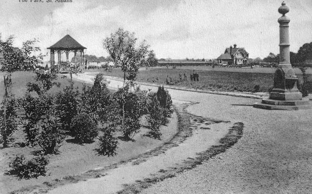
The Statement briefly confirms the area's history as land belonging to St Peter's Farm which had been owned by William Cotton (who was not referred to) before being partly taken for railway construction and the remainder acquired by Earl Spencer. The park was formed from two tranches of land: the former fete field, which became the pleasure park and is the area adjacent to Hatfield Road; and the section purchased by Sir John Blundell Maple specifically for a cricket field and other active pursuits. Only the latter is referred to in the CS, but the fete field was used by members of the public long before the formation of the park in 1894. Lower Clarence Road and York Road were adapted road layouts which, together with the railway and Hatfield Road, were intended to envelope the park. Earl Spencer added to this his residential estate reaching Sandpit Lane, the western part of which lies in the northern part of the CA.
 |
| The cricket pavilion and changing rooms. |
Probably the main reason the park remains within this CA is its largely unaltered layout. It is heralded as an untouched Edwardian open space with the lodge and cricket pavilion both recognised in the CA as original features; also the later-added pay kiosks and earliest football club rooms, the water fountain donated by Lady Maple which was installed soon after the park's opening; all are identified as locally listed.
The only structure which does not fall into the above categories is the building, formerly public toilets for The Crown local area, used today as Verdi's restaurant. This is no longer in the park as the boundary fence was moved northwards in 1928 to provide extra visibility to avoid a potentially dangerous blind spot for vehicles emerging from Clarence Road. A short time later public toilets were built in this space which reduced some of the visibility earlier gained!
 |
| A group of the houses overlooking the park at the Hatfield Road end of lower Clarence Road. |
 |
| Two pairs of large semi-detached villas just north of the park entrance in lower Clarence Road. |
 |
| An arts-and-crafts style house in upper Clarence Road. COURTESY GOOGLE STREET VIEW |
Most of the homes in upper Clarence Road are all on the list even though they were built in a variety of styles. Newer infill properties have been excluded. However an arts and crafts corner house with a lych gate and well-protected with hedging, is feature at the Jennings Road corner. A plot on the western side of upper Clarence Road which has remained undeveloped for over one hundred years is, for the first time, being built on and will probably become the largest house in the CA.
 |
| Houses in York Road were built between c1906 and the mid-1930s and all face Clarence Park. COURTESY GOOGLE STREETVIEW |
Most of the York Road homes, which are detached, are locally listed with the exception of three at the railway end which are later additions to the streetscape. The much-changed house on the corner of Clarence Road which has been used as a nursery is not included on the list.
 |
| A house standing on a Blenheim Road corner. |
 |
| A house standing on a corner of Blenheim and Jennings roads. COURTESY GOOGLE STREETVIEW |
A similar plot of land in Blenheim Road was developed a few years ago (Sefton Close) following the demolition of a property. Otherwise almost every house in Blenheim Road is locally Listed.
There were one or two surprising omissions in upper Jennings Road, which result from later building even though the designs appear to be well-proportioned and similar in design to nearby Listed homes. The south side of the road was built from the 1930s and clearly does not merit Listing. Gainsborough Avenue, which was also much later, contains no Listed properties along its frontages.


No comments:
Post a Comment