Showing posts with label Central Drive. Show all posts

Wednesday, 12 July 2023

After 78 years


The Beaumonts estate as first laid out. Much of Beaumonts Wood has gone to provide ground for the schools and their playing fields. The broken orange lines never saw the light of day – a short stub of the extended Central Drive is now Oakwood School's entrance drive.


This map was surveyed in 1939.  The Central Drive/Oakwood Drive corner
is on the far right.  It would have been a cross-roads.  A swathe of wooded
ground has already been carved out to make the extension of Oakwood
Drive towards Sandpit Lane, which never happened. There are
other roads with no homes yet behind them. They would appear after WW2.

The final tranche of land belonging to Beaumonts Farm was offered for sale in 1929 and was acquired by holding company Watford Land. The company set out the road plan which would connect with Sandpit Lane, Beaumont Avenue and Hatfield Road, and at subsequent auctions plots were purchased by a number of mainly local house-building companies.  Two spine roads, Beechwood Avenue and Oakwood Drive, were to connect Hatfield Road with Sandpit Lane.  A third one had already existed, and had done so for centuries, Beaumont Avenue.  Beechwood Avenue had been aligned  with the agreement of the council, to connect with Marshalswick Lane as part of what was then known as the Circle Road (ring road).

Three connecting roads also appeared on the development map: Elm Drive, Central Drive and Chestnut Drive. None was completed to their finished lengths.  For the next ten years house building continued, working from Hatfield Road and the southern end of the estate, until in 1940 everything halted because of the war. Most of Beechwood and Elm had been completed. So too had the southern end of Woodland.  Hazelwood south was largely finished on one side and Oakwood had almost reached the future Central Drive.

Oakwood Drive looking towards the corner with Central Drive and in the direction of Sandpit Lane (not, of course, visible).  The (cream) house straight ahead would make such an extension impossible
today.

But restarting such a development after hostilities had finished would financially and logistically be a challenge; many pre-war housebuilding firms did not survive the interregnum, and the post-war license system limited how much building each could carry out.  In part the council came to the rescue by purchasing the swathe of ground from Woodland Drive to the school playing fields boundary.  A revised road layout was devised which took the boundary up to the playing field fence, which would then prevent Oakland Drive from continuing from the Central Drive junction as far as Sandpit Lane. Which later enabled number 51 Central Drive to be constructed in the space of the redundant road line.

The council then built a number of houses for rental in Woodland Drive and Hazelwood Drive north.

Of course, since our home area was effectively a huge building site children of the 1940s and 50s were able to take the short route from Oakwood Drive to Sandpit Lane by walking along the western side of the chain link fence erected by the County Education Department; and once the Hazelwood houses were in build it was easy enough to hop over the fence and follow the same line along the inside edge of the school field.  You could wonder how the author knows that odd fact if you like!  You could even wonder how much is known about the oak tree part way along that walked path close to where the Verulam School's pavilion is located.

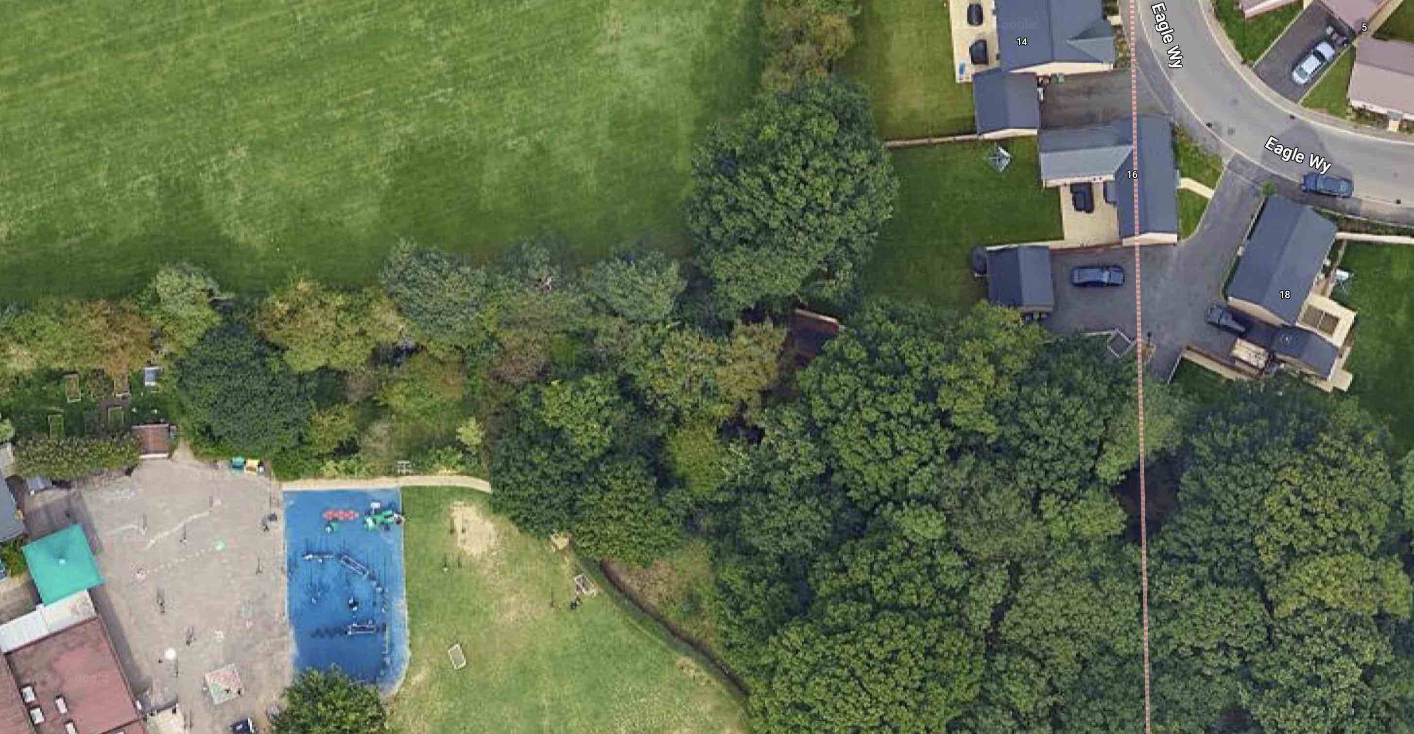
Blue circle: Oakwood/Central corner. Red circle: approximate location of oak tree near Verulam School changing rooms. Yellow circle: beginning of path along Eagle Way. Green broken line: intended path
from Eagle Way to Central Drive. Green dotted lines: informal pathways worn by children in the 1950s.

Almost as soon as we had climbed over that fence we were able to nip across the field to Oaklands Wood, still there behind Oakwood School's site but now much depleted.  The woodland wasn't in any sense public; we knew that because there was a large sign fixed to a tree which informed us to KEEP OUT.  But we ventured there anyway.

I have reached this far in the post to reach the connection between the 1950s and a decision made recently...

Standing out against the sky at Oaklands Grange.

... in the 21st century and at the new housing on the edge of  land belonging to Oaklands, called Oaklands Grange.  Now that the homes are largely all out of the ground an increasing number of people have become familiar with Oaklands Grange and its access to Sandpit Lane not far from the opposite driveway from Newgates, a former mini farm, and the access drive from the Verulam School field.

To leave the Oaklands Grange development residents must walk first to Sandpit Lane – ah ha, so quite close to the old informal route youngsters walked in the 1940s and 50s; seventy-eight years or so after a certain number of those young children found their own way between Sandpit Lane and Central Drive.  If they weren't going to build the extension road, we'll find our own way.  So, an informal path was gradually worn in.   

The future path begins.

The path from Eagle Way skirts outside the boundary of Oakwood School towards
Central Drive.

Children living today at Oaklands Grange are to be given an alternative to the walk along Sandpit Lane, Beechwood Avenue and Central Drive to reach their schools.  They will be able to take a short cut.  The formal start of the path is already prepared at the southern end of Eagle Way.  Pass a few trees westwards and you will reach the former KEEP OUT sign and pass to the outside of the Oakwood School boundary, now itself wooded to reach the school entrance at Central Drive.

Two informal footpaths worn by 1950s children not trying very hard to keep out of trouble, now become part of the 2020s story of families finding their way between home and school along almost the same footpath.  There is little doubt that the child evacuees who came to be part of Beaumont Schools during the 1940s also adventured along these two routes to reach Sandpit Lane and to explore Oaklands Wood and its KEEP OUT sign.

We will look out for the official opening of the new link path, hopefully soon. 


Sunday, 14 August 2022

Central Drive shops

Central Drive crosses the picture from left to right, with Hazelwood Drive and Woodland Drive intersecting to the left and right respectively.  Central Drive shops are in the centre, to the left of the six blocks of Irene Stebbings House.  Until the shops appeared the land was an informal green space where children played.
COURTESY GOOGLE EARTH

Corner shops in the suburbs have always remained popular despite the near universality of supermarkets.  In the early postwar years their owners fought hard against the branded stores, as of course did the small independent hardware shops and butchers in the side streets and residential corners.  Somehow many of them survived with new owners willing to commit to even greater hours and seven day trading.

One of many corner shops in Fleetville, this one being Bransons at the junction of Harlesden and Burnham roads.
COURTESY THE GORDON JAMES COLLECTION

St Albans City Council also committed to serving its tenants on the many residential estates which were considered to be remote from essential shopping locations; blocks of three, four or five lock-up shops with separate flats or maisonettes above, appeared in locations such as St Stephens Avenue, Bricket Wood, Cell Barnes Lane and Central Drive.  These developments came about in the late 50s and early 60s, and were intended to bring opportunities for essential purchases without leaving home for the city centre.  We must remember that car ownership was still relatively low, refrigerators and freezers were nowhere near universal and modest kitchen dimensions often precluded space for generous storage.

The Newgates Cottages.  The left house included a general store during the 1950s and 1960s.


St Albans Co-operative Society invested in several mobile shops to take its products to where
people lived.
COURTESY GORDON JAMES COLLECTION

The nineteen thirties and early post war estates rarely came neatly packaged with extra facilities; just houses.  The Beaumonts estate, begun in 1930, required tenants and owners to walk either to Fleetville or to Wynchlands Parade, although a general store had opened in one of the Newgates Cottages in Sandpit Lane, at one time run by the Sanders and Dench families.  Various vans and old coaches were pressed into service as travelling shops, and the Co-operative Society purchased specially designed mobile shop vehicles which pulled off the road for a couple of hours weekly.  A fish van arrived on occasions.  While we could be served today by the home delivery vehicles of all of the major supermarkets, this is not new; we  were well served by bakers, grocers and milk. Oh, and regular jingly visits were made by an ice cream van. However, there is no doubt the Council's proposal to make use of land in Central Drive to bring retail closer to people was a huge attraction.


Recent images of Central Drive shops.  Unfortunately, no images could be found of the shops
in their early days.


Five such shops opened in 1960, which, on the whole, could be classed as useful; the Council determined the classes of retail which could be traded.  Unfortunately I could not locate a photo of the Central Drive shops early in their life.

Number 13: Greengrocer, first Bonella and then Watson;

Number 15: Grocery, first Home & Colonial, then Hilkene and S&V Stores;

Number 17: Newsagent & confectionery, Mr Bates;

Number 19: Wools, (Gayes), changing to a ladies' hairdresser (Kay)

Number 21: Ironmongery, first Mr S Wrightson, and later by Mr Barrington.

The ironmongery later changed trade; Mr J Patience took over the lease and traded successfully as a butcher.  His customers often came from further afield than the local estate – and of course the name had been well known for butchery on the east side of St Albans since Fleetville itself began.

Returning to Central Drive in recent years I was keen to discover whether the essential nature of the local shops had survived.  Using a rough-and-ready checklist on potential purchases, I intended to seek out some carrots, a tin of peas and loaf of bread, a newspaper and chocolate bar, and a shelf bracket and spare battery.  None of these is available here today.  Instead, we have a cafe, a photographic studio, an off-licence, and no fewer than two hair dresser/stylists.  There used to be a quiet conversational buzz in front of the units; the greengrocer also sold postage stamps; in the period before mobile phones and before most homes had landline phones a public phone kiosk was located to the right of the fifth shop.  But you can at least  still post a letter on the pavement pillar box.

Today, of course, The Quadrant is not far distant and does offer a significantly wider choice.  And it is still possible to walk to Wynchlands Parade or Fleetville, the latter containing a very large supermarket!

Friday, 19 April 2019

Only Waste Ground

There are plenty of accounts and recollections of a piece of development ground – probably enough for up to ten semi-detached homes.  It ceased to become farmland in 1929 and was nominally reserved as a site for a future church between Central, Woodland and Hazelwood drives.  During the 1930s there was, of course plenty of open space for children to play on, but by the mid 1940s when housebuilding began again "the field" became a centre of attention for a new generation of children; their very own  adventure space.

However, the field, much larger then because fewer homes had been built, was used between 1940 and 1943 by the Home Guard for training – they even had a meeting hut nearby.  One or two trenches were dug for exercises and only filled in later when house foundations were laid out in 1947.

The ground was far from level; grasses and nettles grew tall, and hiding was all part of the fun in playing adventure games.  Two badly mauled trees, previously next to the farm house which straddled Woodland Drive at that point, became their own centre of attention for climbing and swinging .  Between these trees traced the usual rough and worn path which enabled anyone to take a short cut towards, well anywhere really.


An informal game of football on the field not yet built on in Central Drive.

Out went the idea of a church; Benskin's acquired the site for a future public house, and erected a large sign to inform the world the land belonged to them.  Children saw an opportunity and used it for target practice – stones, mud, footballs.  Nearby, almost no-one noticed a square of heavy concrete which told of a former well, used by the farm.

In 1953 when just about everyone celebrated the Queen's Coronation, Woodland Drive held a street party on a part of the field where Oakwood School now stands, and in the evening the adventure field was the location for a giant bonfire and a fireworks display – this time it was the turn of the grownups to have some fun.
Team lineup with the the Central Drive shops behind.

Soon after 1960 St Albans Council's policy of making shopping more convenient for those living in residential areas, came to Central Drive and part of the field was developed for a parade of convenience shops with maisonettes above.  In time this brought a post box, and public telephone kiosk tucked around the corner of the righthand-most shop.  Not forgetting children's play, the council levelled the remaining field, and for the first time children could organise their own football games.  The worn path was still there, although foreshortened where the shops had been built.  Probably with safety in mind the Council erected one of those chestnut paling fences around the edge.  The success of the fence is doubtful, as footballs regularly soared over the top  into the roadspace, necessitating an inevitable indirect walk to the gateway to recover the escaped ball, which may have ended up in a garden, or under the only car then parked by the roadside opposite.


Irene Stebbings House replaces the open play space.

All good things come to an end sometime, and that end came with the 1970s building of the flats of Irene Stebbings House.  Today, the two trees have gone, so has the fencing intended to keep the footballs in.  There are no more opportunities for youngsters to engage in adventure games or get thrown into the stinging nettles or  ride their bikes over the uneven ground of little hills and hollows.

It was great while it lasted.