Tuesday, 20 December 2022

Absent Collection

 During the past two months I have identified for everyone data on a range of buildings which no longer exist, and which from my research no-one thought to photograph, or if they did those pictures have not survived.  We therefore have little or no memory of what they might have looked like.

I've nowhere near finished this collection, but when I do I will offer reminders of buildings no longer existing but where, fortunately, photos were taken and still act as a point of reference for all of us.

Meanwhile, back to the challenge of locating buildings long since gone; not just one this time, but a whole group scattered around our East End.  Smaller than your average house and definitely not intended for permanent occupation; all erected in the late 1930s and demolished at various times in the 1950s.  They were variously street shelters, police cabins, and Air Raid Precautions Wardens boxes.  All constructed using stock bricks and with flat reinforced concrete roofs.

Street shelter surviving until at least the 1980s; not St Albans.

1946 aerial photo centred on Royal Road.  The orange boxed area shows the location of six
street shelters constructed on the west side of the roadway.


Street shelters built on the roadway of a city residential area; not St Albans.

Intending to provide emergency shelter to those caught in the road spaces when bomb warning sirens sounded, the last two surviving street shelters (though these were not actually on a street) remain on Fleetville Rec, part of the present Fleetville Community Centre and serving to protect nursery children and their teachers between 1942 and 1945.  The days of these old structures are now numbered as demolition is imminent, but we are fortunate in having a selection of archive photos, one of which is shown below.

Section of a surviving shelter at Fleetville Community Centre where it had sheltered nursery
children.  Section shows the side opposite the main entrance and the emergency escape hatch
with steps leading to the higher ground.

Among the structures demolished decades ago were street shelters in Beechwood Avenue (near Hatfield Road); Sandpit Lane (junction with Homewood Road); Sandpit Lane (The Wick); Colney Heath Lane (junction with Hatfield Road); Camp Road (junction with Campfield Road); Cambridge Road (junction with present Ashley Road); Clarence Park (football area); Sandpit Lane (junction with Lemsford Road); Royal Road (six in-line in the road space).

Of course, we might query why anyone in the 1940s would bother to take photographs of these rather plain and obviously temporary buildings, especially as most residents or travellers who were persuaded to shelter in any of them, will undoubtedly have negative experiences of the damp, dark and cold conditions, not to ignore how unsafe users might have felt sharing a dark windowless space with complete strangers.  

A police reporting cabin stood at the junction of Beechwood Avenue and Hatfield Road.
A street shelter was constructed nearby just to the left of the photo in Beechwood Avenue.
COURTESY PHILIP ORDE


The first reporting boxes were wooden and introduced in 1935.  The box shown above
was located elsewhere in St Albans, but an identical one stood on the west side of Sutton
Road opposite the Rats' Castle PH and close to the junction with Hatfield Road.  It
survived until replaced by the brick version in the upper picture in 1939.
COURTESY BT ARCHIVE
Police cabins were not so numerous, intending to be a reporting base for duty beat officers to avoid the necessity of returning to the Victoria Street police station at the end of a shift.  These cabins also housed a public telephone accessible from the outside.  Fortunately a photo is in the public domain of the Hatfield Road/Beechwood Avenue cabin before it was taken down.  What does not appear in the record is a photo of the early iteration of this brick box, which is the early wooden version on the Sutton Road/Hatfield Road corner; although the former GPO archive has an excellent picture of a similar cabin in a different district of St Albans.

Air Raid Precautions wardens were also provided with brick built boxes which acted as mini offices and provided with electric light and heating, and a telephone connection.  They were much smaller than a street shelter, but most of their locations have not survived human memory.  The former locations of four are certain: Beaumont School (driveway from Oakwood Drive); Fleetville Rec (next to the public toilets, now Beech Tree Cafe); Marshalls Drive (the Wick); and probably at Oaklands (location unknown).  It is also possible that two others existed, at the junction of Camp Road and Campfield Road, and at Windermere Avenue (where the north side Keswick Close homes are today).

So, the second question which needs answering: why would we need to retain images of these former inconsequential structures?  What value would they have for us now or in the future?  For the same reason former streams which no longer flow on the surface; stands of trees or wider woodlands which have long since been removed for their timber; or missing stone or metal milestones which are now obsolete, replaced by our widespread use of electronic maps and vehicle odometers.  

They represent individual items of the wider story of the district; they form the chapter headings for how life gradually changes as progress continues to be made; or as an immediate response to circumstances inflicted by outside circumstances.  When some of the evidence is permanently lost our understanding of a community is diminished.

So we will maintain our vigilance for the recovery of the historical record, won't we?

Sunday, 4 December 2022

Absent photo: Chainbar Toll

 A recurring theme in our range of absent images is turnpike toll payment houses.  Here is another, which probably results from the frailty of such structures even when first erected. and of course the usefulness of their tiny sites once no longer required. It is understandable that photographs would be rare or non-existent; the structures were very basic and once the Reading & Hatfield Turnpike had been taken over as a county road in 1880 there was no further need for the infrastructure.  So we are reliant on the attractiveness of a wider scene for an artist.

This view is from the top of Camp Road. with Stanhope Road on the left; Hatfield Road on the
extreme right.  The house which incorporates Chilli Raj.  At one time this junction was known
as Cure's Corner after the name of an early owner of the shop opposite.


The shop on the site of the former toll house in a photo taken in 1964, before its conversion to a restaurant.  The post box and telephone kiosk stand outside the section of the house next
to the shop.
COURTESY ST ALBANS MUSEUMS


Homing in on the site of today's featured building we recognise it as the Indian restaurant Chilli Raj at The Crown corner, the current building replacing the former tollhouse known as the Chainbar Toll.  An alternative name, the Fete Field Toll, was also in use during its lifetime, taken from the name of the home field of St Peter's Farm nearby.

A feature of sections of the Reading & Hatfield Turnpike was the number of side tolls; that is, locations where payments were made close to the junction of a lane or minor road just before entering the turnpike road.  Although requiring more toll houses and therefore collectors than a system relying only on dividing the main road into sections, it may have been considered more fair to users; perhaps also more profitable for the owning Trust.  From the turnpike trust's perspective it avoided users being able to make use of free sections until reaching the next main toll.

From the OS map surveyed in 1872 is the toll house (circled) near the junction of Camp Lane
and Hatfield Road which curves around St Peter's Farm.  The initials TP stand for Toll Point.
Note that Stanhope Road has not yet been laid.
COURTESY NATIONAL LIBRARY OF SCOTLAND


Throughout the life of the Chainbar Toll there was no Stanhope Road – this was still a cereal field called Hatfield Road field.  Camp Road joined Hatfield Road exactly where it does today, where the Royal Mail posting box is located.  Camp Road was the side road and therefore payment was due to entitle use of the section of the turnpike from that point as far as the Peacock public house at the junction with St Peter's Road.  From then on payment was not required to travel through the city.  The previous main toll was at Smallford – then called The Horseshoes – whose tollhouse was the subject of a recent post.

The next main toll in the St Albans direction was at the Peacock public house drawn in 1865.
It was later replaced by the structure shown below.  It faces Hatfield Road and is at the junction
of St Peter's Road and opposite Marlborough Road.
COURTESY ST ALBANS MUSEUMS


To protect the payment point at the little side toll at Camp Road, a chain was hung across the road from posts on either side.  At certain busy toll points a separate lane was provided for traffic entering the side road since no payment was required, and therefore no chain.  Abuse of this return lane was not unknown and it is presumed that the chain was drawn across this lane at the discretion of the toll keeper.

We know little of the toll keepers whose task it was to collect the fees. Except one, Sarah Gray, who lived in the cottage next to St Peter's Farm homestead on the other side of the Crown junction (where the Conservative Club is located today).  She encountered Thomas Wheeler, who had just murdered Edward Anstee of Marshalswick Farm in 1880.  Her testimony was reported in the Herts Advertiser, and the event would have been a mere matter of weeks or months before the abandonment of the toll system.  Perhaps Sarah was relieved that she would no longer have to face the risks which must have been associated with her role.  

Little detail is available about the toll building itself.  We know it was residential and therefore contained at least one bedroom for permanent occupation.  We also know that it faced directly onto Camp Road and its front looked directly along the line of Hatfield Road eastwards.  The building was also very small.  That's all.

As for when it was demolished the toll house probably remained empty until long after the development of the Stanhope Road estate had begun.  One of the last buildings to go up was an impressive, though not extensive house on one of the then few plots at the eastern end.  The house was built with a detached garage, which was later  converted into a butcher's shop for Mr Bigg, and in the 1960s was  taken over by Mr Holdham.  The house itself was already shown as a Post Office on the OS 1897 map although does not appear to have been converted into a general shop until the 1920s; it incorporated the sub-post office.  Which is why the post box occupies the adjacent spot today – and was once also partnered by a telephone kiosk.

There appears to be no visual evidence of the Chainbar Tollhouse left for us today.  Travelling artists had produced sketches and watercolours, so perhaps one of the Chainbar Toll remains in a collection somewhere.  This junction would have made a delightful scene for artist or early photographer.

Sunday, 20 November 2022

Absent Photo: Third Hand Chapel

 This week we'll remain in Hatfield Road and walk westwards towards the Bycullah Terrace shops, opposite Morrison's in Fleetville.  A most unusual story is about to be revealed – and for further pages on this topic see the links at the foot of this post.

OS map 1922.  The vacant land belonging to the printing works bordered in red; that leased for the
cinematograph bordered in orange – and is now the Post Office plot.
COURTESY NATIONAL LIBRARY OF SCOTLAND

On the western corner of the Woodstock Road South junction is the Post Office; that is where our story is centred. Before the First World War its name was Tess Road.  Apart from the then new Bycullah Terrace shops the nearest Hatfield Road buildings would have been at Harlesden Road to the west and the villas which were the subject of the previous post to the east; although the printing works owner had employee homes in nearby Royal Road and Arthur Road.  Hatfield Road did look strikingly empty in spite of the opening of the elementary school in 1908. I should confirm that the printing works, The Fleet Works, was the first business to set up hereabouts, and was located where Morrison's store is today.

An impresario, maybe of doubtful reputation, arrived in town, and took a lease on the corner plot from the owner of the printing works opposite.  He may, or may not, have erected a board announcing the imminent arrival of a new cinematograph building in keeping with the entertainment fashion of the day.  His name was Russell Edwards and was previously known to the courts for various financial irregularities.

Hatfield Road c1914.  Smith's printing works on the left; Bycullah Terrace shops on the right.
Arrowed is the vacant land just beyond the shops and where Russell Edwards chose to
assemble his cinematograph building, a former chapel or parish hall.
There arrived on the scene several cart loads of metal, timber and panels of corrugated iron.  They had been brought from the Midland (now City) Station where their rail journey from Colne in Lancashire (or Colne Valley, Yorkshire) had begun.  Local people had become used to quirky buildings and Meccano-type temporary structures before.  Tin churches were quite common. But what was this one? Difficult to work it out from the piles of assorted stuff on one corner of the site, although it apparently wasn't certain whether the stacks were fully on the correct site or partly overflowing onto the adjacent plot, which Edwards also chose to use without the owner's permission.

During the next few weeks a variable number of casual workmen turned up each day to assemble what today would be called a pre-used building.  In fact it wasn't even second-hand, but third-hand, and it appears that several assorted parts were missing.  The structure's last use was as a chapel or parish hall, so is that what the people of Fleetville were going to get?  If the workmen can be persuaded to remain at work – many had not been paid for some time –  the word on the street was they were being promised a cinematograph building.

This would have been the view of the building from Hatfield Road.  The projector box, far 
left, was thought not to have been part of the acquired kit and would have been added on
site, if there had been space without incursion on to the neighbouring plot. Tess Road
(now Woodstock Road south) is on the immediate right.
COURTESY HERTFORDSHIRE ARCHIVES & LOCAL STUDIES
The Council was offered a set of plans, as shown in the images below, and proposals for a building which the Council may not have been aware was already in build.  Unfortunately, the Council turned down the plans, because as Russell Edwards had been enterprisingly concocting his Fleetville project a new safety law, the Cinemas Act, was added to the statute books.  This specified how cinematograph buildings should be built, what facilities they should comprise and the standard of those facilities.  The new Fleeville cinematograph, it turns out, did not comply and was not likely to have been the comfortable exhibition building customers might have expected. 

The proposed plan for seating (green) supposedly for up to 450 customers.  There appears not to
be a specific place for payment to be made, although many early buildings ran on the fairground
principle with moneys collected outside.  Electricity had only arrived in St Albans in 1908 and it
would be some while before Fleetville would benefit.  The Engine Shed would have housed
a generator.
COURTESY HERTFORDSHIRE ARCHIVES & LOCAL STUDIES

COURTESY HERTFORDSHIRE ARCHIVES & LOCAL STUDIES

There were other issues too.  One of Edwards' investors was lied to about the details of the project and suffered other financial problems. The purchased building was also too large for the plot, and instead of modifying the structure to fit, he instructed his workmen to "borrow" a part of the next plot, which unfortunately had not been fenced off.

There is no doubt, it was a basic building on a flat floor – even though the elevation drawing shows a sloped floor – and would not have been appropriate for use in winter.  There was one male urinal and no evidence of toilet facilities for female customers.  A tiny porch opened out onto the footpath of Hatfield Road.  If you were to visit the Post Office today, including the vet's premises next door, and then walk round the corner to the rear of the Post Office plot, that is where the promised 450 cinematograph viewers would have supposedly been accommodated on their chairs.  

The building never opened to the public; wasn't even finished. Edwards was taken to court for various financial irregularities and non-payments to creditors or his workmen.  Edwards was imprisoned, but meanwhile the court sitting required the building to be demolished, the component parts and the land sold to reimburse creditors.  So Fleetville residents never got to be entertained here.

Although the opportunity was very brief, did anyone grab a camera and record any part of the construction, particularly the nearest it reached to completion?  Or maybe even the workmen who were not paid but had to return home to their families to put meals on their tables.  Fortunately, we do have access to the plans and elevations, which are shown here, but unlike artists painting what is in front of them, can we be sure there were drawings of the original structure when it was in use at Colne?  Did W H G Hubbard, architect, make his drawings from measurements, from the building's original site, or from a company sales catalogue?

The cinematograph site remained cleared for sixteen years before the current building was
erected in 1930 for A Rankin Smith.

A photograph demonstrating how the building appeared in its street setting would be a rare example of any building work actually in progress in this new suburb, but such activity did not, it appears, excite anyone who owned a camera.  Following the cinematograph's  demolition it would be another sixteen years before another building would be brought to this corner plot; the store and post office of A Rankin Smith.

At this period just before the First World War there was an increase in the number of people who had taken an interest in photography, using their skills to sell copies of their negatives to the locals, or as artistic views of street scenes at events across a wider geographical landscape.  Perhaps, even during such a short construction period, one photographic image might have been taken.  But does it still exist?

Link to Fleetville Cinema on SAOEE website.

Link to blog post "Missed the Flicks": https://stalbansowneastend.blogspot.com/2020/09/missed-flicks.html


Friday, 11 November 2022

Absent Photo: Hatfield Road Villas

 This week the subject of our post is the site which is Queen's Court, the three-block estate of flats in Hatfield Road, Fleetville, and completed in 1952.  But what we are really interested in is what occupied the site before 1952.  As with all of the plots along this stretch of road it was released for development in 1899 as a consequence of the sale of the first tranche of Beaumonts Farm between Sandpit Lane and Hatfield Road.

The green rectangle is the amenity patch around which the three Queen's Court flats are wrapped
on the north side of Hatfield Road near the Beaumont/Beechwood avenues junction.
COURTESY OPEN SOURCE MAP CONTRIBUTORS
Five villas, mostly semi-detached and near the Beaumont Avenue corner, were up within five years, and they are still standing today.  On the site of Queen's Court were two substantial plots for detached villas which were erected in 1902 and 1905.  They were given the names Balgowan and Waratah, which suggests an Australian connection.  Balgowan's generous plot accommodated a tennis court. The story of these two buildings gives the impression of having individual owners rather than tenants.

Compared with the sizes of the villas nearer to Beaumont Avenue on the right, Waratah (blue)
and Balgowan (orange) were built on very generous plots.
COURTESY NATIONAL LIBRARY OF SCOTLAND
There appear to be two varying accounts of the villas' short lifespan and their eventual demolition, possibly around 1949.  In  searching for photographs I have discovered two, both in which one or the other is shown in poor part in the background of an image taken for a very different reason. Together these are inadequate in showing off the villas.  But first, the probable story. 

The distant view of Balgowan, behind the man walking in the road, is the only known photographic
image of the house.  The photograph was taken from the junction of Hatfield Road and Ashley
Road.  Note, in this early view there is no tree screen bordering the road.
COURTESY ST ALBANS MUSEUMS


By contrast this 1930s image of Hatfield Road is looking towards Ashley Road and Beaumont Avenue
and would provide a much better view of the two villas if only they were not hidden behind the screen of trees beyond the lamp post.
COURTESY THE STAYLEY-HAINES COLLECTION

Balgowan was first occupied by Mr A E Jowatt, followed by retired Annie Purvis, her grandson Frederick who was employed in a merchant's office, and boarder Frank Webb, working on the railway and presumably at a local station since he was a clerk.  Balgowan had changed hands by 1922 and George H Williams moved in. 

Across at Waratah Miss E Purvis was the first occupant in 1906.  Was she a relative of Mrs Annie Purvis next door?  Anyhow, by 1907 Henry Williams had replaced her.  Was he related to George H Williams next door?

Waratah gives us the only reference to a family; Henry and Louisa Williams had five children: Norah, Hilda, Leonard, Florence and Henry junior.  Given that the nearest school, Fleetville Elementary, had only opened in 1908, the children were being educated in a very young building. The children's father was employed as a road contractor.

Waratah records its 1926 occupant as Sidney Ives.  By 1939 both villas were empty and had been taken over by the emergency National Fire Service with its temporary brick building to the left of Waratah, and there was plenty of land behind the villas for the parking of fire engines and for training purposes.  What our account now lacks is detail of the period between 1926 and 1939.

Mr Ives developed a building idea which included shops and flats on his own plot and vacant land to the left of him.  The Council refused permission as inappropriate development, since it failed to conform with the Town Planning Act for the zone the land was within.  It seems this frustrated Mr Ives, for the zone boundary came between his house and that of Mr Williams next door in Balgowan where the restrictions did not apply.  Mr Ives made repeated attempts to purchase Balgowan, perhaps to place the bulk of the development there.  The Herts Advertiser carried a detailed report in 1937. Mr Ives probably appeared surprised that his new more extensive plan which had been submitted under the name of Parkfield Developments  was again refused.   

The RAF flyover in 1946 captured the site of Waratah (blue) with the National Fire Service building
in its place, which is the broad white roofed block. Balgowan (yellow) has a number of small building
structures on its plot.  The five villas (green) are those remaining today.
COURTESY HISTORIC ENGLAND
One suggestion reported in the press was that Ives might have  exerted pressure on his neighbour by beginning to demolish his own house (presumably he no longer lived there!).  But by then the plans for war were moving forward and under compulsory purchase arrangements the Auxiliary Fire Service/National Fire Service, which had taken over from the City Corporation's Fire Brigade, moved onto the site and the two homes were renamed NFS1 and NFS2.  The 1946 aerial photographs indicate that Waratah had indeed been demolished before the war began and NFS1 was the brick headquarters building shown as the large white block in that image. Whether they became offices or training exercise structures is not known.  Although not very clear Balgowan, along with a number of unidentified smaller structures were still in place.   A nearby resident's recollection stated a stray bomb had been dropped and damaged part of the site – no clear evidence though.  Anyhow, post-war was a different world and the City Council planning department acquired the site for – guess what – flats!

What a shame that such an unusual story has been poorly remembered and that the occupants of these two homes largely unknown.  Surely somewhere there is a photograph of Waratah and Balgowan, and perhaps the single-storeyed National Fire Service building next door (where Fleetville Library was later built, although that has now also been replaced).


Wednesday, 2 November 2022

Absent Photo: the Tin House

 In this blog research has been made challenging in locating a house, even though it was not demolished until 1938.  In fact, there was a second building which we will refer to later.

The Tin House, circled in red, faces the former footpath from the Marshalswick Lane/Beechwood
Avenue junction.  Today's Beechwood Avenue is the broken orange line.  Today's Woodland Drive
is the broken green line.  The remaining buildings of Beaumonts Farm are close to the farm
track from Beaumont Avenue, only just visible on the left of the map,  We know it as Farm Road and
Central Drive.
COURTESY NATIONAL LIBRARY OF SCOTLAND 


The Tin House, sometimes referred to as the Iron House, is shown as occupied in the 1901, 1911 and 1921 census and continued to be lived in until the late 1930s.  It was brought to a little plot of land north of the farmyard of Beaumonts Farm; today the little house would be in the garden of 75 Woodland Drive but opening onto the footpath which Beechwood Avenue north is close to today.  The question of why such a building, a form of prefab, came to be in this location has not yet been proven.  However, the following provides a probable explanation.  Beaumonts Farm ceased to be managed by the farm's tenant in 1899.  From then on it became the responsibility of Oaklands Farm.  Beaumonts' fields continued to be utilised but lost the use of the farm homestead and any outbuildings.  Two portable structures were acquired; an early form of Nissan building, shown in the photograph below. and a family-sized single storey house also constructed out of metal.

The Nissan Hut between Beechwood Avenue and Woodland Drive and alongside Chestnut Drive.
Probably erected c1916 and in the 1940s used as a Sunday school outpost for St Paul's Church.
COURTESY SHEILA ARTISS
At the start of the First World War there was a requirement to farm the land more intensively, to replace imported foodstuffs which were in short supply.  Nissen buildings were cheap to purchase and easy to erect.  The chosen site was next to an existing track near Sandpit Lane; today it would have been between between Beechwood Avenue and Woodland Drive alongside Chestnut Drive.  In fact, its final function was the builder's yard of Tacchi & Burgess during the contract to construct the houses of Woodland Drive north and Chestnut Drive, after which c1960 it was demolished.  For a short period after the Second World War it served the growing estate as a Sunday school, an outpost of St Paul's Church.

This is NOT the Tin House described in the post, for we have no photograph of it; but is a representation of it from another location.  We know there were four rooms; the map shows a
very small external structure likely to be a toilet.
In 1901 the Tin House (Iron House) was occupied Edward Ashwell, his wife Eleanor and their daughter Sarah.  Edward was employed as a farm labourer.  In the 1911 census this role, or more specifically the cowman, was undertaken by Louis Bundy, with his wife Merrina and their four children.  By 1921 Charles Atkins, his wife Edith and five children lived here.  Mr Atkins began as a cowman on the farm, but by 1921 Mr Ivory of Townsend Farm rented one or more of the fields, and he employed Mr Atkins as a ploughman at the Beaumonts Farm. A resident of St Albans recalls seeing the tin house in the 1930s, describing its location as "in woods next to Beaumont Avenue".  This would have been shortly before the thickets were removed to create Beechwood Avenue north.  The resident knew the Tin House was occupied by the Atkins family because she was aware the children attended Fleetville School.  Charles Atkins and his wife Edith lived there with their five children.

This is the only known photograph of Beaumonts Farm homestead.  The track which became
Central Drive is across the bottom of the picture.  The road which became Woodland Drive north
will lead off to the left.
There is something else we know of the Tin House.  The tenant of the homestead, Edmund Coombe, ran a horse business there and in his retirement was an "assurances clerk".  His death occurred in 1931 and there followed an auction of his possessions.  Included in the inventory was a "corrugated iron four-roomed cottage".  We suppose it might not necessarily have belonged to Mr Coombe; it may well have been included in the auction as being no further use on the estate, then in the hands of Watford Land Limited.  The Tin House  was not sold and remained standing until 1938 when it and the farm  homestead were demolished by Arthur Welch who was about to start building houses in Woodland Drive.

So we know exactly where it was located, when it arrived and when it was demolished; also its shape and that it was constructed of corrugated iron.  According to map evidence the little building was approximately L-shaped.  Of course, we also know the names of three families who lived there during a period of almost forty years – including as many as ten children who all are likely to have attended Fleetville School.

A young group of children attending Fleetville School in 1914 when the building was no more
 than six years old – about the same age as these children.  Children living in the Tin House attended this school and one of them may even be in this group.
COURTESY FLEETVILLE INFANTS SCHOOL & NURSERY
It is probably reasonable to expect no photograph was taken of this little family home; it is only because a group photograph was taken in the late forties in front of the Nissan building that we are blessed with a partial image of the barn.  But there may be pictures out there somewhere.  For the Ashwell, Bundy and Ashwell families the discovery of such a photograph would make more complete their life stories in this part of St Albans.  And because we know the names of the children we can celebrate their lives here individually: 

Sarah Ashwell; Martina Bundy; Dorothy Bundy; Winifred Bundy, Ellen Bundy; Violet Bundy; Nellie Atkins; Louise Atkins; Charles Atkins; Arthur Atkins; William Atkins.


Monday, 24 October 2022

Absent Photo: Smallford Tollhouse

 You might be surprised to note the location of this week's absent picture, convinced you have viewed a photo of this building on this very blog and on the SAOEE website itself.  You would, of course be correct – and to prove it here it is below.  Undoubtedly one key reason for its survival was the building's survival, thought to have been the early 1950s, which gave it a better chance of being photographed. In fact by the Herts Advertiser in 1935 when the demolition proposal, for road widening, was first announced; but the war intervened.


A press photo taken in 1935 when it was anticipated the cross roads junction would be widened
with the consequential demolition of the toll house (left), which we eventually lost in the early
post-war period.  Hatfield Road facing east towards Hatfield. Station Road on the right and, 
mainly hidden Sandpit Lane (now renamed Oaklands Lane) on the left.
COURTESY HERTS ADVERTISER

Many readers will already be aware that the HA, several years ago, destroyed its entire photographic library in order to save space.  So the version shown here is a low grade photographic copy taken directly from a paper copy of the HA at Hertford.  The result is therefore unique.  I say unique, unless other good images taken, perhaps, post war come to light.

OS map published 1898 after the closure of the turnpike, but the toll building remains, circled in
red.  The house faces both St Albans and Station Road.  This is the first edition of the map
which identifies a telephone call box (TCB) at the Three Horseshoes PH.
COURTESY NATIONAL LIBRARY OF SCOTLAND


Let's therefore investigate what our image shows, and therefore work out what it does not reveal.  The context was an event, as mentioned above, about to take place in which the highways department of Hertfordshire County Council was to widen a section of Hatfield Road at what was then known as Smallford Crossroads.  The photographer captured the scene which would shortly change.  The road shown is Hatfield Road facing eastwards a short distance before its name changes to St Albans Road West. On the right is the entry to Station Road, but the fourth road, which we now know as Oaklands Lane and which then was still called Sandpit Lane, is almost completely hidden from view.  Its entrance is just visible in front of the corner building.

It is the corner building which was the toll house, a much more substantial building than others in the locality, such as the Hut Toll in Colney Heath Lane, or the Rats' Castle Toll (see Absent Photo series two posts back).  For a start it was built of brick, had a tiled roof and substantial chimneys.  We therefore assume it served as a headquarters for the eastern half of the 51-mile turnpike, possibly as far as Rickmansworth or Chorley Wood (as then written).  It was occupied until c1880 after which the turnpike was disbanded and became a county road.  It is probable that ownership of the toll house transferred to the County Council but there is no evidence that the premises were occupied during the period until 1935.  In fact there is no reference to the toll house, or former toll house in any of the following four census returns. Its condition is likely therefore to have deteriorated, although the image gives the impression of being in perky condition.

The thicket of trees on the north side of the roundabout marks the location of the former toll house.
Its front boundary on Hatfield Road would lie below the present road surface; however it is
thought the whole of the Sandpit Lane arm of the house is below that road.
COURTESY GOOGLE EARTH


If we are able to see an image of the eighteenth century tollhouse; is that not sufficient?  Well, certainly it is a help and does inform us of the architectural style.  But there is no clue about the extent of the two wings, nor therefore the number of rooms, which a photo taken from the entrance of Station Road would do, or from Sandpit Lane/ Oaklands Lane.  An earlier image, say c1900, may have captured the location of the gate or gates.  The main gate crossed the Hatfield road, but there would have been two side gates for traffic entering the turnpike towards St Albans.  All of these features are a matter of guesswork and assumptions without  photographic evidence, or from an artist's brush or pencil. 

It is thought this boundary fence was part of the rear boundary of the plot on which the toll house
hat been constructed.  The paddock beyond is the same one shown on the 1898 map.


As with previous absent photos, the toll house was as much about people as its structure.  In 1851 married couple William and Elizabeth Berry lived here and were responsible for collecting the payments.  No doubt they both engaged in casual work in the hamlet even though it is likely to have been a busy spot, especially as a public house, farrier and rooms were nearby.

An earlier generation photo which shows the Hatfield Road elevation of the toll
house.  The building beyond is the Four Horseshoes Beer House which was eventually
demolished in the same road widening operation.  Today's bus lay-by is behind here.
COURTESY SMALLFORD STATION & ALBAN WAY HERITAGE SOCIETY


John and Rebecca Simpkins had replaced the Berrys by 1861, and they remained at least to the 1871 census; but by 1881 the house was empty – this was the first full year after the turnpike had closed.  No job, so no home.  A family needs to move on; fortunately John was able to take casual work and Rebecca transferred her labour to the Three Horseshoes public house across the road.  So, for these, and maybe other families and boarders, the toll house had been a home, but became an empty building of memories for them.

If we were searching piles of pictures, hoping to discover a further – and better – photograph of the Smallford tollhouse, we could be assured of identifying a building a distinctive design. Just look at it! Might we be successful?  Who knows, but at least we can try.

Saturday, 15 October 2022

Absent photo: Brickworks Cottages


Ashley Road crosses between Hatfield Road and Camp Road (left to right).  Brick Knoll Park is
the industrial estate occupying the majority of the photo on the site of the former brickworks.
Cambridge Road meets Ashley Road in the lower part of the image.
COURTESY GOOGLE EARTH

This week we are travelling southwards from Hatfield Road along Ashley Road.  It is a busy highway, a section of the formerly named ring road, and that part of it as far as the bridge was laid out in the 1930s, intended to connect the homes of the Willow estate.  However, the entirety of the route from Hatfield Road to Camp Road had previously been part of a private farm track, with certain permissive rights from 1899 when parts of Beaumonts Farm was sold.  It was known locally by some as the Cinder Track and by others as the Ashpath.  The bridge referred to above, though not the same structure as exists today, was an occupation bridge carrying the farm track over the Hatfield & St Albans Railway (now Alban Way).

Land to the east of the track was believed to have been dug in the late 19th century on a small scale for its clay and used for making bricks.  When the wider area was sold in 1899 this field was specifically marketed for its brick making opportunities.  The brickmaking firm of Fenwick Owen, with existing interests at sites in Welwyn, acquired the field along this track, which today is an industrial estate.  Two parallel roads on the west side of the track, Hedley Road and Cambridge Road, were being developed in the early 1900s although a narrow band of land close to the track was also dug, its clay being taken across to the main works on narrow gauge rail wagons.

Early postwar aerial photograph viewed from above Hill End Hospital towards north-west.
HR = Hatfield Road; CR = Cambridge Road; AR = Ashley Road; HEL = Hill End Lane
red broken line = former Ashpath/Cinder Track; yellow circle = former hump back bridge
green circle = Brickworks Cottages
The major brick making focus grew on the east side; the kilns sited close to the railway leading to a small loading area for the finished products to be removed by train. But the larger area was gradually dug for the clay.  The temporary wagon tracks laid on both sides of the Ashpath transported the raw material to the brick shaping shop  and then to the kilns.  All bricks output from this site were impressed with the letters OSTA (Owen St Albans).

In 1899 when the site was set up this was very much a rural business, with the nearest residential development at The Crown in one direction and a few homes at The Horseshoes in the other.  North and south was open country other than isolated farm houses.  Owen's therefore took the decision to build a group of three cottages at the works for resident employees.  


Top: 1937 OS map; eastern end of Cambridge Road meeting Ashpath/Cinder Track. Brickworks
Cottages circled green.  Below: aerial image of the same map view.  The former Brickworks
Cottages site now under industrial estate car park and outlined in red.
COURTESY NATIONAL LIBRARY OF SCOTLAND and GOOGLE EARTH


Of course it took only a few years before housing encroached nearer to the brickmaking, thus benefiting its business.  The cottages, generally known as the Brickworks Cottages, survived until around 1960 although they may not have been occupied during the post-war period.  The works lay dormant during hostilities and a brief revival proved unsuccessful.  The pits were used by St Albans Corporation for tipping refuse during the 1950s, while plant machinery and concrete batching operations leased parts of the southern end.  During the 1960s the Council developed a plan for industrial estates in outer parts of the city, of which this, Brick Knoll Park, was one.

So ended the life of the three brickworks cottages.  Stand at the end of Cambridge Road and look across Ashley Road.  To your right is the road access to Brick Knoll Park industrial estate.  The cottages were located directly opposite and to the left of Brick Knoll Park; they lasted just sixty years.  Given their remoteness they may have been oil lit for a while although it is not clear when or even if mains services were installed.

Brickworks Cottages was one domestic building divided into three cottages and in a remote and unlit part of St Albans well beyond the houses.  So, few people would have taken much notice and most would have been unaware of them.  Does it matter that we have no visual record of them?  Well, a successful company built them (probably using its own bricks) and employed men to produce its output for over fifty years.  Three of those employees were fortunate in living in these dwellings in spite of any discomforts.  

1911 census entry for the Sida family living in the first cottage.
COURTESY THE NATIONAL ARCHIVES
The 1911 census does inform us of three of the early households. Clay miner Edward Sida occupied number 1 with his wife and 7 children, the two oldest also working as clay miners on the site. Number 2 was occupied by James Street, his wife and two school aged children.  James is described as a brickfield labourer.  In the third house was Charles Charge, his wife, two school aged children and the parents of Mrs Charge.  Charles was a brick maker. So, in those three rather isolated dwellings, lived a total of 19 individuals.

Though we may have little idea who they or their families were, nevertheless their lives and their homes deserve to be remembered, and their endeavours remain in many of the houses which others built  in the surrounding streets.

Searches of photographs showing the track from the bridge to Camp Lane (as it was then named) have resulted in a complete blank – so far.  The call therefore goes out: has anyone seen, or owns an image of this section of track and especially Brickworks Cottages?  Until then this little part of St Albans lacks a visual record of its past from 1899 to 1960.

Sunday, 9 October 2022

Absent Photo: Original Rats' Castle

 The first in our series of absent buildings which have left no known visual trace occupied a well-known plot in Fleetville.  Mention the Rats' Castle to anyone who has ever lived in our around Fleetville and they will identify with the corner of Hatfield Road and Sutton Road.  The Rats' Castle (inevitably printed without the apostrophe) public house has been a landmark here since 1927; and there is a reason why the building sits at this spot.

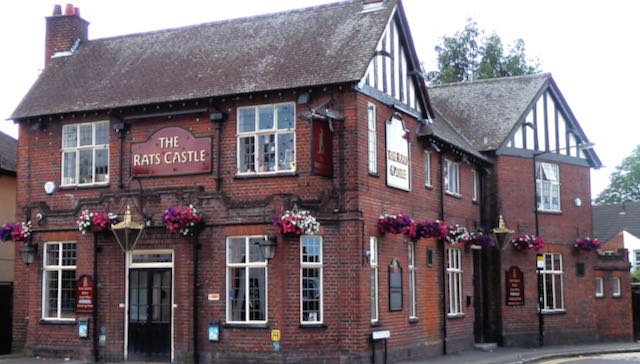
The latest of three buildings which have occupied this corner of Hatfield Road and Sutton Road.
The Rats' Castle PH opened in 1927.
When we pull out photographs of this corner we are inevitably shown a view of the current structure designed for Benskin's by architect Percival Cherry Blow and opened in 1927.  Many versions have been taken: with or without floral displays, and with one or another of several hanging signs interpreting the name of the pub using the artist's imagination.  We'll return to the name shortly.

Primrose Cottage was first a dwelling but was subsequently partly converted into a shop.  It seems
that the windowless rear extension was added at this time, with a boundary wall against the
recently converted track into Sutton Road.  Part of either 1 or 3 Castle Road can just be seen on
the extreme right.
COURTESY ST ALBANS MUSEUMS
Alternatively, a fine monochrome print of the building which the public house replaced, Primrose Cottage, completed c1895.  The title suggests it was constructed as a detached dwelling, but within two years construction work began on a large printing factory, the Fleet Works, and nearby workers' homes which were given the collective title Fleet Ville.  Until that moment Primrose Cottage was alone in the countryside, the nearest dwelling over a quarter mile away.  No time was therefore lost in converting part of the ground floor into a general store, and, as far as we know was first photographed c1903 after shop conversion under the management of Percy H Stone.

If you compare Primrose Cottage and its shop with the later public house it is possible to spot similarities in some of the design elements. There is just one known image of Primrose Cottage and shop, but I wonder whether, during its thirty year life span other views existed – still exist.

A section of the 1879 Ordnance Survey map shows the Hatfield Road (in brown) and the turnpike toll house (in red).  At the bottom of the extract is the low embankment of the Hatfield & St Albans
branch railway.  The former track, later renamed Sutton Road, then tree-lined, is between.
COURTESY HERTFORDSHIRE ARCHIVES & LOCAL STUDIES
Before either of the above buildings had existed a far more basic structure had been erected on the same footprint.  Although there is no proof of the wall materials – probably brick – we do know from recorded recollections that the roof was thatched and that it was a "little square" in floor area.  Its function was to house a turnpike toll collector (the road between Hatfield and St Albans was part of the Reading & Hatfield Turnpike Trust).  The track beside the little building later became Sutton Road and was on the edge of Beaumonts Farm owned by Thomas Kinder who also happened to be a trustee of the Turnpike Trust.  He gave the land on which the toll house was to be built and which enabled tolls to be collected before travellers set foot, wheel or hoof on the turnpike.  The track belonged to Mr Kinder and so he had a double interest in benefiting financially.  We know the toll house was erected before 1879 as the Ordnance Survey map of that year informs us, but the only known earlier record is the 1840 tithe map which is absent on the matter.

The rest of Broad Field was sold for development in 1899.  By then it was known locally as
Rats' Castle Field.  This photograph shows the upper end of Castle Road.
COURTESY HERTFORDSHIRE ARCHIVES & LOCAL STUDIES
Formally called the Hatfield Road toll house it was given up by the Turnpike Trust and continued to be occupied for a time before being abandoned by 1890.  It became rat infested, the rodents making their  homes in the straw roof.  Passers by had already given it a nickname by the time of the 1891 census: "the rats' castle". The building was identified as such in the 1891 census, and the field in which it stood, previously known as Broad Field, was known as Rats' Castle Field.  When in c1899 houses were built on part of the field the road was named Castle Road.

While we have been able to build a story based on those facts available to us no-one has brought forward a photographic image or a reasonably accurate pencil drawing or water colour painting.  We know where it was located from map evidence but we are badly in need of a photograph or drawing.  Let's get searching.

For further details of the above buildings on this site:

http://stalbansowneastend.org.uk/topic-selection/rats-castle/


Monday, 3 October 2022

The Quadrant Local Shops


The coloured base map shows the area covered by The Quadrant (in red).  The black overlay is the
former site of Marshalswick Farm (which had previously been known as Wheeler's Farm).
Marshalswick Lane is the curved road lower left; Sherwood Avenue (previously called
Woodlands Avenue) branches almost northwards from Marshalswick Lane.
COURTESY OPEN STREET MAP CONTRIBUTORS and NATIONAL LIBRARY OF SCOTLAND


A quiet period at The Quadrant recently.  Marshalswick Lane curves across the bottom of the image.
COURTESY GOOGLE EARTH

A mid 1930s proposed plan of part of the New Marshalswick estate. The red circled area is labelled
"School site - at present Marshalswick Farm". This would later become the site of The Quadrant
instead.
COURTESY ST ALBANS MUSEUMS

We can forget a cluster of four or five retail units round the corner or along the street, such as we've explored recently.  This week we've come to explore the daddy of them all, standing back proudly behind its own bend along what was known as the ring road – Marshalswick Lane – with its own pair of roundabouts.  This is The Quadrant, sporting its own definitive Article built into the title.  While intended to serve both old and new Marshalswick, today it is more widely signposted as a destination.  If the definition of Local Shops is a location you could walk to, in the case of The Quadrant it rather depends on how fit you are. While the centre's car parks (plural) have always been busy their main function today appear to serve more distant visitors.  As for bus services, if you live halfway along Charmouth Road, or anywhere else in Old Marshalswick for that matter, you are effectively as far from local shops as the city centre.

A view of the centre block at the front of The Quadrant in 1959.  There are as yet unoccupied
premises and an almost empty car park.
COURTESY CHRIS CARR


The developer placed an advertisement for potential tenants in the Herts Advertiser. Twenty-one of
31 shops in phase one were currently let.
COURTESY HERTS ADVERTISER


The Quadrant's gestation goes back to the mid-thirties when Marshalswick Farm was sold for housing following the eventual sale of Marshalswick House. T F Nash, a north London developer, published its initial plan for "the estate" meaning new Marshalswick, for old Marshalswick was already in build.  The road now known as Sherwood Avenue was to be a shopping street with units on both sides, and a cinema – possibly a multi-purpose hall.

But the style of the 1930s, replicated in dozens of north London residential estates alongside or spanning major roads, did not suit post-war retail layouts.  Instead a large swathe of the new estate was classified as a high density zone for flats, schools, shops and other services.  The former farm was still standing together with its barns, ponds and wooded surroundings, and in 1957 work began on clearing the site and creating phase one of the shops.

In a blog of this size it is not possible to plot the many changes which have taken place in the past sixty years, but a second phase was added from the mid-sixties, with an additional five shop units to lengthen both wings, although a sixth unit was created on the south  side by the expedient of dividing one full unit into two halves (the first iteration of Marshalswick Carpet Company, and Terry Watts, hairdresser).

The early days of the north wing, part of which was developed later, included a Chinese food outlet, Neighbourette laundrette, Wright's grocery, Kristian ladies' hairdresser, Norbury greengrocer, and the double-fronted corner shop was held by Victoria Wine.

Phase two of the southern wing showing a double unit occupied by Barclays Bank, which went
on to be joined by Lloyds Bank in the same block. Both have now left.
COURTESY BARCLAYS ARCHIVE

Phase one and phase two blocks on the south side taken c2012.  Opposite are the branch library,
community centre, M&S Food Hall (formerly The Baton PH) and Sainsbury's Local.


The south wing's double fronted unit launched with Giffen's Electrical (although this was soon followed by Darby's Radio and then Sherriff's Garden Shop).  The rest of the lineup included Micheline de Paris ladies' hairdresser, Drummonds toys and sports, Martin's newsagent and Post Office, Allen's hardware, Marshalswick Motors, Marshalswick Carpets, and Terry Watts men's hairdresser.  This side also features branches of Barclays and Lloyds banks, and the estate office of T F Nash, later McGlashan & Co.

The long sweep of the front road began with a double unit in the centre: Marshalswick Car Sales, although this seemed to be a temporary arrangement as the company moved to a separate building fronting Marshalswick Lane where today's Sainsbury's Local and petrol forecourt is.  Bishops Stores nestled into the double unit by c1965.

A full page advertisement placed in the Herts Advertiser by the DIY shop
Edward Carter, who also had a shop in the parade at Beech Road.
COURTESY HERTS ADVERTISER

From left to right the early shops included R J Blindell, shoes; Josephine, newsagent; C J Martin, chemist; Edward Carter, hardware (today we would called it DIY); The Woolshop; Notts bakers; E Butler, butcher; Pearks Dairies; Gerrard, fruiters; Kingston butchers; E Wright, watch maker and repairer; Longman's baby shop; Alicia, drapers; Andrews, outfitters; Eastman, dry cleaners; Marshalswick Furnishing (although a cycle shop existed here for a short time).

The frontage view of The Quadrant seen from Marshalswick Lane.
COURTESY GOOGLE STREET VIEW

That's quite a range for everyday as well as more specialist  requirements. But how have our apparent needs of yesteryear become our apparent needs for today?  As in many places the hardware/ironmongery shops have disappeared to more distant warehouses on retail parks.  Our groceries have become more diverse – the size of Budgens is identical to earlier Bishops, although next door's McColls may, by the time you read this, have morphed into a Morrison's Daily, but Sainsbury, which once wanted to make a sizeable appearance at Jersey Farm, now occupies a prominent location close to another even more prominent position at M&S Food – for readers who have moved away from the district in recent years the Baton PH was located here.

If the definition of Local Shops is a location you could walk to, in the case of The Quadrant it rather depends on how fit you are. While the centre's car parks (plural) have always been busy the main function today appear to serve more distant visitors.  As for bus services, if you live halfway along Charmouth Road, or anywhere else in Old Marshalswick for that matter, you are effectively as far from local shops as the city centre.

We now appear to crave more food on the go, and although Fish and Chips had made an appearance from the earliest days, Subway and Greggs have been added to the list.  Not to mention a Chinese,  Italian, kebab, KFC and Molen's cafe.

Not surprisingly I suppose, the banks, of which there were two, are now absent.  On the other hand, no-one felt the need for an estate agent, but now there are four.  There are also three charity shops and a kitchen design service for the five thousand homes which are apparently looking more old fashioned since the 1960s.  

Whatever the mix there is bound to be plenty of variety and competition among over forty shops, much as there has been since this retail adventure launched in 1959, gradually replacing the ad-hoc trade provided by a small number of mobile shops and delivery vans.