Friday, 28 February 2020

Long School Trip

A recent (2019) front page item on the website under the heading Decade News 1940, refers to schools which evacuated to St Albans from south coast towns in 1940.  While this was a significant event in itself and lasted for two years, we must not lose sight of the initial 1939 evacuation of schools from London whose official return did not take place until the war's end in 1945.  Given the distance in time from these evacuations we are in danger of losing what memory of the experiences still remains.

A letter of thanks and appreciation appeared in the Herts Advertiser in 1945 from the head teacher of Princess Road School, London.  As there were five schools with the same name in different parts of the capital it was necessary to identify the correct establishment.  The school which came to our city was Princess Road School, Camden, now renamed Primrose Hill Primary School.  There were some 300 junior children and the same number of infants.  It is not yet known whether both departments came, but we know that the school was paired with Fleetville School, which of course then only occupied the Royal Road building and its recently acquired huts.  Would there have been sufficient space for 600 children, if the hall was used for two classes?
Princess Road School, now renamed Primrose Hill Primary School, Camden.

Fleetville's own children attended school in the mornings, while Princess Road used the buildings in the afternoons.  Lest we imagine that this straightforward arrangement lasted uninterrupted for six years we must take into account a number of varied factors, including parents choosing to have children returned to London at any time they chose, children transferring to a senior school when they reached eleven, parents moving to a different town when allocated to new jobs; so the situation was fluid.  London County Council's own records are therefore scratchy.

A group of children – the adults are possibly their teachers – walking from
the station on arrival.  It is not known which school they were part of.
HERTS ADVERTISER.
Princess Road was also given access to the hall at St Paul's Church, presumably only for the mornings where their less formal education and other activities took place.  It was, at least, a base out of the rain and snow in winter.  That part of Blandford Road outside the church was cordoned off to form a temporary playground each day.

We know from occasional reports in the Herts Advertiser that the children ranged far and wide around the city visiting places of interest – and at least one letter home mentions a history study of the Romans at Verulamium.  Of course!

Princess Road School shared the accommodation at Fleetville School
for up to six years – afternoons only!
All of these children were billeted with families around the district, and it is presumed most stayed in homes in and around the Fleetville district.  Hosts would have taken responsibility for their evacuees during the weekend. So for up to six years the child population of our East End probably doubled.  On the positive side that's twice as many friendships which might have developed, and it would be good to think some of those friendships continued, at least by letter, after the return to Camden.

Today, we know that Primrose Hill Primary is interested in its own history, because it has a history page on its website.  So it is possible the school will wish to add a little extra paragraph about the extended school trip their children experienced between 1939 and 1945.

In the next post we will discover what happened to another Camden school, Haverstock Hill, when it was evacuated to St Albans.


Wednesday, 19 February 2020

Without a Name

Some years ago a recollection by a long-established resident of Fleetville lead to an unusual discovery.  The former Smith's Institute building, on the corner of Hatfield Road and Arthur Road, has undergone a considerable number of changes during the past 126 years.  It was built to perform the role of an employees' social club at a time when the printing factory (on the Morrison's site) and a few employee houses were all to be had in the embryonic suburb.


The Institute when new.  The commemorative stone
panel is just below window level at the building's corner.
It has been extended further into Arthur Road, had doorways altered, the facings have changed, and most of the ground floor internal walls removed to enable later printing machines to be installed.  

But one person recalled that on a corner wall there had at one time been a stone panel marking the formal opening of the building by the Mayor.  The event had taken place in 1899.  After having been covered by a modern facing, a contractor had drilled through the panel – although he did not realise it – to install a gas pipe.


The same building recently.
A few years ago the facing was removed to confirm the presence of the remembered panel.  We all looked at it and then continued with our lives.  But it is worth looking at again, because there maybe a story attached.  "This stone was laid June 24th 1899 by Thomas Smith Esq, donor of the Institute."  That much is plain to see.  Mr Smith's name is bold enough, and so was his role.  He both owned the new printing factory on the opposite side of the road, and he had given the money to pay for his employees' club building.  We know from other documents that he set up a trust fund from his own monies; the resources did not come from the company.

"Which was opened by His Worshipful the Mayor of St Albans Dec 2nd 1899."

These days the new Mayor is appointed in May when the local elections take place, but in 1899 the elections, and therefore Mayor-making were in November.  If you were going to invite the Mayor all the way out to Fleetville, especially as Fleetville was then outside the city boundary, to open the building you are so proud of, surely you would give him the honour of including his name rather than just calling him The Mayor.  The man had a name, and it doesn't take that long to carve his name into the stone panel.  On the day of the opening ceremony and the speech given by the Mayor it was clear he was excited to be present on that winter's day and he expressed the hope that Thomas Smith would one day wish to move his home (from Enfield) to live in the city.  The mayor was anticipating in return that the city would move the boundary outwards to include Fleetville.  Both of these hoped for targets would, of course, benefit the finances of St Albans.


Henry J Toulmin
ST ALBANS MUSEUMS
OK, so the time has come to reveal the name of the mayor, both in 1899 and 1900.  It was Henry Joseph Toulmin, whose home was at Childwickbury, also outside of the city boundary!

There are two other relevant facts which might fit into this story.  Thomas Smith was, by politics, a Liberal; Henry Toulmin was a Conservative.  Perhaps that was the reason why His Worshipful the Mayor was not mentioned by name; and it would ensure for the life of the Institute, that Thomas E Smith would be the name associated with this structural gift to his own little hamlet of Fleetville.  Job done!

Sunday, 9 February 2020

Up for the Cup in 1996

Every so often it behoves all of us to spend time clearing out, or maybe tidying the piles of stuff we hoard.  A while back we were undertaking a similar task at Fleetville Community Centre, although the intention had been solely to discover records of the Centre's early years from 1982.  But you know what it's like; you discover interesting programmes, minutes or newspaper articles, stop to read them, and later two hours progress remains slow.


The 1995-6 squad.  Back L-R: Robert Ade, Nick Malham, Jonathon Smithers, David Adams, Elliott Ryan, Jonathan
Michie, Tom Price, Stuart Hames.  Front L-R: Sam Parratt, Ben Herd, Chris Seeby (Captain), Matthew Jones, James Buck.

Among the miscellaneous documents were the three images shown on this post.  They were familiar and the reason became clear later when I consulted Bob Bridle and Duncan Burgoyne's book "100 Years, a History of Schools' Football in St Albans".  1995/6 was the final year described and illustrated – that year was Bob Bridle's final year overseeing the fortunes of schools' football in the district.  The book shows a squad line-up, the three goalscorer from the Cup match, and captain Chris Seeby holding aloft the trophy after the match against Hackney.


Goalscorers David Adams, Ben Herd and Jonathon Michie
in the Southern Counties quarter-final.
In a box of documents at the Community Centre is also a set of three photos, though not originals.  The squad from that year has fewer players than the one in the book, the goal scorers photo is in the collection, and another threesome pic is from an earlier match against Sutton, with the two team captains and the "regular referee".  The photos are all captioned and probably came from a local newsletter.  The locations may well have been at Fleetville Junior School, and at least some of the team will have had Fleetville connections.


Captains Chris Seeby (SA) and Ben Harding (Sutton), with
referee Chris Wood.  Southern Counties quarter final.
So we ponder over their futures, both in football or other sports, and in life.  All will now be in their mid-thirties and it would be great to hear from any of them, wherever they are now living – anywhere between Colney Heath Lane and the Falklands – as they reflect on their team recollections.  No distinctions will be made, so comments from ex pupils of other parts of the city are also eagerly sought.

The owner of these pics isn't known and so can't yet be acknowledged.


Saturday, 1 February 2020

A Mile is Not a Mile

There are many puzzles about the Hatfield Road cast iron mileposts and what they tell us.  These posts are reminders of the Turnpike road between Hatfield and Reading, and in this district the only posts left are at Ellenbrook, Popefield, Oaklands, Fleetville, The Peacock PH and St Stephens Hill.  All of the others have disappeared.


Turnpike mile marker at Fleetville
Recreation Ground.
The Fleetville marker may still be present, but it has moved.  It is currently on the corner of Hatfield Road and Royal Road, but there are people who seem to recall it has not always been there.  But if it is a mile marker it should be exactly one mile from the previous mile post at Oaklands; in its current location it is further than that.  Ordnance Survey maps up to and including 1924 locate the post outside a shop on Bycullah Terrace.  The marker is not shown on the 1937 map, either in its original location nor any other.

Of course, the post, when first installed, was at the roadside in front of a field in the countryside – Fleetville was still to be invented!  When Bycullah Terrace was built c1900 the property doorways were arranged around the location of the post, although it can't be ruled out that the post was moved along the road by a yard or two!  


Numbers 207 and 209 Hatfield Road
Photographic evidence is also absent.  Two fine postcard photos of Bycullah Terrace dating from approximately 1914 show the shops both from the west and the east, but obstructions and shadows on both views hide a potential post.  The map suggests it should be present outside number 209, presently an optician's premises, but in 1930 was a house occupied by Dr Frederick Smythe.  Dr Smythe then had a house built on the corner of Royal Road – Fleet House – which gave the new owner of 209 the opportunity of opening up the front,  first built as a manager's house for the Fleet Print Works, for use as a shop.


Bastin's plan showing the mile marker position.
But absence of the post from its measured location is intriguing, and until recently we still couldn't be conclusive about where it was being stored.  Now, as a result of a recent find we can be more specific about its removal.

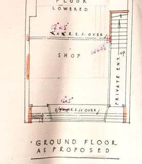
William Bastin was a Fleetville-based builder and had his yard, now occupied by Chapman's Auto Centre, just east of the Rats' Castle.  Albert Smith acquired Dr Smythe's premises at 209, with the intention of opening it as a bakery.  He therefore engaged William Bastin to draw up plans, which he did before realising there was an obstruction: the Turnpike milepost!  We know this because the post was drawn onto the plan by hand afterwards.


Proposed new shop front showing where the milestone
would obstruct the shop door.

This is therefore the first visual proof of its exact location.  While it was satisfactory for the building before modification – it stood in front of a piece of blank wall – the planned shop required the entrance to the shop to be located on the left, while the existing door on the right would give access to the first floor flat.  It seems that some negotiation must have taken place with St Albans Council, which then agreed for its removal and storage.  It is thought that the post re-appeared when Hatfield Road was widened slightly at the recreation ground.

The answer to the question, where was the post in Bycullah Terrace?  Between numbers 207 and 209.

The answer to the question, when was the post moved?  The plan is dated 1933 and Mr Smith was trading by 1934.