Many of our popular sites in the city give the impression of being timeless; old friends, that since their creation have experienced few changes, just the process of ageing gently. Clarence Park is one such location, now reaching its 128th birthday. In 1946 when the RAF overflew the eastern side of St Albans the park was only 52 years old. It is doubtful there had been an actual celebration – we would have other priorities at the time. The photographic negative seems to have been ageing gently too, with well scattered specks across its surface; or perhaps it just needed a good clean!
Clarence Park has received a few changes since its opening by HRH Duke of Cambridge in 1894: maturing flower beds, shrubs and magnificent trees; the separation of football and tennis, previously sharing the same plot according to season; the formation of a bowls club; the addition of a refreshment chalet and, for a time a cinder cycling track. Not every facility proved successful; the original bandstand of timber with wicker and thatch roof was the first to succumb, and although public toilets were added at The Crown boundary in the 1920s, toilet facilities are probably today in poorer state than they have ever been.
 |
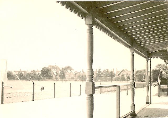
| The cricket pavilion, bottom left, with the refreshment pavilion in the centre. The embanked and fenced terraces of the football ground from a period before the turnstiles were installed. |
An original pedestrian gate opposite Granville Road was finally closed in the 1950s, the result of increasing traffic in Hatfield Road just up from The Crown and therefore posing an increased risk of accidents. In the second photograph the sun is shining across from the end of Granville Road as if forming a virtual crossing towards the park.
 |
| An end of bowls. |
Also in the recreation ground near Clarence Road are two white patches which represented two children's features of the time: the cone, or witch's hat, and the old favourite of swings. A small roundabout and bucking horse were sited near the gate leading to the cricket ground. Today the much enlarged area has been upgraded as a very colourful playpark.
 |
| Though this example is not at Clarence Park the Witch's Hat provided enjoyment for all. |
 |
| Though this example is not at Clarence Park the horse it is very similar. Hold on to your seats! |
 |
| Designer's drawing of the new playpark where the former roundabout and horse used to be. |
The circular interruption along the path across the recreation ground was the old bandstand – and is now the new bandstand. But in 1946 the Parks Department had arranged regular seasonal flower shows on what was then a raised circular bed.
 |
| Today's bandstand is on the same site as the original timber structure, but I wonder how many concerts take place here today. |
 |
| Location of one of the Second World War underground shelters in the recreation ground, close to the memorial drinking fountain. |
The first occasion during which the park was commandeered for alternative uses came during the First World War, its open spaces being used for troop training. In 1939 the park was once more under threat. A first aid centre and gas decontamination unit was set up in the area behind the cricket pavilion (orange circle in the top photograph). Two unidentified buildings remained near the gate leading to the recreation ground. Public underground shelters were excavated near the Hatfield Road path in the recreation ground. They serviced employees from the nearby factory of W O Peake Ltd, as well as park users and nearby residents. In particularly dry summers it is still possible to identify the long lost rectangles and square emergency exits in the parched grass. In fact the regularly spaced square exit slabs stand out clearly on the edge of the shadows on the second aerial photo. Several facilities for civilians were set up to encourage young men to maintain their fitness; and schools and clubs, including evacuated schools, continued to use the spaces for organised sport and games.
 |
| Public Toilets facing out onto The Crown junction, but now converted into a restaurant for Verdi's. COURTESY ST ALBANS MUSEUMS |
Focusing on the Maple-inspired cricket ground, which was previously part of St Peter's Farm, we would find the early cinder cycle track has gone, and the two parallel light lines from the top two photographs indicate the 1920s addition of tennis courts (today they are multi-use courts) funded by a donation from Samuel Ryder. At the northern end of the ground was a tiered stand seen in the 1946 photo (green circle). Presumably it was for those not privileged to be admitted to the pavilion. The stand was removed many years ago, but behind it was, and still is, a maintenance area and sensory garden.
A popular refreshment chalet next to the welcoming shade of a mature tree (red circle), occupied a grass triangle between the cricket ground and football pitch. That little building has also been removed, leaving no refreshment facility in the park. The Council built public toilets at the Crown boundary. That was back in the 1920s. The only other, rather rudimentary, facilities are near the football pitch and the bowling green, the latter available with a RADAR key. For many years these have remained the only facilities since the Council leased the Crown toilets to a restaurant business.
Anyone enjoying the Park in 1946 and returning today would discover remarkably few changes.


No comments:
Post a Comment