I have previously illustrated in this blog that we can identify the levels of that part of Hatfield Road between The Crown and Loreto College can be dated specifically to the 1860s. For readers who are unfamiliar with this section of road a cyclist beginning a journey at The Crown would be engaged in a steady climb to the railway bridge on the Midland Main Line Railway. The cyclist would then, assuming the Lemsford Road traffic lights are in her/his favour, be able to freewheel some distance until the climb resumes outside the former College of Further Education – this, incidentally, is the foot of the St Albans hill along the main entry road.
 |
| From the recreation area of Clarence Park the view shows the height of Hatfield Road above park level opposite the Station Way junction. |
A similar remoulding of Victoria Street (then named Victoria Road for most of its length) was undertaken for the purpose of "vaulting" over the Victoria Street Bridge, before reaching the foot of St Albans hill near Lattimore Road.
 |
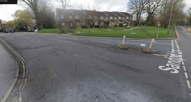
| It may not look very steep, but for a bicycle without gears and waiting for a green light the effort would have been – and still is – considerable. COURTESY GOOGLE STREET VIEW |
 |
| Pre-world war two buses used Beaconsfield Road to negotiate an awkward junction, especially for under-powered vehicles, to make their way into the former station forecourt. COURTESY GOOGLE STREET VIEW |
 |
| The Alma Road/Victoria Street junction could be just as challenging as Hatfield Road for cyclists, although Alma Road lacked traffic signals until the 1970s. COURTESY GOOGLE STREET VIEW |
 |
| Buses also advanced over the bridge and turned into the station forecourt on occasions – another exciting part of the route for upper deck passengers! COURTESY GOOGLE STREET VIEW |
 |
| Hatfield Road: on the left is Loreto College; on the right the former Further Education College. The St Albans hill begins as we approach Lattimore Road. COURTESY GOOGLE STREET VIEW |
 |
| Victoria Street at the Lattimore Road junction. The St Albans hill begins beyond this junction. |
The circumstances are almost identical for cyclists on their way from Alma Road to Beaconsfield Road, or, even more challenging, intending to turn right from Alma Road launching into the climb to the even steeper Victoria Street Bridge.
Not a problem today, but when the railway station was on the other side of the bridge and of Victoria Street – and when Stanhope Road was tree-lined, the early buses stopped using the latter road and, instead, used Hatfield Road and turned left into Beaconsfield Road, many of them turning in the station forecourt before proceeding into St Albans centre. Before the Second World War buses had less powerful engines and less sophisticated gearing than today, so driving these vehicles to negotiate such changes of gradient demanded extra skill from their drivers.
Even double deckers approaching the bridge from a decapitated (i.e. felled) Stanhope Road would provide top deck passengers with an uneasy sensation at the bus stop just before Alma Road. Not only was the road gradient still steep from the top of the bridge, but rather strangely, the road camber gave travellers the feeling they were about to be tipped sideway out of their windows, or that the bus would itself inevitably tip across the pavement into the hotel back yard! The stopping place has of course been removed, passengers now leaving or boarding their services outside the new station building.
We certainly have been left with awkward junction gradients as a result of the railway passing through the city.


No comments:
Post a Comment