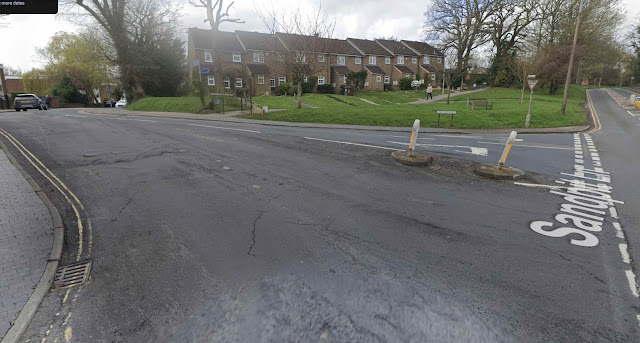
The following roads are often referred to as a group, the ladder roads: Blandford Road, Glenferrie Road, Sandfield Road and Harlesden Road. Although it is often assumed they were all developed as a single building estate under the ownership of Horace Slade, the straw hat and cardboard box manufacturer, only three fell into this group. Blandford Road was developed separately by Jacob Reynolds (of Heath Farm) and H J Skelton.
Of course, there was a much shorter parallel road: Laurel Road, and others further east, Royal and Tess roads but I haven't included these.
To discover more about how the four roads began after the land was acquired in 1898 I had made use of the early almanacs and street directories, but these don't always publish the correct timescales with the consequent delays and inaccuracies in publication. For the purpose of this article I left the 1901 census alone as this survey would have come along far too soon to provide an accurate picture of occupancy. Consequently, I gained an overview of the rate of development by means of the directories and the precision of the 1911 census following a decade of growth on the estate.
Blandford Road came to life on the east side along half of its length in a single block completed c1903 and most of the rest left lying green until c1908. The west side remained unbuilt until the middle of the decade. Now, let's see whether Mr Slade's estate was any different.
Although we are reminded of housebuilding all over the place in a continuous development, that leads us to a false conclusion. While there was certainly work proceeding in all of the roads most of the time the focus was limited to a small number of dwellings at a time, probably limited to the availability of sufficient skills building trades employees. The pattern was very similar to Blandford with building work being concentrated firstly at the Hatfield Road end and the higher numbers left until the middle of the decade.
Much of Sandfield's building work was more spread out, with a few homes followed by plots left empty for a number of years, and unlike the previous two roads, plots at the Hatfield Road end were left empty beyond the end of the decade or even until the 1930s. One plot on the corner of Brampton Road even remained a green patch until c1960 – it had been identified and reserved for a general shop, but eventually became a detached house. The shop did arrive, but was located on the corner of Harlesden and Burnham roads instead.
Of this group of roads it was Harlesden which shown the quickest and shortest build period. Activity began by 1900 and almost all homes were completed and occupied by 1903. The pattern of occupation throughout the estate seemed to be dictated through a combination of distance from the the park (i.e. Clarence Park and the town), size of plot, and in two of the roads closeness to Hatfield Road. Where the opportunities arose homes for rental were available at lower rents and on weekly terms, rather than monthly.
So, who was living in these streets during the first decade of the twentieth century? As might be expected two occupations shares the top spot: railway work and printing. The growth and popularity of the Midland Railway had encouraged a number of homes to be in build during the 1880s and 1890s where commuters were close enough to walk to the Midland Station, the Midland Railway employed men to maintain and fire the locomotives for journeys beginning locally; and of course a considerably number of trained and skilled locomotive drivers – the term engine driver became a popular term.
There was a necessity for offices of clerks making out and recording details of tickets creating timetables, and no doubt recording employment details and freight loads. All four roads had a fair number of employees working on the railway, some in supervisory roles could be detected in the larger properties further west.
And yes, the same can be said for tenants in the printing industry, and no doubt all had local work at the two Smith's works – Orford Smith quickly becoming the Sally Army building at Campfield. The many skills in the industry were represented on the estate, in machinery maintenance, paper, compositing, proof reading and distribution. Again there was evidence of more highly skilled employment and supervisory work in Blandford and Glenferrie roads.
1911 would be the last census that would identify the number of printing employees compared with railway operatives; the impending war from 1914 affected this trade more heavily than in rail transport.
Beyond these two industries other occupations were more widely spread and varied. Two residents were employed in the prison until that closed; carriers, no doubt for local carriage; at least five residents worked in the GPO (post office); a number of tailors, not only those from Nicholson's coat factory in Sutton Road; naturally there were a number of brickies and joiners given the quantity of building work in this part of St Albans. Engineers, perhaps described more vaguely what their work involved, but one was at the electric arc lighting factory in Campfield.
The ladder roads gave home to a wide variety of employment, and no doubt this would increase and change over the following decades, to include retail, an increase in law, property and banking jobs. The betterment of wages would begin to alter the mix from rental to purchased homes, particularly when landlords decided to cash in their investments and look for potential house owners. Enter a new style of banking with the Mutual or Building Societies in th 1930s.


.jpeg)


