Continuing the series on public open spaces – or parks by any other name – we need to include those spaces which were proposed but not created, as well as open space which already existed but failed to become enlarged, although that increase had been proposed. An example of each lies in Marshalswick.
The expectations laid at the door of local authorities from the 1930s onwards required the provision of public open space for use as parks, recreation grounds, sports grounds and informal open spaces in all new and growing development areas. The council worked on planning the distribution of spaces across the city for different kinds of public use so that, as far as possible, no parts of the urban sphere were unfairly deprived, and that in each residential district there was sufficient public open space to satisfy the needs of a healthy population.
In the late 1940s the council investigated two locations on the early Marshalls Wick, but because all of the land was in the hands of developers by that time, plots could only change hands at full land prices; the proposals were therefore heavily constrained by cost.
 |
| The horseshoe-shaped road was designed to replace an earlier series of parallel roads. Gurney Court Road and Charmouth Road are to the left in a photograph taken by the RAF in 1946. |
Now, it is true no house building had begun on the inner circle and even outer circle building was in its early stages. So there were few individual objectors, but developer/land owner Christopher Miskin – who also built a substantial house at one end of the outer circle – certainly exerted some pressure. With a cricket field in the middle the value of the outer circle homes would have been considerably lower. And of course the council would have to expend the land costs of around thirty detached homes on the first stage of acquiring the sporting space. Thereafter the authority would have denied itself the annual income of valuable rates (now council tax) due – and presumably the additional ongoing cost of occasional broken windows from across the road; every one a six!
 |
| Homes along the inner circle of The Park, which did not develop into "a park" in the 1950s. |
Due east from The Park (which did not materialise into a park) is the public open space known as The Wick, which we have all enjoyed since the 1930s. The Wick began in much the same way as The Park; a development opportunity which appeared on planning maps of the early 1930s; yet more roads-worth of homes spreading eastwards towards Marshalswick Lane, including one to be called Hazel Grove. But the owner of a large house in Sandpit Lane, Sir Arthur Peake put a stop to the housing development opposite him just in time. He used his wealth, effectively became the developer, and then gifted the land to the Council for the benefit of the people of St Albans. Thank you, Sir Arthur.
 |
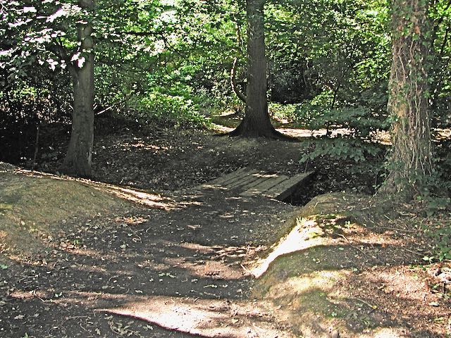
| A summer scene within the wooded section of The Wick, a local nature reserve. |
.jpeg) |
| Part of the open space, originally called a recreation ground, at The Wick. |
However, during the 1950s it did recognise a genuine shortage of open space between Fleetville and Oaklands and took the opportunity of acquiring the Jescott Dahlia Nurseries smallholding from the retiring Ernie Cooper, which became the new site of Longacres Park.

No comments:
Post a Comment