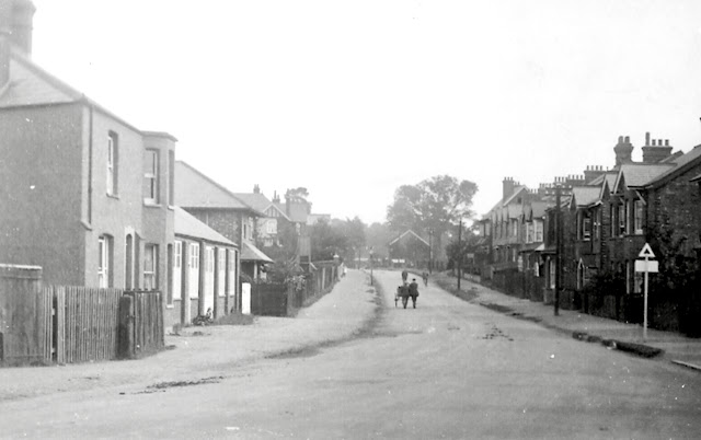
In the previous post we identified three former fields grouped around or near the double roundabout at the heart of the Beechwood Avenue and Hatfield Road junction – a very busy and sometimes congested traffic meeting point. To name the fields as they were prior to building development and when active farmland we'll take a walk eastwards along Hatfield Road, beginning at the Bycullah Terrace Fleetville shops.
 |
| View east along Hatfield Road from Sutton Road (off camera to the right). |
 |
| The fields laid out over today's street map. OPEN STREET MAP CONTRIBUTORS |
While we have been walking towards Oakwood Drive, the field on our left behind the shield of roadside trees and part of Beaumonts Farm was called Three Corners Stewards. It certainly has three sides and therefore three corners. Steward is someone who takes responsibility for something, in this case perhaps not the field itself but at the farm or manor. It has an Old English early medieval derivation with the first part of the word referring to a hall – an early style of manorial building. We note that the nearby area of Sandpit Lane is still referred to as Hall Heath.
If you were wondering about the bridge included in the name Hither Bridge Field, you may be similarly perplexed about its neighbour, which today is part of Brick Knoll Park business park; it was formerly named Further Bridge Field. The bridge in question had nothing to do with the branch railway, but there may have been a simply formed bridge somewhere near the boundary between the two fields. We have to follow the contours and remember that below the clay there is chalk. Though the water table is not as high as in previous centuries it is likely a spring surfaced nearby and followed the natural land surface in the vicinity of Cambridge Road, meeting another stream flowing from The Wick, across Hatfield Road and Campfield Road towards the River Ver, thence to the Colne.
When building development first began in 1899 your walk along Hatfield Road would have begun with the general shop on the corner of Sutton Road, where now is the Rats' Castle public house; the route of Castle Road, with its two sub roads Cape Road and Kimberley (later renamed Burleigh) Road, had been laid out and one or two groups of homes and a few isolated cottages built, or in the process of construction, by 1905 A little nursery garden had quickly grown near the Ashpath track, but the remainder was left as open land. Even along Hatfield Road where housebuilding was slower off the mark. The field appears to have been initially purchased by two different businessmen: Tom Tomlinson and Horace Slade. As with other early development in Fleetville the roads were lined with a mix of houses and business premises, although there has been slow transformation away from workshops in favour of compact homes and small groups of flats, the most recent only coming out of the ground within the past twenty years.
Further Bridge Field east of Ashley Road was retained by the Fish family of Oaklands (who had acquired Beaumonts Farm c1899). The owner had released some of the remaining field as an allotment garden, but not the Hatfield Road frontage. There was space for approximately seven homes here but the plots did not become available until 1929, all but one completed by 1931. At the same time homes for rent were built on what is now known as the Willow Estate. This included a row of homes on the east side of newly named Ashley Road, completing the first phase of road names with the theme of trees.
On the former Hill End Farm's Hatfield Road Field, building had begun earlier; three were complete by 1923, twelve more by 1926, and the remainder by 1930. As with all homes in this period only the plots were purchased, leaving the owners to negotiate separately with a builder; a majority of the homes became detached dwellings, mainly having substantial rear gardens.
Across the main road Three Corners Stewards became part of the remainder of Beaumonts Farm to be sold in 1929. So a line of large semi-detached homes became the subsequent development along Hatfield Road, the first to be marketed as "an estate". Many of the line of mature trees along the Hatfield Road frontage of Stewards had conveniently been removed during or shortly after the First World War, the work carried out under supervision by prisoners of war billeted at Oaklands. The boundary near the Beaumont Avenue end was in the form of an embankment, out of vertical alignment with the road surface – and there was no footpath for several years.
Both sides of Elm Drive were within the curtilage of this field and marketed between 1933 and 1936. For those pondering over a distinctly more modern house at the junction of Hatfield Road and Beechwood Avenue, this was built c1966 on the site of the builder's compound for the field's development.


No comments:
Post a Comment