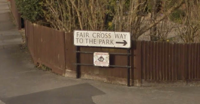
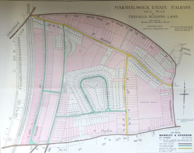
The question which follows is not Which park? for this is the road named The Park, looping off the northern side of Faircross Way. The roads between Sandpit Lane and Marshalswick Lane had previously been the historic estate and gardens of the Marten family's Marshals Wick House, sometimes referred to as Wick House. The house was torn down in the 1920s. But a recognisable portion of the gardens came to be regenerated as The Park, a horseshoe-shaped road which today contains 72 mainly large detached homes and mainly built in the 1950s and 1960s.
 |
| The Park and Faircross Way shown in 1946 on an RAF Aerial Survey. COURTESY HISTORIC ENGLAND |
 |
| The western divided exits between The Park and Faircross Way. |
So let's check how The Park looked in 1946 and compare it with today's streetscape. Many of the Marshals Drive plots had been sold in the 1930s and a few homes had been built. Owners who had been forced to wait until licenses were available after 1946 discovered materials were in short supply, only sufficient for small homes considering the wide sites they were to sit on. There were around twenty occupants in Charmouth Road east and a nominal number in Homewood Road near its Marshals Drive junction. Plot owners in those locations would also have to wait for more generous licenses.
 |
 |
| Space or no space; both are on show at both ends of Faircross Way. |
What was left of the former grounds of Marshals Wick House was a wide swathe of open parkland between Charmouth and Homewood roads. A boundary line of trees extended NNE from Sandpit Lane towards Charmouth Road and onwards to Sandridge Road at the railway bridge. A small number of mature trees were growing within the horseshoe roadway, many of which survive in the present private gardens. I am surprised not to discover on the aerial image, an extensive collection of temporary allotment gardens, commonly found in other parts of St Albans. But there is evidence of, perhaps, grain or grass recently cut for hay (the photo was taken in October). Lines of small shed-like buildings occupied land immediately north of The Park. Perhaps these had supported earlier allotments or smallholdings. We should realise, of course, that Marshals Wick House and its estate was first offered for auction as early as 1921, the sale process taking many years to complete, during which time it is likely the grounds were not fully maintained.
For couples and families living within "local adventure" distance of The Park traditional Sunday walks were popular in the 1940s and 50s. The open spaces were unofficial playgrounds for children, picnic spots for those unable to afford travel to more distant or real countryside, and perhaps wistful journeys for future homeowners. However, this landscape did not remain static for very long, as the street directories reveal.
 |
| The Park from a recent aerial photo. COURTESY GOOGLE EARTH |
But that was only half of the account: at the same time all but three of the inner plots were in build, and the owners' list for The Park and Faircross Way contained a fair sprinkling of the city's trading success stories and professional businesses.
 |
| The Park, a streetscape. |
There remains, however, one query with the 1946 RAF aerial photo. Although the level of detail is not high there are two plots which already appear to have houses on them; one at the middle of the north-west curve (seems to have a circular feature in the front garden) and one as that same curve becomes straight again. This suggests that two homes were completed earlier than surviving directories suggest. Maybe they were begun earlier but could not be completed before the 1940 moratorium. Anyone who has an answer to this query is sure to post an answer!
The original split entry and exit junctions of The Park have remained in tact; many former estate trees have thrived and been much enriched by house owners planting their own; the street tree programme; the original silver street lamp posts in place (though they have lost their elegance since the LED conversion in recent years); and the driving schools of the district who warmed to the quiet, lack of street parking, the junctions and curves, all regularly incorporated into their training routes.
There is no doubt a stroll or cycle ride in this vicinity will prove to anyone the streetscape has kerb appeal in spades.


No comments:
Post a Comment