Monday, 29 July 2019

Right of Way

A few followers of St Albans' Own East End may recall reading of an application to St Albans Council around 1900 to divert part of  the footpath between Princes Road (Woodstock Road South) and Brampton Road so that homes could be built in Burnham Road.  This was agreed to since walkers would have a network of paths they could use on the new road network.

A current footpath through what remains of Chandlers
Grove wood
T F Nash, the company which developed Marshalswick Estate, encountered a similar problem, imposing a new road network on an existing network of public footpaths and tracks, which is why gaps between homes have produced St Mary's Walk and an un-named path between Pondfield Crescent and Queen's Crescent, which had previously been part of the edge of Chandlers Grove.  The narrow band of woodland accommodating a right of way footpath is also preserved parallel to Chiltern Road before it forms the boundary between Malvern Close and Sandringham School.

Path between homes from Pondfield Crescent
and Queen's Crescent
So, it is unsurprising that a public right of way issue has arisen once more on the site of Sandringham School.  For the roots of the story we must wind the clock back to the days before the school existed and a network of paths linked the farms and other rural habitations on the substantial Marten estate focusing on the former  Marshals Wick House.  One such path linked St Albans Road, Sandridge at St Helier Road and Jersey Farm; another branched southwards towards the House from Sirdane, a dwelling seemingly in the middle of nowhere but which came to be at the T junction of these two paths.

When the County Council purchased land for the Marshalswick Boys' School it clearly understood the problem as the north-south footpath, which had been allowed for by Nash on the south side of The Ridgeway, becoming St Mary's Walk, intersected the new school site.  The path was therefore diverted west-east along the northern boundary of the school before joining the path mentioned above near Malvern Close.  Walkers could then use The Ridgeway and pick up the  St Mary's Walk path.  

Later, when Sandringham Crescent was driven through, the County acquired more land for the school (only half of the school had been constructed in 1959 due to a restriction of cost availability), it had neglected to adjust the footpath to the new boundary further north.  Hence today's problem as the school plans for new facilities on the north side of its site.

Marshalswick Boys' School when new, fronting The Ridgeway.  The newly-posted fence forms the northern boundary of the school and the diverted footpath.  Previously the path had followed a
route from the house known as Sirdane (background left) towards The Ridgeway (foreground left).
The future Chiltern Road is the neck of woodland to the right of the playgrounds.  Sandringham Crescent, also in the future, will cross the light coloured field northof the original
school boundary.
 PHOTO COURTESY ANDY LAWRENCE.

But it does pose an interesting question.  What does the current path through the school grounds provide which the alternative – the original west-east extension of Helier Road towards Chiltern Road – does not?  One seems to be a duplication of the other for a few hundred metres.  If you were going to choose which path to follow, surely you would walk the path on the north side of Sandringham Crescent, where there are alternatives within Jersey Farm Woodland Park.  What would be the benefit of using the straight-line path along an educational establishment's boundary – or rather inside it – other than because the law allows us to.  Which is not a very strong argument on its own for so short a distance.

Of course, a precedent had already been set at the site of Samuel Ryder Academy, formerly Francis Bacon School, where extensions to the original boundary enveloped the lower end of Hill End Lane on its way to London Road.  At one time it had been a traffic route, but the lane had been allowed to "re-wild" along its edges and became a footpath, but as this passed inside the boundary of the school a risk was perceived to exist.  The authority therefore stopped up the path and authorised a diversion via Drakes Drive.  Drakes Drive had, after all, been constructed to replace Hill End Lane.


Thursday, 25 July 2019

The Orchid King

It is possible that you have joined one of the groups attending Hatfield Road Cemetery on one of the popular Laid to Rest story walks, organised by the local history group Fleetville Diaries.  If so you will have seen, because we have told the story of the families Sander and Moon, a rather forlorn and overgrown family plot.  Brambles and Buddleia are not really representative of one of the country's foremost orchid hybridisers of the 19th century!


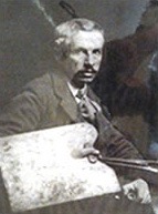
Henry G Moon, artist
If you now take a walk in the cemetery you will discover an impressive plot; the offending brambles and other invasive plants have been coaxed out of the ground, the granite stonework has been cleaned, restored and re-set, fresh topsoil and weed inhibiting matting laid – and there is now fresh green grass growing inside the kerbing.  The grave is along a curved path from the main avenue opposite the chapel, leading towards the Cemetery Manager's office.


Orchid Laelia Goldiana
The work was undertaken by a team from Fleetville Diaries, having become temporary guardians under the Adopt-a-Grave process, and of course with the full blessing of today's members of the Sander and Moon families.  J J Burgess carried out much of the stonework.

Frederick Sander, informally known as the Orchid King, had his nurseries in Camp Road from the 1880s, and in-law and artist Henry Moon produced slightly under two hundred stunning paintings of orchids.  So, there are members of both families buried in the plot.  The full story of the Orchid King can be found on the Frederick Sander & Henry Moon Tribute section of www.fleetvillediaries.org   During the course of the project it was discovered that Moon had also undertaken similar paintings for Peter Barr, a daffodil hybridiser in Streatham.  Peter, rather appropriately, had been known as the Daffodil King.  So representatives of Barr's Streatham research group also joined the Tribute Day.

Before the restoration project began

On a very hot day this week Fleetville Diaries invited some eighty guests, including the current generations of the Sander and Moon families to a special Tribute Day, firstly around the grave in Hatfield Road Cemetery, and then to refreshments and an exhibition at St Paul's Church.  This was an occasion for some members of these two impressive families to meet each other for the very first time, and it is clear that they were overwhelmed by the recognition bestowed on them by the occasion.


The project on completion


Sunday, 14 July 2019

The School House

Many of us are familiar with post-war secondary schools which were built with a house or bungalow for the caretaker of the establishment.  In an earlier era it was deemed appropriate to provide a house for the head teacher in a few circumstances, and  we might use the example of St Peter's Rural Elementary School, which became known as Camp School soon after opening in 1898.

However, Fleetville Schools, nor any others in the city that can be discovered, were built without a head teacher's house.  So the clue may be in the original title of Camp School: St Peter Rural.  While there were plans for new housing nearby, the nearest existing homes were cottages at Camp Hill.  Further away were recently built homes at what we know as The Crown.  But most of the early children came from hamlets such as Tyttenhanger Green, and isolated farm cottages in the countryside.  Children attending the new school would, of course, have walked; but a school could not open if a head teacher (and his wife, to take charge of the Infant department) could not be appointed.  To minimise this risk in an area devoid of appropriate housing, the Education Board added a house on the site.

The 1912 map with the school house on the right, directly
opposite Royston Road.

The first Ordnance Survey map which shows the school house was the 1898 revision in 1912.  On this restricted triangular site the main building housed the junior and infants departments, with the senior department separated on the western boundary.  The separate building on the east side was the school house.  Behind it in the 1930s a portable building, informally named The Bungalow, was built and the last head teacher to live in the house may have been Mr Hill.  Certainly it was empty during the tenure of Mr Belcher who, having come from Fleetville School, had been used to his own family home in Beechwood Avenue.  In fact, the school house had been empty and unmaintained for around two decades until being demolished in 1972 to provide space for the new Nursery.


The architect's drawing from 1898 shows the front elevation of the school, but not the school house.  A good quality photograph from 1914 also excludes the school house, probably because the space between the house and the school was a relatively wide area used as a playground for the girls and infant children.

I have not yet discovered a photograph of the school house, but a tantalising glimpse of its design, appears to coordinate with the school; it is in the recently discovered picture of a 1930 class with a corner of the house on the right edge of the image.  Compare that with other class photos taken in front of the main building in which the entrance porch is a key architectural element.

c1930 class showing a small part of the school house on the right.

So – and not for the first time on this site – the call goes out for photographs of the Camp School head teacher's house.  Since it was designed by the same architect as the school itself, and built at the same time as the school under the same contract, it is inevitable that  one front elevation will have been reflected in the other.


Sunday, 7 July 2019

It's All in a Bag

This year's Larks in the Park on Fleetville Rec attracted the usual friendly crowd of visitors; locals in the main, although it included  many families from across the city.  To greet them were the usual collection of stalls, entertainments and stands representing such charitable organisations such as Highfield Park Trust.  And the bold new marquee charting the latest progress of the proposed new Community Centre building.

Relevant to this story was the bric-a-brac stall, the place where you hope to sell items of a miscellaneous nature, and perhaps pick up treats for a grandchild or two.  Standing on the ground was one of those very ordinary bags you might use to carry a small amount of shopping home from the supermarket or greengrocer.  One visitor carefully investigated its contents and pulled out – a photograph!

A large school photograph, mounted, but without any information of any kind either on the front or back.   Our visitor knew exactly where this picture belonged and walked over to the Fleetville Diaries stand with it.  Apologies to anyone else also at the stand who, at that moment, felt rather left out, but the arrival of the image was rather exciting, as you may gather from the version shown below.

It had been taken at Camp Elementary School around 1930, as evidenced by the back rows who were clearly senior pupils; in fact the whole class of 42 pupils are probably eleven years or over. The school lost its seniors to Priory Park and Hatfield Road schools to enable Camp to become a JMI school.  Mr E Richmond, who lived in Windermere Avenue, was its teacher; he is seen in Camp School  football team photos of the time.  As to where the class was arranged, it certainly wouldn't be possible today.  The space was part of the playground between  the headmaster's house (right) and the main school building; Royston Road is behind.  Today waste bins, parked cars and a modern building occupy the space where the house once stood.

A senior class at Camp Elementary School c1930.

But where has this photograph – still in very good condition – been since the fresh faces lined up c1930?  Not every family would have been able to purchase a copy, or even would have wanted to.  Maybe it was stored in the home of a former member of staff.  If not, it probably spent most of its lifetime in the successive homes of one member of the class shown, though interestingly there is no pencilled circle or extra finger marks around any of the faces shown as is often the case!  To make identification even more difficult – and this is a common issue – no names or dates have been written on the reverse.

Questions therefore remain: who were these children of Camp district, who would today be between 100 and 105 years old.  How did the photo in a bag reach Fleetville Rec in June 2019?  Was it the result of a house clearance, or younger family members having a sort out?  The story of this class photograph remains largely hidden from us throughout the past ninety years.

But if you have information to add please get in touch: the email address is saoee@me.com

And if you would like similar photographs to reach a safe and permanent home – even if it is only a copy of the original – then do use the same email address.  Far too many historically important images of life in our city are being lost because their guardians just don't know what to do with them.