Wednesday, 23 April 2025

Ballito Anniversary

 One hundred years ago in 1925 the Fleetville district welcomed a new business.  An empty building had been the sprawling printing works of Thomas E Smith and was commandeered by HM Government since 1917, overseeing the tenancy of the Howard Grubb telescope manufacturer.  When that company moved north the spacious factory became empty once more.

This striking building from 1897 had been Thomas Smith's printing works.  In 1925 it became
Ballington Hosiery Mill, home of the Ballito brand.

Within months a fresh name moved in, the Ballington Hosiery Mill, a brand we have come to know as Ballito ladies fashion stockings – and later a range of other garment products.

Advertising posters in the press and on hoardings during the early
twentieth century.

Ballington, with offices and a warehouse in the City of London, acquired and imported cotton ladies stockings from the USA – and the product became even more popular when cotton was supplanted first by silk and still later by nylon.  Following the First World War import taxes were added to a wide range of luxury goods, including the stockings which the brothers Alexander and Charles Cotzin had been bringing in from Tennessee.


Hosiery importers Alexander Cotzin (top) and his brother Charles (above) were responsible
for bringing stocking machines and skilled craftsmen from southern USA to set up
the mill in the former printing works at Fleetville.

In order to circumvent the import taxes the brothers sent skilled engineers to America to source and purchase appropriate machines and equally well qualified machine operators; the intention being to acquire a suitable and empty manufacturing building.  Within months the Fleetville building, where Morrison's Supermarket is today, was being fitted out.  The mill always used the company's trading name, Ballito, although its original legal name, Ballington, was retained, being the Tennessee suburb where its cotton products were historically produced.

The Ballito brand name and typeface became distinctive and near universal from the 1930s onwards.

So far this part of the Ballito account is familiar.  But there is a back-story for the Ballington business which is less well known and deserves to be told for that is also part of local employment and economy, and a level of abuse of labour laws, especially children, still common in the southern states.

The Ballington Mill originated in a suburb of Nashville in a state, Tennessee, awash with cotton mills,  An early mill, the forerunner of Ballington, was at Chattanooga, owned and opened by wealthy philanthropist Edward Gould Richmond (1851-1903).

Child labour at the Richmond spinning  mill in 1910
COURTESY LIBRARY OF CONGRESS ARCHIVE

The spinning mills were amongst the thriving cotton growing counties, and Richmond's wealth came via the extensive former slave labour used in the plantations.  Labour was plentiful and cheap elsewhere too at the turn of the twentieth century, and most of the mills took advantage for competitive reasons.  Apart from adults, as many children as possible became part of the labour force at "cent rates".  Such illegal arrangements were kept hidden from the factory inspectors by managers pleading their "just helping out" excuses.  Nevertheless low costs fed their way into the regional economies and made mill managers wealthy.

Such an export market made considerable profits for the young Ballito brand in the years before World War One, and enabled the Cotzins to advertise widely in newspapers, magazines, along railway lines and on the developing bus networks.


Post World War Two employment advertising for Ballito.
COURTESY  HERTS ADVERTISER

From 1925 large numbers of residents living in St Albans at the time, including many migrating here from other locations, obtained good employment at the Ballito works over a period of up to forty years.  And it all began here in 1925.

Further blog posts this summer will explore the progress made by Ballito during that period.  Given that the company was shut down in 1967, over fifty years ago, there will be many "east enders" who will have little or no knowledge of Ballito Hosiery Mill whose tall chimney stack announced the mill's presence along Hatfield Road.

Wednesday, 16 April 2025

What a Mess!

 In the second of our series of posts leading up to the imminent  commemoration of the end of the Second World War I am recalling a few of the rather messy ends to hostilities.  Next month the nation will recall the date as 8th May 1945 – 9th May for those who were residents of the Channel Islands.  We will be celebrating as if on that single day our previously normal pre-war lives will return to how they had previously been.  But just like any major social event on any peacetime occasion, much work goes into the clearing up, returning borrowed items to their owners, conversing with nearby house owners to apologise for excess noise they endured during the event.

A platoon of Home Guard volunteers outside their Central Drive HQ which was hastily removed
to enable post-war housing to proceed apace. Where was this structure removed to, we wonder?

Residents of the East End of St Albans, just as everywhere else, had taken on serious or casual responsibilities if they had not fought on the front line.  So among the equipment which had been shipped to our local communities from government warehouses were basic items such as stirrup pumps.  A few years previously householders had practised the fighting of small fires with buckets, water and these simple contraptions.  So, what to do with them now?  We eventually discovered that, although belonging to the government, we were not required to physically return them to a local collecting point, so  continued to find uses for them in our gardens.

Practising at stirrup pump parties, as they were known.  Just how effective were these hand-operated devices at dowsing a blaze?

Households were supplied with one of two types of emergency shelter back in 1939 and 1940.  One, the Anderson, was for part-burying in our gardens, while the Morrison was a heavy-weight table for the living room, which we could shelter under.  These items too, "property of HM Government" were impractical to return and most of us discovered inventive ongoing uses for them.

Heavy concrete blocks can still be found in odd places, but they were useful in
blocking roads in strategic locations.  Well, they were inconvenient for us and, we
trust, would have been for an enemy invader!

For many months prior to May 1945, normalisation had taken a gradual hold on our lives.  The civilian "Dad's Army", or Home Guard, stood down and had local parties organised for their families.  The uniforms they had worn for up to four years saw further use in their owners' gardens and allotments.  The concrete blocks with their integral metal hooks, which had got in the way of normal road travel had also been removed from the roads leading to the Crown junction, and at Smallford Crossroads.  Community bins which had been set up for householders to dispose of food waste before dispatch to pig clubs, gradually disappeared, as did the piles of sand prepared for creating sand bags to guard against blast.  And while on the subject of blast may companies, schools and other public buildings continued to work round the awkward blast walls in front of external doorways until they could stand the irritation no longer!

Collecting and locally transporting useful salvage materials has always been a feature of
voluntary organisations, including the Scouts, as here at London Colney, although the passenger
seating arrangements today would not be as casual!

Underground and surface street shelters and other utilitarian buildings were locked against "improper uses" in the period ahead.  The rather untidy street scapes of white bands of paint near the bottom of street lamps and key kerb stones, may well have been obliterated but were generally left to fade naturally.  Local authorities themselves were in no hurry to switch on the lights themselves after years of darkness; labour was in short supply, as was the funding for their running costs.  The signs which were removed in 1939 in an attempt to confuse an enemy following invasion, were a challenge to return to their former locations and many never made it – some of the heavier items were simply buried near to where they had been taken down.  Street life was a dour visual experience in many places.

Air raid sirens remained in place until the sixties and continued to function for calling
firemen before the days of universal phones, and later during the Cold War.  In the war
black-out they were just another obstruction to bump into on cloudy nights – the
streets seem to be littered with all sorts of "stuff" which was deemed essential.

No houses had been built since 1940, and many of the damaged properties were repaired ineffectively, or not at all – our chimney stack, having been damaged in a 1940 bomb drop nearby – was not rebuilt until 1948.  In the rush to complete new homes before the imposed 1940 deadline, some of the detailing had been left incomplete and the road surfaces which should have been properly made up were left as the remains of former fields with the minimum of gravel, and f finally being properly completed in the mid 1950s.

In the week around Victory in Europe Day many of the streets were closed for parties; this
one was at Elm Drive.  Some groups combined, but our parents would remind us of 
advanced planning: "I'm keeping this for the street party, so no eating it before the day!"

We continued to buy our everyday requirements with the aid of ration books, sometimes including foods, such as bread, which everyone had eaten without ration throughout the war.  We children had to be patient while we waiting for ration-free sweets until the mid fifties.  Toys in the pre-plastic and battery-free era were rare and expensive.  But the benefit here was that children grew up and could pass on those play items to their younger siblings and friends.

Yes, May 8th (or 9th) was certainly a good reason to celebrate, but it was a period tinged with tiredness and emotional hurt through the loss of family members or friends, a feeling which the whole country continued to experience until that decade had been extinguished.

The 1940s was certainly a very messy decade.


Friday, 4 April 2025

Street Plates 4

 For those of us who have known St Albans for a number of years each of today's street names will be familiar.  Familiar yes, but occasionally can we bring ourselves to locate their whereabouts, visualise their location in our minds, or even know someone, a particular building or style of architecture typical of the area?  We can be forgiven if our recent arrival makes it inevitable that most of the district's roads are yet unfamiliar.


Baker's Close, but not now leading to V A Barrett, the baker's.
COURTESY GOOGLE STREET VIEW

This month's tour begins at Camp Hill, opposite to Dexter Close and where St Albans Rubber Company used to be.  Many of the early 19th century buildings, mainly small dwellings, were demolished earlier in the 20th century and post-World War Two were replaced by the occasional industrial building.  One was the bakery of F V Barrett.

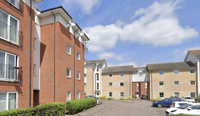
Before the 1960s their bread and cakes were created at the back of their George Street shop.  In fact number 10 had been a bakery at least as far back as the 1850s.  Frederick V Barrett took over the established business c1940 and possibly as part of the post-war business improvements the products were made at the Camp Hill premises.  It seems that the George Street premises changed hands (to Arlow Antiques) at the same time.  How long the Camp Hill bakery survived is uncertain but there are now modern apartment buildings.  The access road to these buildings has appropriately been named Bakers Close – although as is common for street names the label omits the apostrophe!


The long distance trackway from which Marshalswick's The Ridgeway derives its name.

Less today when housing developers are substantial corporations, but in the period up to the 1960s road names offer clues of the origins of the businesses; house builders often being local or at least grew to become moderately sized successful family businesses.  One such which grew substantially between the world wars, brought their expertise from the north London suburbs to St Albans was Thomas Nash.  As a formative small company it made its mark in the Chilterns
A few of the roads in the Marshalswick which emerged from the late 1930s betray their employer's roots from High Wycombe.

It was not uncommon for a lengthy road to be created to link other roads within the residential area's network.  For eighty miles or so between the North Wessex Downs and the Chilterns – Avebury to Aldbury – is the cross country path/trackway known as The Ridgeway. It traverses the landscape and rarely remains level terrain but climbs and descends the chalky hill landscape.  The company, in creating the Marshalswick link road which begins and ends at different points along Marshalswick Lane, adopts the same name: The Ridgeway.

The first section, laid down in 1938 was named The Ridgeway West.  This fell out of fashion post-war as building resumed and names North and South were informally appended, although The Ridgeway was universally adopted for the entire length.


A corner of Highfield's apple orchards.

South Hertfordshire contained a number of mental hospitals from the late 19th centuries and among their commonalities, at least in their early periods, was the acquisition of small farms on the extensive open landscapes about the hospital buildings. The growth of fruit orchards was a connected feature.  None of the hospitals remain in their original forms, having either been demolished or reconfigured into residential accommodation, but one feature retained has been the fruit orchards.  The former Hill End hospital is an example.  Its apple orchards thrive. 

Hill End and its neighbour Cell Barnes have been replaced by the residential developments known as Highfield, and imaginative uses have been found for extensive open spaces, the former and often attractive grounds around the now forgotten buildings.  Highfield Park Trust manage these parklands and related facilities open to the public.

Of the apple varieties found in its orchards seven have been appended into the neighbouring residential roads: St Edmund, Bromley Way, Russet Drive, Grenadier Court, Greensleeves Close, Sturmer Close and Grafton Close.


The village centre at Sutton, Cambridgeshire.
COURTESY GOOGLE STREET VIEW


The sale of Beaumonts Farm began, in sections, during 1899; this to include those fields located south of Hatfield Road. The southern boundary followed the line of Camp Road, while broadly the eastern boundary was a field edge no longer visible but today encloses the Willow estate and the industrial estate which includes Brick Knoll Park.  Over on the west side Beaumonts Farm included the track which became Sutton Road, the second of two tracks which linked Hatfield Road and Camp Road.

The partnership between two well-known men of St Albans sprang into action as this part of the farm was was marketed.  A well-known chemist, Arthur Ekins was clearly the lead partner of the two; the other being Francis Giffin, a solicitor.


Friday, 28 March 2025

Twenty-Five Minutes Missing


Green flag award open space, Hatfield Road cemetery.

 Among the most relaxing and peaceful periods of time in the bustle of Fleetville may be spent wandering the paths of Hatfield Road Cemetery.  A few years ago a group of us discovered some unusual stories among its residents laid to rest.  So I have brought together a small number in an occasional series.  Here is the first.

On the western side of the burial ground is the final resting place of a 40-year old Asian man who, in 1974, almost no-one could admit to knowing.  So intriguing was this man's unfortunate story that the investigating police officer was the only mourner at his burial, using his professional experience to track down the man's parents and brother in Singapore.

We know nothing of his private live, other than he lived alone in a bed-sit somewhere in the city; the Blacksmith's Arms overlooking St Peter's Street, was considered to be his "local"; and that he worked as a wireman at a firm in Welwyn Garden City; since there was no evidence of a car we assume he used the former 330 bus from St Peter's Street to the Garden City.

The man was known as Tan: Francis Tan Kim Choo.

From those people who did claim to know him and who frequented the Blacksmith's Arms, confirmed he was, I suppose like many of us, a creature of habit.  He would sit on his own each evening in one of the bars, acknowledging everyone who came in, but no-one seemed to talk to him.  After last orders and closure he would remain behind to assist with washing up before disappearing back to his bed-sit.

Blacksmiths Arms public house on the corner of Hatfield Road and St Peter's Street.
This was Tan's nightly visiting place.

But one night, his last, was different.

Tan, instead of remaining behind, left the pub promptly at 10.30, carrying with him a white plastic bag.  At the same time, and from another bar, a woman left.  They later met in St Peter's Street and agreed to go somewhere for a Chinese meal.  They were next seen near the junction of Chequer Street and London Road.  A large car drew up and the driver offered the pair a lift.

Today's London Road with Chequer Street out of shot on the left. The car would 
have faced along London Road to pick up Tan and the un-named woman; and Tan's  
lodgings were nearby along this road.

COURTESY GOOGLE STREETVIEW

The lift was accepted, but the woman changed her mind about the intended meal, and Tan then decided to leave the car – at this point he was close to his lodgings.  The time then was 11.20pm.  Twenty five minutes later Tan's body was discovered, covered in blood, in the driveway of a house opposite Great Cell Barnes former nurses quarters in Hill End Lane (now Emmaus).

Hill End Lane at the former nurses quarters, now Emmaus.  Opposite there are a number 
of houses.  This is where Tan was maimed, run over and lost his life.  How did he get 
from London Road to Hill End Lane as he had apparently left the pick-up car at or  
near the Peahen junction, London Road?

COURTESY GOOGLE STREETVIEW

There are still several still-unanswered questions:

Since he had left the car, how did he reach Hill End in so short a time? He would have had to run all of the way, but then, why would he have needed to?

Why, on this night of all nights was his normal routine broken?

What was in the white bag and what happened to it?

Was the meeting of Tan and the woman anything other than co-incidental?

Who was the driver of the car and why was the lift offered? Possibly more to the point, why was it accepted, and was it accepted by the woman or by Tan?

Tan was buried in a public grave approximately where the light blue marker lies.
A police officer was the only attendant at his burial.

The police evidence stated that Tan had been struck by a red car, thrown several feet, and as he lay in the driveway with his skull fractured and legs partly in the roadway, a moped ran over him.  So there must have been at least one witness in Hill End Lane.  But the drivers of neither vehicle were ever traced.

But there was another intriguing element to Tan's story.  In writing home to his parents Tan had told of his wife and child.  The police officer had discovered this when he wrote to Singapore to inform them of their son's death.  His mother had wanted the insurance money to be spent on the child.  They had to be informed that there was no wife and there was no child.  Tan, it appears, had made for himself an invented family for the benefit of his parents.

A poorly photocopied copy of a published
photograph of Tam.  This may have been
the only surviving image of Tan.

COURTESY THE HERTS ADVERTISER

So, here is a trio of final questions: was there an intended rendevous that fateful evening?  Did Tan make that rendevous?   Did it have something to do with the white plastic bag?

There is a period of just twenty-five minutes missing in the life of the city and of this man's life: Thursday 4th July 1974, from 11.20 to 11.45pm.


Friday, 21 March 2025

First and Last House

Traditionally a house builder would lay out his street plan of proposed houses, select one of the plots and then start building on those around it.  The plot held back would then be used as the firm's store yard.  This would become a busy hub for deliveries of materials, meeting point for building employees and base for the site manager/foreman.  Near the end of the contract the builders' years would be cleared and the final house built.  

The Hatfield Road face of the Beaumonts estate today.  Among the house builders of the estate
were G N Burgess, A A Welch, H C Janes and Harvey & Webster.
COURTESY GOOGLE STREETVIEW

Although I am not certain of the name of the house builder in the case of Hatfield Road, between Beechwood Avenue and Oakwood Drive on the north side, the sale of Beaumonts Farm did not take place until 1929, and the new edition of Kelly's Street Directory was dated 1930.  By then all but six of the forty-two new homes had been completed and occupied, which seems to be a remarkable pace, especially considering that it is known there was usually a delay in the publication of changes in addresses.

The plot held back for use as the builders' pound had been numbered 267 but left blank in Kelly's for many years.  The plot lay barren with no attempt to build on it, and becoming overgrown; the boundary hedge line grew taller and the open space – still growing the kind of weeds and grasses which had previously grown as a source for grazing on the farm.  Thus it remained until it was tidied after the Second World War, when  occasionally occupied by an arriving vagrant who slept beneath the hedgerow.

The future 267 plot as seen in the mid 1950s with the former police box.  The poster frame 
pointing to Tacchi & Burgess's site in Sandpit Lane and Chestnut Drive, their poster having
been stuck over the earlier 1929 board for Watford Land which purchased the farm. The word 
WATFORD is just visible at the base of the original poster and underneath the red arrow.
COURTESY PHILIP ORDE 


A recent Aerial photo of 267 at the junction of Beechwood Avenue
and Hatfield Road.
COURTESY GOOGLE EARTH

There was change too along the footpaths of Beechwood Avenue and Hatfield Road from the late 1930s.  The City Police had sited timbered cabins for their officers to use (and the public in emergency situations), the nearest being on the corner of Hatfield Road and Sutton Road.  Just before the start of the war the cabins were replaced by brick structures and the Sutton Road building transferred to the Beechwood Avenue corner where today is the floral bedding on the corner.  When the police box was eventually demolished a red phone box arrived on the boundary between the 267 plot and house number 269, before it was relocated to a safer position at the entrance to Beaumont Avenue – it's no longer there either!  A letter posting box was also an early arrival in a convenient position near the Beechwood Avenue junction, and in 1939 a large and substantial brick walled structure with thick concrete roof became a bomb shelter for pedestrians caught in the open during  an air raid.  Although sealed up when Peace arrived that did not stop vagrants – and occasional children – to make an entrance, before its final removal in the mid fifties.

On the road itself the junction became increasingly worrisome as sightlines were poor, Ashley Road was still unmade and history chose this part of Hatfield Road to be formed into a bend.  As Beechwood and Ashley became part of the ring road, traffic signals were installed, although these did not include Beaumont Avenue.  Finally a double roundabout was devised.

T&B's c1960 house taken c2000.  The public flower bed replaces the former police box
location as shown in the second photograph above.

Plan from the planning application to St Albans District Council.


267 in the process of demolition
COURTESY DAVID GAYLARD

In the mid-1950s the well-known building firm of Tacche & Burgess began erecting homes in Sandpit Lane, opposite Rose Walk.  To advertise these inviting homes T&B erected a large poster board on the 267 plot – so perhaps it was this firm who purchased the plot afterward finally built number 267, a detached property.  A vehicle driveway was laid at the boundary with 269, and a separate pedestrian gate appeared halfway along the public flower bed, although we are hard-pressed to discover the gate today because of encroaching undergrowth and trees.

The Beechwood Avenue boundary was originally timbered and then became a brick wall, at times becoming an attractive surface for informal paintwork!  Vehicles moved to the Beechwood end of the property.

The house in its present form is now being torn down and replaced with a semi-detached pair, having reached the grand old age of 65 years.  Work is currently underway and the pedestrian gate will be revealed once more; one garden will become two, and we presume 267 will have a partner in 267a.  Each house will have parking space for two cars, although the drive-in for 267a appears, from the plan, to cross part of the public flower bedding.  We will discover in time, no doubt, how that will be managed.

And so, an increasing number of residential plots, sufficiently sized to form a spacious setting, are having additional and smaller homes being squeezed between the party walls or fences.

For those who have no memory of a public air raid shelter below is a photo of one from a different location.

Street shelter with the entrance unseen at the far end.  There would also have been an
emergency "window", here hidden on the left side.


Wednesday, 5 March 2025

Street Plates 3

 I expect a number of blog readers are beginning to pay closer attention to street plates they pass regularly in their home area, and/or those signs which are not where you expected them to be located, or appear to be missing altogether.  This week I began to wonder how unusual various addresses are, or alternatively, how frequently they are to be found, and why that might be.

Let's begin with the first of this week's bunch: Stanhope Road. A relatively short street in Victorian St Albans and part of the housing expansion which came about through the opening of the Midland Railway in the 1860s; the filling in of a field on the eastern boundary of St Albans Midland Station (Midland because there were already two other stations named St Albans, and it was added to the Midland Railway).  Today it is renamed St Albans City.  But back to the street which attracted commuters – no doubt a novel name in the 1880s.  St Albans was fond of recognising important or notable figures associated with the town. Flash the title Duchess of Marlborough about (and you've no doubt already made an connection with Marlborough Road) and the name St Albans' people associate with that title is Sarah Churchill, who we will return to on another occasion.

The Duchess made many bequests in favour of government minister Philip Henry Stanhope, the fourth Earl of Chesterfield.  The fourth Earl (1781 to 1855) just happened to to be president of the Medico Botanical Society of London from 1829 and was honoured by having a genus of orchid, Stanhopea in his name.  And of course Sander's Orchid Nursery was just at the foot of the hill joining the newly named Stanhope Road.  How many Stanhope Roads may be nationally found?  The National Gazetteer identifies 53 others, and only one other, Waltham Cross, in our county.


Next, we feature two roads which are unique.  The first is Puddingstone Drive.  Not even any other Puddingstone, whether Drive, Avenue or any other suffix.  Puddingstone Drive came into being resulting from the proximity of a rare geological feature nearby.  The drive is one of those road layouts found in a number of late twentieth century residential developments which begins logically enough at a T junction, in this case Highfield Lane, but then is given free rein to wander.  The road circumvents a collection of mature trees which were previously part of Cell Barnes Hospital estate and now a pleasant green space between the houses; and then includes a diversion to take in a small group of homes which would otherwise have to be called something else!

If you have never come across the geological feature previously think of it an irregularly shaped boulder of conglomerate rock which looks rather like rough concrete and found mainly in Hertfordshire and Buckinghamshire; rare enough to match the rarity of the street plate of the same name!

The other rare name in this month's collection is Milvus Road.  The National Gazetteer identifies no other with this name in the UK.  And if you have not come across the name before most of us will recognise red or black kites in the skies around us, and especially in the Chilterns.  These are raptors or, if you like, birds of prey.  Check their details in a specialist bird book or view stunning video clips online.  Milvus Road does not stand alone; there is a little collection of raptors in the newly completed Oaklands Grange located along Sandpit Lane.  Unique as befits the glory of red kites in the skies across the Herts and Bucks countryside.

Someone thought to select a small group of men who had come to prominence at or shortly before the twentieth century dawned. They stood apart for their command skills within the British Army.  A small group of roads in the Cell Barnes (formerly known as London Road estate) were selected for such an honour.  Field Marshal Sir Douglas Haig led the Expeditionary Force throughout most of the First World War.  His was also the name behind the unique and continuing fund raising charity supporting ex-servicemen and women.  It was called  the Haig Fund and is what the red poppies represent.  Through most of the period since 1921, when the fund began, Haig's name appeared on each poppy; it now reads Poppy Appeal.  I wonder whether a poppy appears on one of the street plates in Haig Close each November.

There are countless examples of Haig (rather than Haigh) in the country's roads.  Of the eight versions of Haig Close, plus one Earl Haig Close, this is the only example in Hertfordshire.

Finally, an example of a road which sported one name and then a need to change that name was realised.  Of course there could have been many reasons for that action, but in this case it was confusion caused to the postal service and a certain amount of carelessness during the addressing of envelopes.  The Marshalswick road which linked woodland surrounding Marshalswick Farm and nearby Skyswood led to the rather obvious name of Woodlands Avenue being applied in 1938 to the formative estate.  No-one appeared to make the connection with a road of almost the same name on a nearby estate just a few years earlier: Woodland Drive. The similarity resulted in frequent confusion, with post intended for one road being sent to the other, and even the spellings were transposed, So, choose any combination of Woodland and Woodlands, Avenue and Drive!

In selecting an alternative and coming up with Sherwood Avenue, there were locals who mused over the continuing connection with woodlands and a legend popular in our culture.  Instead, the connection was on residents' doorsteps.  With the formation of the parish of St Mary, daughter of St Leonards, Sandridge, in 1948, the driving force behind much of the groundwork in creating the new parish and its new church of St Mary had come from the Reverend Michael Sherwood. For the residents of the parish the renaming would have been a personal and community honour, and they certainly would not have been aware that throughout the UK there would have been 54 other Sherwood Avenues. 

 Surprisingly, perhaps, for the most famous of all forests, only six of the 54 known Sherwood Avenue examples are located in the county of Nottingham!  Time to remind ourselves that other labels are also available; there are six Sherwood Avenues in Notts, but there would be Sherwood Roads (7), Closes (0), Drives (1) et al.


Tuesday, 25 February 2025

Eighty Years On

 Eighty years ago the residents living in our part of Hertfordshire were relieved to begin the experiences of mopping up World War Two, a process which would engage us all for many years, but at least, so they theory goes, we could look forward to a more peaceful and positive life.

So, here we look back to note a few of the main stories the Herts Advertiser covered during the key year of 1945.  In January the recently published Greater London Plan was discussed and the largest project on the agenda, especially for Redbourn, was the proposal for another of those new towns for Hertfordshire – actually a huge expansion for a small town already on the map: Hemel Hempstead.  The Report also wanted significant expansion east of St Albans, although the proposed limit was set at the outer boundary of Butterwick.  The reason for this location was not stated at the time but later revealed to preserved a green strip to separate from another new town to be attached to an existing community: Hatfield.

The building which had been the focus for military training and army volunteering alike, the Drill Hall, was also the focus for a celebration in January.  Members of the Home Guard, having been stood down from their volunteering roles were given the opportunity to bring their children for a grand party – food permitting – a family "let-your-hair-down" event.  The Drill Hall was at the top of Hatfield Road where today is the Alban City School; the site also served as a bus garage!

An impromptu street celebration in Camp district who were just thankful the conflict was over.
COURTESY THE HERTS ADVERTISER

St Albans was still a dark town and would continue to be so until public street light would, we were told, be switch on once more in July.  Although people had been used to darkened streets since 1940, the state of affairs was an irritation, and a sometimes dangerous nuisance.

One of those street renamings took place at the end of January, for Union Lane, a turning off lower Catherine Street, celebrating the recent Normandy Landings from 1944.  From now it would become known as Normandy Road, the entry to one of the sites of St Albans Hospital.

The bitter February weather encouraged a rare opportunity to skate on the frozen Verulamium lakes.  Although they had been emptied at the start of the war, it is presumed they had been re-filled later, or allowed to refill, otherwise no skating would have been possible.

By Easter everyone with Anderson and Morrison shelters was given permission to dismantle them, although we were reminded that they were all the property of the Government.  Does anyone know whether the shelters were eventually collected?

For some years there would be a shortage of a number of materials and products.  We continued to remain relatively cold indoors as there was an acute shortage of coal, as huge advertising campaigns would attest.

Culver hall was one of so many buildings formerly requisitioned by the military "for the duration".  The hall was returned to its owners in poor condition, but there was an improvement programme; renamed St Saviour's Parish Hall, its functions include dancing and boxing events.  Proper dressing rooms also made it a popular venue for drama.

Trinity Church was a unique organisation in promoting press advertising for its regular services and special events, resulting in large congregations and audiences to fill the building's 750 seats.  People were beginning to feel more confident about "going out" in the evenings again.

Trinity Church hosted events of music, lectures and drama as well as its regular services
throughout the war.  When the Peace came there was no change in its approach.
COURTESY THE HERTS ADVERTISER

The condition of ultra narrow Marshalswick Lane was poor, and would have to join the queue (life was full of queues).  Until that takes place the bus to Marshalswick would travel via Sandridge Road as far as the King William IV public house, Beech Road; passengers having to walk from there.

A proposal was announced to improve the City Station and renew the road bridge to a 64-foot dual carriageway – except that it never happened.

In May St Albans Rural Council published its statistics on the numbers and locations of bombs which had been dropped and casualties since 1940. We need to remember, military personnel were not the only casualties of war.

London Road's Capitol cinema was formally renamed Odeon in June, although the Grand Palace cinema would not yet take its new name of Gaumont for a while.  The Odeon, of course, is still very much alive under new ownership as the Odyssey cinema.

The Grange in St Peter's Street is another property which had been in use by the army and now released, but in "dreadful condition."

St Bartholomew's Hospital (Barts at Hill End) first announced its wish to remain in St Albans.  However, department by department it did return to the City of London and finally relinquished Hill End in the early 1960s.

The Pioneer Youth Club (in more ways than one) acquired The Elms in Upper Marlborough Road; another sign of re-organisation for peaceful times ahead.

The air-raid sirens were taken over by the fire service to call part-time foremen for emergency duty.  Radios were non-existent and there was a considerable shortage of telephone equipment.

Before the end of 1945 new housing programmes had already restarted, depending on the
funding available.  This site was in Hazelwood Drive.
COURTESY THE HERTS ADVERTISER

Discussions began on merging the city's own police force with the county-wide force, a process which would bear fruit in 1948, although it did not find favour with the City Council.

Trinity Church arranged another 'first' with the Odeon Cinema.  The first peacetime Nativity, a 15 minute drama, was performed between two of the films being shown in December.

And in the middle of all this, we stopped to celebrate the end of hostilities on 8th May, and again the following day in support of the many Channel Islanders who had become part of our communities since 1940.