Tuesday, 6 May 2014

The place with four names

Two centuries ago Smallford was a quite different place from where we understand it to be today.  At the southern end of Colney Heath Lane was Smallford Farm, and nearby were a few cottages.  At this point the lane widened to become a large space – it is still possible to see evidence of the yard – and there is still a pair of cottages a short distance into Barley Mow Lane, then called Sion Lane.  The little stream which passed near Butterwick and through Smallford Farm, crossed the lane towards the river Colne.  Today it is gullied under Colney Heath Lane, but then you crossed the ford, which, depending on season, was probably limited in its flow – the small ford.

Dury and Andrews map shows Four Wants (now Smallford)
and the original Smallford hamlet – named here as Small Foot !
Over a period of time the number of people living here reduced, but there was increased activity further north in Hatfield Road, around the crossroads which includes today's Oaklands Lane and Station Road.  At this point in the mid-eighteenth century the Reading and Hatfield Turnpike Trust set up a toll house, and over time an inn was built and a blacksmith's shop opened to service the travelling trade.

But this crossroads hamlet had no proper name.  In 1766, when Messrs Dury and Andrews published their map, the turnpike was newly opened.  The mapmakers labelled the little collection of four or five cottages, the Four Wants.  Many have puzzled over this label; did it mean the four ways?  Or perhaps it described the hovel-like dwellings, with its occupants in severe need of almost everything which might be regarded as a minimum standard of life (want, as in need).

By the time the next map was published in 1826, the little community was named 3 Horseshoes.  We assume the inn had received its name by then, and the hamlet was known by the name of its public house.  Another generation, and 3 Horseshoes had become Horseshoes; in part probably because across the road was a beer house called the Four Horseshoes.
The name has moved.

Horseshoes it remained until after the Second World War, when the name Smallford, clearly redundant at the bottom of Colney Heath Lane, was then given to the increasingly important hamlet at the top of Station Road.

So, four different names in two and a half centuries.  That's some record for a small crossroads hamlet.

Sunday, 27 April 2014

A significant birthday

Before the twentieth century St Peter's parish was huge in area, as evidenced by the roll map which can be inspected at Hertfordshire Archives and Local Studies at Hertford.  Since then bits have been removed, such as St Paul's, St Luke's, St Mary's, St Mark's and St Peter's London Colney.  But just imagine all of those parishes sewn together, and then add some more.  The "more" would be St Leonard's at Sandridge.  Before about 1100AD St Leonard's was part of St Peter's as well.

This year, 2014, the 900th anniversary of St Leonard's parish is being celebrated.  The decision to form a new parish out of part of the old one was taken approximately 900 years ago – and that is the reason for the small addition sign next to the celebration organisation's logo.  It would be nice to mark the anniversary in the correct year, but no-one is quite sure when that was.

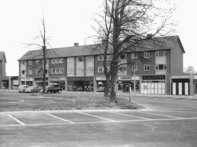
While there are several events in Sandridge this summer, one, in particular, is of special interest to those of us who live or have lived in Marshalswick or Jersey Farm.  Remember that before those developments were built and found themselves in the new parish of St Mary, they were part of St Leonard's and its church in the middle of the village of Sandridge.

An exhibition, Discover Sandridge, is now open at the Museum of St Albans, and will remain open daily until June 1st*  An opening function was held last Thursday evening in the museum gallery at which some 40 invitees attended.  It is a busy exhibition, with over thirty panels of information and pictures, as well as a number of artefacts, and two screens showing slides and videos throughout the day.

It may be the youngest part of the exhibition, but already visitors have engaged with the Marshalswick and Jersey Farm area of the display; and a number have spotted the little info boards identifying their road and how it came to have that name.  That is the problem with young districts; it is assumed they are too youthful to have a history or a story to tell.  Young or old, a few decades or a millennium, there is much to explore.  Don't think of popping in for ten minutes.  Once you are there the time will fly.  You may end up making a return visit.  It is certainly one of those events you will find yourself recommending to friends.  Oh yes you will!

Amazingly, at the time of writing this blog, the St Albans Museums' website carries no information about Discover Sandridge, and is still advertising Gadgets and Goggles, which closed on 13th April.  More disturbing, the website devoted specifically to the Sandridge900 celebrations, (www.sandridge900.com) carries no front page marketing about the exhibition, and you have to dig into an inside page to find a brief reference. Forget Discover Sandridge; it is a matter of Discover a poster!  So, well done St Albans' Own East End, which has carried front page marketing about the exhibition for two months, and now this article.  And, of course, we first asked residents to look out interesting photos as early as last winter.  Chris Reynolds also came up trumps.  His Hertfordshire-Genealogy website
 (www.hertfordshire-genealogy.co.uk) posted the exhibition opening the following morning.

SAOEE also lists events happening at Highfield Park and Fleetville Diaries.  If you have a website which people want to return to, inform people of what is going on; that is why the number of visits to this website has been increasing steadily month on month.

* Although the original poster, which we have used on the website, says the final day is 29th April, Discover Sandridge will remain open until Sunday 1st June.

Sunday, 20 April 2014

The Quadrant

As with The Ridgeway and The Park, The Quadrant always has the definite article as part of its name.  Oh, and by the way, The Quadrant is fifty-five years old.  I know, can you believe it?

Opening a trade show in 1960.
Photo courtesy HERTS ADVERTISER
Until 1959 there was Fleetville, of course, or Wynchlands Parade, or Beech Road.  Mr Dench had a little front parlour general shop in Sandpit Lane at Newgates.  Several traders, aware of the difficulties Marshalswick residents encountered, ran mobile operations for essential goods.

Twenty years after the first homes went up on the former Marshalswick Farm, the shops finally arrived.  The three linked blocks facing the car park and a wing of five shops on each side.  A few years later five more units were added on each side.  The car park seemed vast at the time and there was always plenty of space.  Yes, really!  And many drivers and cyclists used the service road directly in front of the shops as well.

Pride of place at the front was a double-sized unit which went to Marshalswick Car Sales, with a grocery on each side of it – Pearks and Bishop's.  However, within 3 years the showroom had moved to the petrol station site and Bishop's (now Budgen's) snapped up the showroom to triple the size of its grocery; or shall we call it a supermarket?

One of the first shops to open was Edward Carter, where Marshalswick Furniture is today.  Mr Carter ran a diy store, leasing two units, as well as having a shop in Beech Road, both later being taken over by Timberland.  In order to promote business in a growing residential estate he organised trade shows at St Mary's corner, both in the hall and in marquees.  Somehow he managed to find Harry Oakes who agreed to open the show in 1960.  Harry won't mean much to people now, but in 1960 he played the patriarchal role in a young radio series.  It was called "The Archers".  The same series runs even more successfully today.

Bishop's Stores, now Budgen's
Early shoppers will recall two shops called Martin's; one a chemist and the other a newsagent which incorporated the sub post office.  There was a specialist toy shop (Drummond's); a specialist shoe shop (Blindell's); a specialist cycle shop (Pearse's); specialist electrical shop (Giffen's); a specialist ironmongery (Allen's) and a specialist butcher (Butler's).  Although those no longer exist, the following are still trading, at least under the same name:  Martin's newsagent; Wright's watchmakers; and of course, the two banks, Barclay's and Lloyd's.  On the other hand, today we have little cafes and restaurants, two charity shops and a pet supplies shop, which were not part of the mix in the early years.

The centre block at the front in 1959.  Some shops are not yet
open and you could play football on the car park!
Photo courtesy CHRIS CARR.
The Quadrant is now known as a "destination shopping location" and therefore deserves a reference on direction signs.  Oh, and one more difference: if you take your car, you might find it difficult to find a parking space at busy times.


The same view on a recent Friday morning at 9am.

Saturday, 5 April 2014

The back garden

Browsing the suburban landscape on Google Earth or Apple Maps I am struck by the amount of green in back gardens.  Where, at one time, there would be tiny pockets of grass, much of the space would have been a mottled green/brown, depending on season, indicating where householders grew vegetables, fruit and flowering plants.  Today, there are extensions, swathes of reasonably low-maintenance grass and, in family homes, the occasional adventure playground and/or pool.

Homes which lost their newness decades ago also have a forgotten history.  New owners or tenants decide on their own utilisation of the back garden space, though elements of what was previously there may remain.  Most of us would guess at how the space began and its first incarnation as what could be described as a garden – replacing whatever the builders left behind.  Unless of course photographs remain!

An intriguing picture arrived recently, passed on to the present owner by the family who had first occupied the house shortly before World War Two.  And because I already have photographs of the back garden further along the same street, Woodland Drive, taken around three or four years later, we can compare the two.
The builders have left, and the rest is up to you!  Photo courtesy JOHN ALLEN

The top picture shows the daunting task facing any new owner, with field weeds – and probably a goodly amount of rubble.  A start has been made with clearance operations and laying out a border.  The low and open fences between the properties are friendly, encouraging neighbours to talk with each other.  They also made the garden feel so much larger, your own garden blending into those of your neighbours.  Today, these seem to have been replaced by six-foot paling fences for privacy.

The houses in the background are in Oakwood Drive, and the undeveloped space between will later become Hazelwood Drive.  The family photographer's viewpoint was the window of the back bedroom.

Gardens brimming with fresh food for the table.
Now compare this with the bottom picture.  Here the middle ground has already been developed, becoming Beechwood Avenue.  The middle of WW2 and the space is full of vegetables, including a large area of potatoes in the foreground.  Again, the low open fences encourage neighbourly chat; and the back bedroom is, once again a viewpoint for the photographer.  Ten years later and the scene would look very different, with the addition of lawns, swings, chicken enclosure, tree house, and the young trees already planted would be fully grown and offering apples and plums in abundance.  Twenty years later and a pond will also have been dug, but the tree house and swings swept away as redundant

.  Fortunately there is a photographic record of most of these changes.

How many of us have photographic record of our own back gardens; how they were and how they are today?

Tuesday, 25 March 2014

Goodbye Cherry Grange

Cherry Grange was not a widely known building through its name, but most us who have either lived at Camp or passed regularly along Camp Road, will have known its fine, but slightly austere front elevation.  Well, Cherry Grange is no more, having been demolished earlier this month so that the plot can be redeveloped.

Constructed in the first decade of the twentieth century, it was occupied for many years by Mr J Godseff and his wife.  Mr Godseff was a manager at Sander's Orchid Nursery near the town end of Camp Road, where is today's blue bridge.  Until Oxford Avenue was laid in the 1930s Cherry Grange occupied one corner of an expansive smallholding and fruit orchard.

Demolitions of buildings in our district remind us to check that there exists a record of them and other infrastructure before changes take place.  This may not necessarily be complete demolition, but could involve structural changes, such as extensions, added or removed features, or changes of name boards.

While many may mourn the loss of buildings they have come to love or live with, we have to move on, and the demolition of Cherry Grange will be part of that moving on in a section of Camp Road.  If the proposals include similar properties to those on the opposite corner of Oxford Avenue, a few more households will be joining the Camp community.

For me, the record of Cherry Grange came just in time, and last summer I took this photograph, among others.

.........

On Sunday last the eighth Fleetville Festival took place at its new home of St Paul's Church.  Although there was no full orchestra this year, there were ensembles and choral works, including songs and a recorder group from Fleetville Infants and Junior schools respectively.

It seems that the annual Fleetville Diaries' exhibition, Camp, was well anticipated, judging by the numbers of visitors it generated.  Many people inquired where it would appear again during the year. Although we have one or two booked "pop-up" dates, if any organisations would like to accommodate it for a few days during the year, please email the site at saoee@me.com

Sunday, 16 March 2014

Mr Lupton

We have heard recently of the ongoing competition between the major supermarket companies, and the inroads being made by smaller groups such as Aldi.  With grocery shops around many street corners, competition must have been similarly fierce among the small independent traders before WW2.

Regular readers of this blog will already know of the continuing search for pictures of early shop frontages in and around Fleetville and Camp, so this week it is a delight to show a photo submitted by Ian Tonkin.   It is also rather earlier in time than many, having been taken in either 1908 or 1909.  We can be this precise because Mr Lupton was only at these premises during those two years, although he traded at other addresses in Fleetville at other times.

The shop is at the corner of Hatfield Road and Glenferrie Road, which later would be S G Brown's Dairy (Hedges Dairy) and later still Express Dairy.  Today it is a glass shop.

In typical pose is, presumably, Mr William Lupton with an assistant – or perhaps a brother – and two boys.  There are also two bicycles, so they are possibly delivery boys.

The County Council had recently kerbed and paved Hatfield Road, but it would be some years before the property owners of the parallel roads would agree to make up those roads for which they were responsible.  The front of the shop is neatly paved, but not Glenferrie Road!

Ian also submitted a second photo, because he recognised the name Butler's on the van.  Butler's Garage was on the corner of Hatfield Road and Cavendish Road – houses occupy the site today.  Misfortune had fallen upon a van, which may have been an early electric vehicle, perhaps for the delivery of milk.  The location is not known, but may have been in Hatfield Road, between the Lemsford Road junction and the railway bridge.

On the main site are two more school photos, courtesy of Jean Smith, and taken at the Oakwood Drive buildings of Beaumont School.  From 1938 to 1953 the Girls' School occupied the top floor of the main building; its playground and field was on the north side of the site – now lost underneath modern classrooms and workshops.  Headmistress Miss Ellis is in one of the photos.  Now the hunt begins for the names of the many girls who appear.

Sunday, 9 March 2014

It used to be called Camp Lane

This week's focus is Camp – as it was three weeks ago when we compared two photographs from different eras at Camp School, and the most recent one was 1938!  It was just possible that readers might recognise faces, and so it proved.  As soon as possible the version of the photos which appear on the website (School Groups 2) will have the names of those identified added.

Meanwhile the work undertaken during the winter to create the 2014 Fleetville Diaries' exhibition is complete.  CAMP: the place on The Hill where the Militias trained will have its first airing on Sunday 23rd March at the Fleetville Festival.  In previous years this event took place at Fleetville Junior School, but has now been relocated to St Paul's Church, beginning at 3pm.  There are more details on the Welcome page of the website.

The exhibition contains forty-five photos, together with a short story for each.  You'd be amazed at what you didn't know about this eastern residential district, which spreads from the bottom of Camp Hill all the way to Ashley Road.  Unless, of course you've never lived anywhere else.

The exhibition will also appear at Larks in the Parks at Fleetville Rec on Sunday 29th June.  Like other good 'pop-ups' look out for it at other locations during the year.

Linked to the exhibition is a new guided walk for 2014.  A Ramble Along Camp Lane takes place on the evening of Thursday 29th May, starting at 7pm.  However, twenty-five places only are available.  Booking details are available on this website and that of Fleetville Diaries.

How much Camp has changed.  Some years ago someone who had grown up in the district recalled the fields on each side of Camp Road, and how disappointed she was that they became built on.  That the rubber works came, and then went again; but in its place lots of people now have places to live at Dexter Court.  She remembered the open space at the Spring Field, between Camp Road and Cell Barnes Lane, now the location for the houses which line those roads and Springfield Road.  And the "wonderfully open fields"  on either side of Cell Barnes Lane, now home for hundreds of families.  The district is thriving and evolving: the library arrived, and then went; Mrs Harris' shop opened, stayed for a good number of decades, and then closed.  Businesses such as Mr Crain's taxi and coach operation occupied the triangular space near Ely Road, but is no more.

Is Camp a better place than it was?  Or is it just that it is different?  Do we like it as it was, or as it is? How would we like it to be better.  They sound like questions from a survey, don't they, but we are frequently making our personal judgements about the place where we live.  In one sense we don't want it to change, but in another ...