Sunday 21 December 2014

The naming of homes

By 1932, a small collection of families living in New South Wales had become friends; and one reason for their bond was their joint origin.  Five households had emigrated to Australia from St Albans: Mr and Mrs H Harvey, Mr and Mrs Robert Clifton, Mr and Mrs C Wren, Mr and Mrs William Howard, and Mr and Mrs R Clifton junior.  As might happen on a particular celebratory occasion the five families met up at the home of Mr and Mrs Clifton, pictured behind the group.  The Cliftons named their house Fleetville.  I have no doubt that a small amount of research will reveal that they had previously lived in one of Fleetville's roads before emigrating.  A memory of a previous life.
Fleetville, Ascot, Brisbane, NSW

When Mr and Mrs Alfred Nicholson arrived in St Albans in 1900 to open a coat factory in Fleetville, the couple had one of the first homes to be built in what was then Upper Park Road – now the section of Clarence Road north of York Road.  It was an impressive detached house, in which they lived for the next six or seven years.


Asphodel, Clarence Road
The preponderance of house names was not simply a fashion; names had a very practical application. The process of numbering a street was only undertaken once the majority of houses were present.  So, the only method of identifying an address was by owners giving their houses names.  Alfred Nicholson named  his house Asphodel.  Asphodel, it appears, is a colourful herb; it is also referred to in Greek mythology.  Once the property changed hands, however, the new owner chose a different name, and so the house became known as Holbrook.  Later still it became Mure.

Highclere, Woodland Drive
Jackie contacted me recently about her grandparents' house in Charmouth Road, named Redley.  Names often evoke memories, as in the Fleetville example above.  They may also intend to impress, as in Buckingham Palace given to a modest cottage in the middle of a terrace (although I have never seen this particular example).  Names may also be portmanteaux, as in Jackie's reference.  Her grandfather had previously run newsagent's shops in Redhill and Worley, hence the house name Redley, which was later transferred to a new house when he moved.

My own parents, moving into a newly built house on an unfinished estate in 1939, called their home Highclere.  I have no idea why they selected this name – it was some seventy years before the Downton Abbey drama series.  In our particular case the Post Office allocated numbers within a few months, but I still retain one letter address to them at Highclere, Woodland Drive.  But not enough time to get a nameplate fixed to the gate!


Thursday 4 December 2014

Underground in Fleetville

No, not THE Underground, as in an extension of the Bakerloo Line.  Underground, or under ground, as in below the surface.  Rooms below ground floor level – cellars – became of strategic interest to St Albans Council at the start of World War Two.  It recommended that, where possible, they were strengthened for use as small air-raid shelters to protect the occupiers, and if necessary, visitors to the address.  The County Council had provided underground shelters at Central School (now Fleetville Junior School), Fleetville School (under the recreation ground) and at the County Boys' School (now Verulam).  Camp School also received an underground shelter.  Privately, Ballito Hosiery Mills had extensive underground shelters on its site where Morrison's is today.

The war disappeared into the past and life returned to an approximate normality.  Eventually motoring again became popular – once we could afford to avoid exporting vehicles.  During the sixties and seventies various arrangements were made to ensure it was possible to park somewhere close to people's homes, but it became increasingly challenging to find spaces to park along Hatfield Road.  Even today, we might wonder where we would be without the extensive surface car park at Morrison's.

Apart from tinkering with a few yellow lines and a bit of one-hour parking, it is easy to imagine that no-one has given much thought to the congestion along Hatfield Road created by parking bottlenecks, particularly in the narrow section on the Crown approach and outside Bycullah Terrace.

However, there was some beavering away below the surface!  Design Team Partnerships in Clifton Street produced a plan for their client City Car Parks for an underground car park in Hatfield Road.  Perhaps we should remember the year; it was 1988.  The fact that there is no underground car park in Hatfield Road will inform us that the plan did not proceed; or to use another phrase it didn't get through planning.


Taking a leaf from the council in a precedent set in 1939, the proposal was to create a substantial car park under the rec – yes, under – and then restore the surface, replant, and restore the children's playground.  Apart from the temporary upheaval of removing so much spoil, there would have been a number of permanent reminders of what would lay beneath, in the form of light wells and six staircases linking the car deck to the park.  They would have been screened with shrub planting, meaning that much of the rec near Hatfield Road would not have been available for recreational games.


Of course, it is unlikely to have been a free car park, although the promoters did suggest local residents could have used it for their cars overnight, and it would have provided a "valuable reinforced space in case of disaster."  So that was reassuring!

Now let's imagine that it had been constructed.  Would, today, it be thought of as a safe space, especially in the evenings and overnight?  Given a choice would drivers prefer to use the (chargeable)   underground car park or the free Morrison's car park?  And what kind of junction, so close to Morrison's, would link the ramps to Hatfield Road?  This could have become Fleetville's major accident zone, and so soon after the County Council's attempt to remove that status by widening the road by eating into the rec in the process.

Sunday 23 November 2014

Viewpoint

View points (or viewpoints), almost by definition, are locations which enable us to see our surroundings.  Mostly, they are elevated – tops of hills, castle ramparts, church towers, cliff tops.  There are, of course, none of those in Fleetville.

However, you could stand at the north side of the junction of Hatfield Road with Sutton Road,  with your back to the track beside The Emporium.  The view takes in the entire length (parked vehicles permitting) of Sutton Road as far as Camp View Road.

Here is, or was, the entire history of Fleetville before even that name was applied.  Before even that earlier sobriquet for the old turnpike toll house: "the Rats' Castle", now applied to the public house.
On your left was the former Beaumonts Farm stretching ahead as far as Camp Road; on your right, where Morrison's is now, cows grazed in a field owned by St Albans School.  Carts loaded with goods for the market would occasionally trundle down the farm track to reach the Hatfield turnpike road and turn towards St Albans right in front of you.  That was the reason for the toll house in the first place!

In earlier times your feet would undoubtedly be extremely wet from the stream which flowed from behind you along the Emporium track, straight along the farm track (Sutton Road) before veering to the right roughly where Campfield Road is.

In the mid 19th century a branch railway steamed its way across the scene en-route between London Road and Hatfield, with a low and very narrow bridge carrying the railway track over the cart track.  The route is now Alban Way.


The thatch roofed toll house was abandoned in 1881 and left to be infested – by the afore-mentioned rats.  In 1896 a printer arrived to size up the school's field for a factory; and three years later Beaumonts Farm was auctioned for development.  The first result was a house and corner shop, called Primrose Cottage, right on the corner, where the pub now stands.  Hard on that arrival came a coat manufacturer to put up a manufactory a little way along Sutton Road.  That building is still there: Beaumont House.

Immediately to the right of you was built a terrace of homes for the printer employees – Arthur Road; and the corner building on that road was an institute for the recreation of those same men.

Immediately to the left, before the display windows of the Emporium, is still the cottage occupied by Mrs Turner in around 1905.  Oh, and the track behind us was well used by carters and horse owners  visiting the farrier who had set up a forge at the far end.

Other than at Arthur Road, there was not much other evidence of houses although the homes along Hatfield Road to our left gradually appeared during the next two decades.  But beyond the railway and opposite Beaumont House gather groups and teams on Twelve Acre Field to play football.  That was before today's Rec.

We have seen all of this – and had to imagine some of it – without walking a single step.  So I think it is fair to say this small patch of pavement is a view point (or viewpoint).


Tuesday 11 November 2014

A road that never was

In the late 1960s the part of Hatfield Road between Hobbs Garage (now Kwik Fit) and Sutton Road was widened.  Not by very much because there is hardly room to breathe in some places.  These are the same frustrations which many of us feel now, negotiating our vehicles or cycles around parked cars, delivery trucks and pink buses, all of which have reason to use the highway here – the  frustrations were serious enough in the 1960s, and that was the second occasion; the first being in the 1920s.  After wartime restrictions on motoring, owning a car was growing in popularity – and very quickly.

Alban Way west, formerly a single track GNR branch railway.
The original bypass, designed to divert traffic around the east and south of St Albans, was itself busy, and did not appear to have much effect on Hatfield Road.  The proposed solution?

The branch railway line between Hatfield and St Albans had closed fully by 1968, and someone saw the overgrown railway track as a possible way of taking traffic away from Hatfield Road for the second time.  The news came in July 1970.  "St Albans could get a new two-mile main road from the Hatfield side of the city to the centre at a rock-bottom price by using a derelict railway line.  The land for the road ... has been offered to the city council by British Railways."

Although one person did mention a dual carriageway, in effect it would be a standard 24-foot freeway with no properties along its length, from Hill End Lane to London Road, with a connection to the city centre's controversial main distributor road (a road scheme ditched later that year following a General Election).  "A spokesman for the City Council said, This would be a very useful scheme.  We would not need to pull down any buildings and much of the preparatory work would have been done for us by the people who built the railway., so it would be a very cheap scheme to improvement."

Fleetville is still waiting for its congestion buster, but I suspect using the Alban Way would no longer be acceptable as too many people have taken their own emotional ownership of the route in their walks and rides along part or all of the green way.


Another group:

Mavis has sent us this great photograph, taken in the 1950s, of a group of employees outside their place of work, Nicholson's, at the Beaumont Works in Sutton Road.  One of the first factories to arrive in Fleetville, it had already been turning out high quality coats for peace time rain and wartime mud for over 50 years when this picture was taken.

Forty 1950s employees of Nicholson's.
Now, it would be nice to find some names – forty of them if possible.  If

you know anyone in the lineup do please email me on saoee@me.com  They can be added to the caption of the photo on the stalbansowneastend.co.uk website.

Sunday 2 November 2014

Our new Ridgeway house

Even in the earlier days of photography, at the beginning of the 20th century, moving to a new house – meaning a different home for your family or a newly-constructed dwelling – was a reason for celebration.  If the house owner did not have a camera, a photographer might be hired if this could be afforded.  The result would be a record of at least some of the family at their new abode.  There was an explosion of camera ownership after WW2, and more informality too.  Opportunities arose to take a photo or two "to finish up the roll".

The rear of 189 The Ridgeway in 1959
Last week Martin contacted the blog because he had spotted the feature about The Quadrant.  This in turn alerted him to a photo he still has which was taken at the Ridgeway house (number 189) his family moved into in 1958.

"It shows the back garden, not much more than a bit of farm land enclosed by a chain link fence, and the rear of the house.  The house under construction next door is the detached corner property (187) at the junction with Packhorse Close.  My father spent a year or so landscaping the garden to combat the slopes, much of which is still in evidence today and can be seen via Google Earth."

Previously Martin had said, "I remember the early days of The Quadrant well. Butler's butcher's shop had sawdust on the floor and a separate payment booth at the back of the shop.  The shop boy then brought your newly-acquired joint on a bike direct to your door later in the day.  I later did a paper round for Martin's, the newsagent, from 1970 to 1974, when Mr Thompson was the proprietor.  Most of the proceeds was spent in Drummonds on Airfix kits.  Great days."

I am pleased that more recollections are appearing about Marshalswick, so here are a few more prompts.  Maybe someone will remember  the old concrete scout building, youth club activities, adventures in Chandlers Wood, the old farm house, ponds, the controversy over the nearby waste tip and the greater controversy about proposed new housing at Jersey Farm and a supermarket (Key/Sainsbury).  Oh, and the early years at Marshalswick School, and Wheatfields, St John Fisher and Skyswood schools.

Dearman Gomms just before the closing-down sign appeared.
The closure notice of Dearman-Gomms in Camp Road coincided with the discovery last week in an issue of Herts Advertiser in 1970, of a feature article titled "Everything for the Keen Handiman"

"Just over 11 years ago John Dearman gave up a secure job in his father's firm, sold the house he had built himself, and with the proceeds bought some broken-down shop premises in Camp Road.  That was the first of two major decisions which changed his life.  He and his wife ran the shop as a grocery for the first three years [similar trade to the Tuckett's who were there previously].  It became more difficult to make a living out of the shop as competition from supermarkets increased.  Finally, Mr Dearman made the second decision which changed his life.  A practical man himself he foresaw the do-it-yourself boom which has materialised in the last few years."

That success story lasted until 2014!

Sunday 26 October 2014

Exhibitions and conferences

The group of volunteers who have been researching the community of Smallford and the history of the branch railway between Hatfield and St Albans, celebrated a significant milestone last Wednesday.  At the University, where many meetings and workshops have been held during the past two years, we all gathered for the 'big reveal': the exhibition called Bringing The History of Smallford Station to Life.

It was appropriate that the celebratory evening was held at the University, the home of the Heritage Hub, which has provided so much support to the project.

This was the first occasion on which members of the project team were able to see the compete range of the research to which they had contributed, and the first occasion for their guests as well.

Although there is no immediate prospect of the exhibition being available for a season, there will be 'pop-up' opportunities at other events during the coming year.  We will publicise these pop-ups on the SAOEE website.


Yesterday, another significant event took place at Verulamium Museum: the fourth in the series of Autumn Conferences arranged by the St Albans & District Local History Network.  Over fifty representatives of local history organisations and groups came together to hear presentations by specialists in their field, on a coin find in London Colney, St Albans boundary extensions, the University's Heritage Hub, the role of Scouts during WW1, activity in the city during the 18th century, a report on the Museums' collections, a biography of John Griffith, and the history of Rothamsted Manor.

The Network is a loose amalgam of those people who have an enthusiasm for their local history and environment, whether they are part of a group or organisation, or whether they are keenly interested on a particular project, working on their own.  We do not 'belong' to the Network, but by contacting the organising committee on sanetwork@me.com you can add your contact details to the database, which is used to communicate details of events, queries about aspects of research, and of course details of the Autumn Conference each October.


Wednesday 15 October 2014

New Generation Oaklands

The name Oaklands first became a location on the east side of St Albans in the early 19th century.  Before that the buildings, no longer extant, had been known as Three Houses at least as early as the 14th century.  William Knight purchased the land and that part of Oak Farm on the south-east side of Sandpit Lane, on which to built his mansion and establish a farm.  It is possibly the Oak Farm stub that gave Mr Knight the idea for the name of his mansion.

The mansion ceased to be purely residential at the outbreak of WW1, when Italian POWs were based here, as well as troops in training.  After the war the entire site came into the ownership of Hertfordshire County Council as an agricultural institute, later college.

Since WW2 there have been countless re-organisations of tertiary education and the current version is an amalgamation of several former colleges under the unfortunate name of Oaklands.  I only say unfortunate, because a multi-campus institution with the umbrella name of one of its, then, non-central locations, has inevitably confused large numbers of potential students and visitors, requiring the Oaklands site of Oaklands College to have the subordinate title of Smallford Campus, even though it is not in Smallford.

Detail of part of the south elevation at Oaklands Mansion.
The college's move from central St Albans to its new hub at "Smallford Campus"  involved a substantial upgrade of existing buildings, and  the construction of new ones too.  The plans had been agreed, and funding prepared, by the previous government, but the present government removed funding support as part of the austerity plans, which rather left the college searching for solutions.

Although the answer was seen in the development of part of its estate for housing, in fact housing had always been part of the mix, although not quite as extensive as now intended.

The residential proposals are controversial for three reasons: firstly because most of the estate is within the metropolitan green belt; secondly, because it has been recognised as a site for future housing in the new draft District Plan, now out for consultation.  Finally, it is controversial because there are residents in modern houses nearby who thought they would always look out onto green pastures, and now find that they may not.

The new District Plan does identify the proportion of the entire estate to be used for housing, and identifies a need for a two-form-entry primary school.  This in itself is interesting because the residential proposals would not, by themselves, require a 2FE school.  The cushion, presumably, is being provided because there is little flexibility within the remaining schools to the east of the city; will provide places for Smallford children, who currently have no nearby school; and possibly the council is looking towards the two other substantial housing proposals: Coopers Green Lane and Little Nast Hyde.

The rather neglected East Drive and lodge.
What possibly exercises the minds of many people already living nearby is the capacity of Hatfield Road and Sandpit Lane to cater for the number of new homes and their occupants' cars.  The District Plan does raise this issue, and the need to make improvements, but the only specific reference is to intersections.  The is no detail on the need to increase the capacity of these key arteries.

It is clear that with the current university population, the planned student/tutor increase at Oaklands College, the new homes destined for Beaumont's south field, and the three residential developments mentioned, it is not just higher-capacity roads and improved junctions which will be required.  These roads lead to other places, especially the centre of St Albans.  What will be required is a sustainable transport policy; a different approach to travelling.  Otherwise travelling is the last thing we will be doing in our cars.

Monday 6 October 2014

The Council and its acquisitions

I have recently received a very interesting question about what the Council did, or proposed to do, with land which it acquired by purchase or by gift.  The inquirer was particularly interested in Fleetville Recreation Ground.

In 1913 Charles Woollam acquired the remains of the former field which was not required by the executors of T E Smith, of the printing works which stood where Morrison's supermarket is now.  The field was one of three owned by St Albans Grammar School (Abbey Gateway), and by buying it from the school Charles Woollam, a governor of SAGS, was helping to swell the building fund for the new school buildings.  The field had probably remained unused for a decade, although stacks of bricks had been kept there during the period of building operations in the previous decade.  By 1913, it was probably weed infested and in poor condition.

Before the council had the opportunity do anything with it to turn it into a recreation ground, as intended by its benefactor, WW1 had begun and priorities changed.  Increasing amounts of land were pressed into service as emergency allotments, but recreation grounds and parks were generally not affected.

Of course, by 1918, the food situation was more critical than ever and we can only speculate on why Fleetville rec was still not used; after all, it was still not fit to be used for its new purpose – maybe it was being held strategically for use as a last resort. The council knew it would have to clear and seed the ground at some point, although it had proposed to turf it.  A nearby resident certainly thought it was a waste not to use the ground for allotments in the short term. 

There is also the question of the legality of the council using such land for purposes other than that which its benefactor had intended.  Charles Woollam did indeed place covenants on the transfer of land (to prevent the council using it for housing, for example).  However, the government gave local authorities permission to waive such covenants during the two wars.  This is the reason why the present Fleetville Community Centre was able to be erected as a wartime nursery by Hertfordshire County Council.  This also raised an interesting question afterwards; because the emergency nursery continued to be used for educational purposes – and it still continues to be partly used for that purpose today.  The covenant on that part of the rec has lapsed by continuous usage and is therefore no longer active.  


Hay was a standard means of continuing to make practical use of land in an interim.  When the council purchased Hatfield Road Cemetery field, hay money was earned for some years around the early graves, and this would have been considered legitimate as it helped to defray costs otherwise paid for by ratepayers.  The council would not have seen this as making a profit, simply as making a temprorary income to support that from the domestic and business rate.  The council also owned farms around the district, including, from 1929, what is now Verulamum Park.  Income was obtained from all these locations.  Hay was not obtained from the Fleetville rec field as its condition was probably too poor at the time the council took it over.  But hay was obtained from part of the recreation (front) field of Clarence Park during the first few years.  I suppose that the modern-day equivalent to hay money would be the collection of car parking charges!

Today transfers to the council – now usually by developers as part of 106 funding and other measures – often include elements to cover maintenance for a given number years.  In this way the newly acquired facility is not an immediate drain on rateable (counci tax) income.  In all these matters it is not the council’s money; but our money (either through council tax or national tax) which the council spends on behalf of everyone who lives and/or works here.

Saturday 27 September 2014

Land tax

One clue to a busy month is that the number of blog posts has reduced.  Here we are on the doorstep of October and this is only the second post for the month of September.   This afternoon, in wonderfully warm weather a number of us will be meeting in Hatfield Road Cemetery for another in the series of Laid to Rest guided walks organised by Fleetville Diaries.

Meanwhile there has been some research carried out at Hertfordshire Archives and Local Studies (HALS) at Hertford, on the subject of Valuation Office Surveys – Land Tax Maps to you and me – which were created from 1910.  The subject may not appear to be riveting, but a huge amount of helpful data can be extracted from this key resource.

Beresford Road homes built on land once owned by
Messrs Placeham, Moody and Ryder.
The government of the day initiated a levy or tax on the increased value of plots of land between its value as a field plot and its value once developed.  The increment did not include the value of anything that land was used for – for example a building – only the value of the land itself.

For local historians, of course, this information is irrelevant.  What appeals to us is the range of maps produced, and the field books which act as reference books for the numbers written on the maps, one number for each plot of land.

The Camp estate was formed from the southern section of Beaumonts Farm, which was sold by the trustees of the late Thomas Kinder in 1899.  This was acquired by the partnership of Arthur Ekins and Francis Giffen, who laid out the roads, consisting of Cambridge, Camp View, Ely, College, Royston, Wellington and Beresford,  the southern boundary being Camp Lane (now Camp Road).  Individual plots or blocks of plots were then sold on to investors, developers or directly to small house builders.

One decade after the sale it is clear that the whole of the estate had been sold on and the Ekins/Giffen partnership in this area was able to be wound up.  The maps therefore show no references to these two men, but among the large blocks of yet-to-be-developed street-side land were the names of familiar citizens of the time.  Among them were another partnership.  Three men invested some of their resources in purchasing sizeable blocks both here and on Alfred Nicholson's land north of Cambridge Road.  They were F C Placeham of Marlborough Road, J G Moody of London Road and S Ryder of Marlborough House.  Yes, that's right, St Albans' own Samuel Ryder.
The triangle of land at the junction of Camp Road and
Camp View Road belonged to T W Gear, who also
owned a shop (the first white-fronted building on the right).

The field books tell us the owners and their addresses, the land values, and for plots already developed, the occupiers of the properties.  Where occupiers are not shown, even though the buildings are shown on the map, we can assume the structures to be only recently finished and therefore not yet occupied.

Such information helps the local historian, as well as everyone who lives here, to understand more about how the ownership of the land on which their home sits, changed through time.

Wednesday 10 September 2014

One Direction

This photograph appears occasionally in archives and publications.  It shows columns of soldiers walking (not marching) along Hatfield Road, and accompanied by a number of horses and gun carriages or carts.  A few young cyclists are looking on with interest in the approximate year of 1914 or 1915.  It is slightly surprising that there are no other bystanders, especially as the day is probably not a Sunday – several shops have their sun blinds open, indicating they would be open for business.

Probably the key question is, where were they marching to?  We know that soldiers were billeted at the Fleetville Institute, the club building for employees of Smith's Printing Agency, but I rather think there are too many men here for that accommodation – especially as we can't be sure the photographer has captured the front of the column.

It is more likely they are en-route to Oaklands.  The estate of Oaklands Mansion and its farm was the base for thousands of troops in training, just one of many training grounds in and around St Albans.  Many parades formed up in St Peter's Street before proceeding outwards along the main roads to their camps, which, on the east side included Cunningham Hill, Clarence Park, near Sandpit Lane and Oaklands.  Billets were also available at the former prison in Grimston Road.

The Union flag is flying above a house in the distance.  Behind the soldiers in the foreground is the white of the freshly-laid pavement by the County Council, while on the opposite side is the unmade footpath left higher than a roadway compressed by centuries of pounding.

Harlesden Road is just about where the horses form the line and to the right of it are two shops with a house sandwiched between.  Although we know today there is a parade of shops after the space shown in the photo, at the time of the picture the first part of the open space was still owned by Benskins in its unsuccessful attempt to open a public house on the site.  To the east of that, Charles Woollam had recently purchased the field from the executors of Thomas Smith of the printing agency, and handed it over as a gift to St Albans Council for the recreational use of the people of Fleetville.  Today we call it the rec.  The council had only recently taken over the added areas between the Crown and Winches.

Saturday 30 August 2014

Seen this before

Visitors to the SAOEE website often do so because they are looking for a specific topic and a search engine suggests something which may be useful to them.  At other times browsers are clicking until they come across an interesting topic.

Christopher was doing one of those recently and found himself looking at a picture he definitely recognised, although there were some subtle differences.  The picture is this one:


It is on the SAOEE site because it had been donated by the Tuck family.  Horace Tuck ran a small garage and workshop a few doors east of the Rats' Castle PH.  The family were members of Hatfield Road Methodist Church, which, the caption suggested, the group was part of, together with an approximate date of 1908.

My assumption was that the church, which at that date was worshipping at a tin building west of St Paul's, but which may by then have acquired the land on the Glenferrie Road corner, arranged for the photo to be taken there.  The Tuck family presumably had a copy because members of the family were in the shot.  But who else was present.

It was Christopher who took the story forward, as he had come across two similar photos, which he has posted on the My Methodist History website 

The event, which took place annually, was the Junior Missionary Collectors picnic and the location was St Julian's Farm.  Marlborough School is located on part of the farm today.  The two photos on that site are specifically 1908 and 1910.  It therefore seems reasonable to assume that the Tuck picture was from 1909.  We understand that the minister in the 1908 picture was Rev T C Legg, while Rev J W Almond was in the 1910 shot.

"The two adults in the centre of the back row (above) are Mr Herbert Read, who was instrumental in setting up the church in 1894 at the old shoe factory in Cavendish Road, and his sister Miss E Read, who set up the Sunday School and Band of Hope a year later."  So writes Christopher.  Several others are in at least two of the three photos.  What intrigues him – and it something I now notice more, having seen all three pictures – is the presence of what appears to be a replica stone angel at two of the events!

I am sure we will discover more about the people in these pictures in the coming months.  Meanwhile, if anyone has in their family photo box, a picture of the Methodists' tin church (it was where the Liberal Club later had their premises) please do get in touch.


Sunday 10 August 2014

Courts and fields

A short while back I was posting about tennis courts which were once popular, including in some rear gardens, as well as those which appeared in parks and the grounds of certain businesses.

Large local businesses once acquired, on behalf of their employees, fields which could be transformed into sports grounds.  These organisations treated the facilities as investments in retaining a dedicated workforce; encouraging men and women to participate in healthy sporting events and gatherings.  No doubt employees contributed towards the cost of the clubs which made use of the spaces, and each firm would have arranged matters each in its own way.

Ballito Sports Ground from Alban Way in 2012
One of the largest companies in the East End of St Albans was Ballito at Fleetville.  Originally called Ballington Hosiery Mills, the company was highly successful at manufacturing its silk, and then nylon, stockings, as well as other garments.  It operated on the current Morrison's site from the 1920s to the 1960s.

Its social club had premises within the works, including a dance hall and games room.  Boxing matches were held regularly.  Large crowds homed in on the social club events, especially on Saturday nights.

The company purchased a plot of land between Boggy Mead Spring and the glasshouses at Smallford, where tennis, cricket and football events were held, either within the sports club or between it and those of other firms.  A pavilion was erected along one side, but never having had anything to do with Ballito, I had never ventured inside, so have little idea what its facilities were like.
A Ballito employees band

Ballito closed down around fifty years ago.  The sports facilities may have continued for a while, perhaps under the ownership of the factory's new occupier, Marconi Instruments.  But surprisingly the sports field is still there.  The trees and boundary hedging may have grown and the grass not in playing condition, but at least the site has not become another housing estate or more factories.  Yet.

You would never have spotted this while driving along Hatfield Road, even if you knew where the sports ground was; even a pedestrian needed a keen eye, especially as there is no footpath on the south side of the road.  But one such pedestrian noticed, languishing behind the fence and among the hedge shrubs, the sign which had once stood at the gate to announce the presence of the Ballito sports ground.

Spot the sign
Arrangements were made between Glinwell Ltd, owners of the adjacent glasshouses, and the Museum of St Albans, for the rescue of the sign.  Glinwell, because they had strong and willing employees, and the Museum, because it has a home for it in its stores.  There is therefore a part of Ballito which still exists in a corner of St Albans.

This week, a new question on the website's front page, has a question about the Ballito sports club – in this case cricket.  If you or your parents were employed by the firm in the 1950s you may have some interesting recollections.  Let's hope so.


Tuesday 29 July 2014

New licks of paint

First of all, the title itself is a conundrum, though it is not meant to be.  Licking is an action you do with your tongue.  It begs the question, what would you be trying to achieve by licking paint.  Of course, there may be a difference between the verb and a noun, but I'm afraid I am not sure of the connection between using your tongue (for refreshment, sealing envelopes) and applying paint to undertake a repair job.  However, that's not important.

A short while ago some fuss was made – and a photograph appeared in the local press – about a repaint which has been given to the frontage of Fleetville Post Office.  I cannot now remember what colour it was before the workmen arrived, but now the woodwork is freshly painted "post office" red. And that decision appears to have pleased many people, presumably based on the historic assumption that post offices should be painted red.  To be honest, although Royal Mail vans and posting boxes are red, and so are the little oval signs announcing the presence of a post office, I am convinced that post office buildings – window frames, doorways, fascias, floorings and fittings – are not universally red, though sub post offices, of which Fleetville is one, may have had some signage which is a mixture of red and green.

On the other hand there is quite a lot of red in the newly-revamped main post offices which are gradually appearing.

If you are unfamiliar with Fleetville and are looking up and down Hatfield Road for a post office, you might well spot the stand-out colour on the corner of Woodstock Road and make a guess that it is a post office.  From a distance it points us in a likely direction.

Another lick of paint, slightly further afield, has been applied to the down-at-heel former Odeon Cinema in London Road; a very calming cream.  Suddenly that cinema is feeling very exciting, and I am looking forward to the new sign, Odyssey, which I hope will be fixed to the front shortly, in advance of a celebratory opening before the end of the year.

This building is not quite the nearest cinema Fleetville residents had access to in the heyday of movie-going.  The Gaumont (formerly Grand Palace) in Stanhope Road, was closer.  Three early attempts at giving us some screen entertainment came to nothing.  A temporary building, on the site where Fleetville Post Office was later built, did not last long enough to see its first screening.  A small cinema was also proposed, in the 1930s, for the Quadrant (where the Baptist Free Church is today).  Finally, a little further away, and a short ride on the 330 or 341 bus, would have been a large 2,000-seater next to de Davilland's if it had been built, but it became a shopping parade at Harpsfield Hall instead.

Whether there will be a distinctive colour scheme for the Odyssey, has not yet been revealed, but I have no doubt that plenty of East End folk will relish the thought of visiting the cream and ..... building for an evening of screen entertainment once more.  And for the first time we will all discover the inside has not just been given a lick of paint, but a complete new appearance.


Sunday 20 July 2014

The Dream Wall

With apologies to all lovers of Shakespeare's A Midsummer Night's Dream, the title actually refers to a less human wall, which, at least until now, may or may not have existed as a complete and outstretched "character" in the story of Hatfield Road Cemetery.

It is certainly known that each of its four boundaries were treated in a different way when the cemetery was laid out in the early 1880s.  The finest boundary was, naturally, at the front, facing Hatfield Road.  This is the stone and iron gate frontage still there today.  But it does not extend the full length of the frontage.  Which begs the question, was it built like that or had part of it been removed?  Or was this a dream plan, too costly to realise?

We know that Hatfield Road was widened to its present width in 1927, and that 12 feet of cemetery land was acquired to accommodate the works.  We are also informed that consequently the wall and gateway was to be demolished and rebuilt.  So what we see today is the rebuilt version.  But what about the two end sections of the frontage?  What happened to them?  When the 1881 specification told us that the front elevation would be a stone wall, we naturally assumed that to mean all of it, from the eastern boundary to the west.  The one photograph (above) in the public realm and which was taken cWW1, does not show any part of the wall which is not visible today, so that does not help to solve the conundrum.

Until recently we considered two options: either that, in spite of the original specification, only the central part of the wall and gateway was approved, the council being able to save on the cost of the cemetery project by purchasing iron railings where better was not required (as along the eastern boundary).  Or when the demolition and rebuilding came in 1927, only the central section was rebuilt; the surplus stone being sold to help pay for the rebuild and the provision of iron railing fencing, which, of course, is in position today.

I am grateful to the eagle eyes of Andy who has discovered a previously unseen (at least by me) picture of Hatfield Road (right), taken from outside the former Liberal Club, again cWW1.  It is striking how narrow the road was – the same as the width of the hill down to the Crown.  But look to the right and we see a thick hedge.  Now, if there had been a wall here there would not have been room for a hedge, and the council would certainly not have wanted its expensive wall to be hidden, would it?

I think we can conclusively state that the wall was never built where it does not stand today, whatever the building specification stated.  The written record is not always the complete truth!


Monday 7 July 2014

Court playing tennis

I have made good use of the past two weeks, sitting in front of the television with the remote control, attempting to keep up with various tennis matches on BBC1 ("this match continues on BBC2"), BBC2, the ubiquitous red button and online.  So, by the time the annual yellow-ball-fest came to a close, I still had just a few small strawberries left to savour.

While devouring these my mind began to wander to all those locations I once knew in the our East End where it was possible to play tennis.  On Sundays there was once a council regulation about enjoying oneself in one of its open spaces.  If you were caught you might have had to present yourself at a court of the legal variety – a couple of young men playing an informal game of footy in Camp Road were apprehended by a well-turned-out police officer and were delivered a fine for breaking a bylaw.

Courtesy St Albans Tennis Club
To play tennis "properly" you took your wooden racket in a frame, plus a couple of off-white or grey balls to the man at the booth in Clarence Park.  Until Mr Samuel Ryder paid for the grass courts – where the all-weather pitches are today – you could play on the football field which was marked out for the purpose in the summer months.

Three other opportunities opened up for play.  In the 1930s the County Council decided to install courts at its secondary schools.  But generally this meant when schools were in session, or by arrangement with a member of staff and the caretaker on Saturday.  School courts were, and still are, largely unused throughout the summer holiday period.

Then there were the private clubs, such as the Salisbury Tennis Club (still extant), and Trinity Church Club in Camp Road, now Ulverston Close.   Or those belonging to factories.  Hence the former Ballito sports ground at Smallford, or the Peake's courts in Cell Barnes Lane.  There was also a court or two to one side of the Campfield Press.

A pre-war garden court, when there was space.
Finally, several of the more substantial houses in the district had their own private courts: Sandpit Lane, Marshal's Drive, Jennings Road and Beaumont Avenue were among the roads where various surfaces were laid in the rear garden; maybe even sharing the space with a neighbour.  Today there are probably no garden courts left; householders lead busy lives and we have left the period of the leisured well-to-do behind.

Instead, garden courts have been replaced by modern clubs and sports centres, such as at Jersey Lane and Cell Barnes Lane, which cater for tennis players, among others.  The gardens have become grassed spaces for the children to kick balls around, and when they have left home, the occasional garden party and a zone for today's golfing dads to practise potting a few holes.  Come to think of it, we did that at home when we were children; only then it was a game called clock golf, and played on the same worn lawn on which we also played French cricket, which was safer than English cricket, which kept our's, and the neighbour's windows in tact and saved our parents' embarrassment when it came to an apology and compensation.

Tuesday 1 July 2014

One hundred blogs

Summer months are busy months, and as regular visitors to this blog site have realised, there was no post last weekend.  Which was probably a pity because we then reached our centenary.  One hundred posts.   The St Albans' Own East End main site contains a feature called One Hundred Objects (which represent the East End of St Albans).  It is therefore about time that an index to the blog stories is included.  That is something for the autumn; and having briefly celebrated the blog birthday, it is time to move on.

At the end of June each year Fleetville celebrates with a community event under the Larks in the Parks brand, or Larks on the Rec.  The 2014 event, last Sunday, was doing some celebrating of its own.  Larks was ten years old.  By general acceptance there were more activities, more visitors and more entertainment.  While a number of visitors arrived for a spell and then left, lots of people spent the whole day Larking, even picnicking under the trees.

The rec itself was also celebrating a birthday.  It was in 1913 that Charles Woollam purchased the field from the trustees of T E Smith's estate, and gave it to the city "for the recreation of the people of Fleetville".  The city council ensured the space was adequate enough to use by the following year, and installed a boundary fence.  The rec was therefore available for recreational use, which makes 2014 the centenary of the rec.

Another open space is even older, and its benefactor, Sir John Blundell Maple, ensured that the section of Clarence Park devoted to organised sporting activity, was retained as such for the people of St Albans, through a trust deed.  Because the southern section of the park was "ornamental" and not used for sporting activity, the trust deed was not considered necessary  there.

This disparity has exercised the minds of the council in recent years, to ensure that governance of the whole park is more simply structured, making it easier to apply for funds to improve and upgrade facilities (toilets fit for purpose would be a start!).

The football club also announced that it was considering upgrading its facilities, either in the park or on another site.  News that its lease would shortly be reviewed, as well as the above-mentioned governance issue, were in people's minds at the same time, alerted nearby residents to possible changes over the way the park may be used in future, or the way the traditional Edwardian space may look.

Thus were born two new organisations.  The first was a residents' association for the home occupiers of the roads surrounding the park.  And the second was the Protect Clarence Park group, open to anyone who has an interest or concern for protecting the park as an open resource for all.  The residents' group is now a member of the City Neighbourhoods Committee.

Issues of concern currently include lighting, the state of the pavilion and lodge,  temporary closure of a footpath, the renewal of the football club lease, and the agreement between the council and Verdi's, which may or may not be part of the park, depending on your historical definition of the boundary.

Between the various groups and the council it should be possible to keep a guardian watch over the well-being of the park and its many users.  And all of us will be grateful for the work they have set out to achieve.


Monday 16 June 2014

The Way We Were

Many of us were attracted recently by the marketing of a DVD by the St Albans Review newspaper.  Called St Albans: The Way We Were, it was a collection of stills and movie clips from the history of photography, almost all taken in St Albans.

We  called out the names of places we recognised, and reminded ourselves that particular events were also shown in previous presentations – on videotape then – called Bygone St Albans and St Albans: a City to Inspire.  This new DVD enables a new generation of residents to see the familiar city back through time.

In the package was a second DVD, one in a series taken from national newsreels, of events through a particular decade.  This one was the Fifties – or "50's" as the titling insists on labelling it.  For those still puzzled, 50s does not require an apostrophe!

Naturally, The Fifties made use of a wide range of newsreel footage and told its more specific story in greater detail.  The screen lingered on buildings, on people and on incidental happenings.  After all, the film was being shot and edited by professionals on professional film, mostly in colour.

On the St Albans DVD, the concentration was on film taken much earlier, even including a few shots by Arthur Melbourne Cooper himself.  These were from rescued films shot by amateurs, mainly on basic amateur cameras and smaller gauge film stock.  Maybe the comparison is unwarranted, but it does highlight one aspect of our archiving of still and moving pictures.

It is only possible to archive what is available.  While professional newsreel camera operators are filming to order, according to a company's requirements; the rest of us film and photograph what pleases us.  And in St Albans, what pleases us most of the time is Verulamium Park, the Cathedral, Clock Tower, St Peter's Street and the market.  That material forms the basis of archives.  If no-one films the building of a public toilet, or the arrival of the bin men on Friday morning, these subjects will eventually be absent from the archives.

There were delightful scenes from George Street, High Street and anywhere else in the Cathedral Quarter; but this is only part of the city.  There was one brief shot of women working on shell casings at the former Ballito factory.  Nothing else to represent the busy and densely populated eastern districts of Camp and Fleetville, for example, key industrial centres.  There was nothing to represent the schools, nothing for the farms around the city.  It was interesting to note, however, that the little family picnic "somewhere at Marshalswick" survived another outing, having been previously shown on the videos (see above).

The producers of the DVD worked with what was available, and it is a reminder to us all that for future generations to have a clear idea about St Albans today, it is today's photographers and film makers who should be recording a wide range of events and scenarios in preparation.

We can still make some recompense for the past, however.  Many of us still have movie film and  photographs which we have held on to.  For those pictures not strictly private, is it time to give them
an airing, sharing the scenes with others?   This website and the local history group Fleetville Diaries have frequently called for us to look through our photo boxes.  And when we have done that, just email saoee@me.com to tell us what you have found!

Sunday 8 June 2014

Starting nursery

Children attending a nursery group had always been a reality if parents could afford the fees.  But this was outside the remit of the county council which was responsible only for children of legal school age; 5 to 13, 5 to 14, 5 to 15, and so on, as the Government progressively raised the leaving age.

One major event changed all of that for a number of years: the Second World War.  The Government could not accept that women could simply stay at home and bring up their children.  There was huge pressure to encourage them to "do something for the war effort".  In Fleetville that included working at the Ballito factory, a hosiery mill where Morrison's supermarket is now.  Production of stockings gave way to manufacturing shell cases.

The car stands where once one of the ramps led below ground.  On top
the former wartime nursery building is now Fleetville
Community Centre.
However, that posed a problem: what to do with the employees' children.  The Government ordered hundreds of concrete section buildings from a firm in the county, and councils were able to claim a number of them for wartime nurseries.

Between 1938 and 1940 tunnels had been dug below ground at the recreation ground, both for the public and for the children at the school, all capped with a concrete "lid".  On top of this, in 1942, was placed one of these concrete buildings, which was fitted out as a nursery.  At each end the city council constructed brick surface shelters in case of an air raid.

All three buildings, incredibly, remain in use, in spite of the main building initially having a useful life expectancy of no more than a decade.  Since 1983 they have been the home of Fleetville Community Centre.  Before that time, the nursery continued in the period of postwar peace, and increasingly as an overflow for Fleetville JMI School.

One of the former surface air raid shelters is now
converted into useful storage space.
Unfortunately, we have no photographs of the building in use during those early years.  The author can remember walking along Royal Road from school and seeing the ramps disappear under the nursery building, and the locked metal doors preventing entry.  This scene we took for granted and did not question what was behind the steel.  My friends from other classes sometimes came from rooms within the building to join us in the playground.

But in the thirty years the nursery building was open for use did no-one take a photo or two?

If you were a young mum delivering a pre-school age child to the nursery do you have recollections you could tell?

As a pupil at Fleetville JMI school, did you have your class in one of the rooms at the nursery, and can recall what it was like to be part of the school, yet separate from it?

Do email any information, even if you think it is not terribly useful, to the author at saoee@me.com

Sunday 1 June 2014

Central School pupils identified

If you were thinking of spending an hour at the Museum of St Albans browsing the Discover Sandridge exhibition ... well, I'm afraid you have missed the opportunity.  The doors closed this afternoon for the final time.  Tomorrow (Monday) the displays will be moved out to make way for a First World War-related exhibition.  There is no doubt that Discover Sandridge has been popular; every time I have called in several visitors have thronged the little alcoves, and left  messages indicating how much they enjoyed the experience.  There is no indication yet, of where the exhibition will reappear – it was intended to visit various locations as a pop-up for the remainder of the year.  If and when this information is received you will find it on the front page of the SAOEE website.  However, one decision made is for the original files (from which the info-panels were formed) detailing the Marshalswick, Jersey Farm and Newgates areas, will appear permanently on the SAOEE website later in the year.

Some considerable time ago I received a photograph – in five sections – of the pupils and staff of the Central Girls' School in 1931, the year in which they moved from their inadequate premises in Victoria Street, to Hatfield Road.  These are the buildings now occupied by Fleetville Junior School.  Unfortunately, they had to appear on the website without any names.  However, another former pupil from that year also still has her copy of the same photograph, and has submitted a selection of names of the children she remembers.  These are now added to site, on the second School Groups page, together with the names of the teachers and their specialist subjects.  Now that a start has been made, perhaps others may be prompted by a pupil now recognised, and come up with one or more class mates or personal friends.


Part of the former track near Camp Road, now a footpath
behind the houses.
The guided walk along Camp Road last Thursday evening proved popular, with a full turnout for a street-based event.  Beginning at the junction of Campfield Road and Camp Road, we climbed Camp Hill, discovered the former rubber factory, and the location of the former beer house on The Hill; then there were the first two Camp shops, run by Mr and Mrs Eastall and Mr Gear; the dairy farm run by the Oakley family, and a taxi and coach enterprise owned by Mr Crain.  When we reached the school we realised it had opened, in 1898, without water, gas, electricity or mains drainage.  By the time we reached the eastern end of the road we had counted four triangles in different contexts (you will have to join the walk next year to find out more about these).

The shop now called Dearman Gomm's in Camp Road was once
owned by the Tuckett family.
The next walk is on Saturday afternoon 28th June, the first of three ambles with stories in the grounds of Hatfield Road Cemetery, under the general heading of Laid to Rest in Fleetville.  The first event is subtitled The Baker's Dozen.

The following day Fleetville celebrates its Larks in the Parks at the Rec; which is a convivial day supported by entertainment, food and activities.  Fleetville Diaries will have its marquee, within which this year's Camp exhibition will pop up for the day.  June and July both prove to be busy months for outdoor events.

Was it really two years ago that the Olympic Torch came along Hatfield Road?  How time flies!


Saturday 17 May 2014

Books – and golf

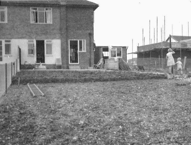
In 2008 four contributors to a 48-page book they gad been working on, saw their publication go to  print. It was titled Marshalswick: the story of a house and its estate.  From the cover shown below right many St Albans people will recall seeing it on sale.  Because of its restricted funding, the volume quickly sold out.

Now, those joint authors, Brian Adams, Clare Ellis, Elizabeth Gardner and Helen Leiper, have reached an agreement with the Sandridge 900 Organising Committee, by which the latter has funded a reprint, copies which now on sale at the Museum of St Albans.

Of especial interest to anyone who was unaware of the existence of a large house sitting in extensive grounds to the south of Marshals Drive, it is also a great relief to all who had intended to purchase a copy and then discovered stocks had become exhausted.  Well, now you can.


It may come as a surprise to another author, living in St Albans, that his book, not only features on this website (and now its blog), but is an artefact at the Discover Sandridge exhibition currently running at the Museum of St Albans.

Allen Nicklin wrote an unusual fiction book in 2012, called Winning the Benevolent Cup and Reaching First Base.  I came across it in a shop called Raindrops on Roses in High Street, St Albans. It is an unusually-written story blending some eyebrow-raising accounts of teenage life in a fictional St Albans with events which we all knew about at the time through the national press.  I say fictional, but most of the places can be identified, roads, bus routes and other places are named correctly; even the main character in what is clearly an autobiographical account has a name too similar to that of the author!  Only the name of the school, which features strongly, has been changed, but it is clearly the formerly-named Marshalswick Boys' School.

The book is of special interest to me, quite apart from its entertainment value, as Allen attended that school just a few years after me, so I could tick off the same people, events and locations which he weaves into his chapters.  If anyone reading this knows Allen Nicklin, perhaps you would ask him to get in touch.   Whether there are any copies left I am not sure, but I think it may now be available as an e-book.

A recent trawl through the 1911 census returns recently revealed a place I had not previously known of.  At the hamlet which was called Horseshoes before WW2 (now Smallford) was living Frederick Simpkins, a general labourer.  With his family were staying two boarders, Charles Prickett and Frank Legg.  Their occupations, respectively, were Green Keeper and Golf Labourer, both at the Hatfield Road Links.  Yes, the Hatfield Road Links.  Further along the road at Ellenbrook lived William Parrott, a horse driver at the Hatfield Golf Club, and Edward Henderson was a professional golfer at these links.

This place does not feature on any map of the period, and if the road has been named correctly it would be located somewhere west of the former Popefield farm homestead.  It is possible, however that what was meant was St Albans Road west, which the main road is named from Popefield to the centre of Hatfield.  Great Nast Hyde is in this section, as were a number of large detached homes on the north side of the road at Ellenbrook.  All of those have now been demolished.

Does anyone have knowledge of golf links along Hatfield Road, and how long the facility lasted?  Or was it Hatfield Golf Links, not Hatfield Road Golf Links?  Suggestions?  Remember, this was in 1911.

Finally, in this blog of miscellaneous content, what a wonderful sight yesterday afternoon at Fleetville Rec.  Shortly after the schools were finished for the week, parents and young children could be heard and seen on that part of the rec near Royal Road and the Beech Tree Cafe.  Enjoying each others' company, children were using the varied items of play equipment or simply the open space, while parents, mainly mums, chatted and enjoyed a drink.  It was a scene of unfettered joy for all.  The rec has never been such a popular honeypot.

Monday 12 May 2014

School before the corner

During the 1950s the farmland purchased by the council in the 1930s and continued in use as "chicken land" since that time, revealed its new function, becoming the London Road Estate.  A proportion of its homes were offered to London boroughs to ease their waiting lists, even though St Albans had a seriously long list of its own.

On a rectangle drawn on a map of the time was the written label site for school.  Next to it was a broken line labelled proposed new road – which later became Drakes Drive.  The rectangle did not quite reach London Road as there was a house and garden (no longer there) fronting London Road and standing next to Hill End Lane; in the 1950s this was the only route between London Road and Camp Road.  The rectangle was drawn so that Hill End Lane went through the middle, the idea being that the new road would replace it.
Francis Bacon School under construction in 1963.
Photo courtesy CHRIS NEIGHBOUR.

The county council had some success in negotiating with key London schools, in which spacious sites would be offered, enabling them to sell their metropolitan plots and move out to the countryside.  Parmiters and Clement Danes schools were among those which arrived as a result.  The two Central Foundation Schools in Islington and Bow were also aiming to rebuild their institutions in Hatfield (boys) and St Albans (girls).

For the county council this move would prove extremely useful, partly as some funds for school buildings could be diverted elsewhere.  It was also in an embarrassing position regarding the Eleven Plus selection system.  In St Albans there was a woeful shortage of grammar school places.

However, by 1959, the Central Foundation Schools decided to stay where they were, and the county council had no alternative but to proceed with the new school on its own.  The only way to launch a new school in the short term was in existing accommodation.  Dependable Alma Road was the answer, but part of Marshalswick School was billeted in the old board school building in 1960, waiting for the completion of its new buildings at The Ridgeway.  So Marshalswick was removed early and Francis Bacon Grammar School installed and born, only moving to its permanent site in 1963.
Very close to Drakes Drive the school under construction in
1963.  Photo courtesy CHRIS NEIGHBOUR.

The former Hill End Lane continued to separate the buildings from the sports field as a public right of way for many years until officially closed and diverted via Drakes Drive.

No longer a grammar school, Francis Bacon School recently changed its name to Samuel Ryder Academy, became an all-age school (in a throwback to the old elementary school system?) and has just completed extensions and a new 14-classroom primary suite.