Thursday, 31 August 2023

Green District Plan

 If you have downloaded the file elements which comprise St Albans District Plan Consultation you will have discovered the wide range of component parts.  It is not possible to include a summary for all  these within a single post – and in any case no-one would make use of it to assist them in the consultation process, particularly the afternoon/evening sessions which are being held in various locations during September.

Treat this post instead as a series of observations if perusing the Open Space Study which is part of the package.  Remember, the Study includes comparisons in all of the districts of the city, although  this blog is mainly interested in content forming part of the city's own east end (generally – though not exclusively – the historic parish of St Peter).

We are tempted to focus on the most well-known named open spaces such as Clarence Park. So let's begin there. The Study throughout quantifies the ranges of facilities in each space; if you like, the reason we might give for making a visit; and a limited range of support services, such as signage, bench seats and bins which form the basis of  an open space's percentage score compared with other local spaces.  Where it is deemed necessary (not only necessarily desirable) toilets are included, as are interpretation and other information panels.  But part of the assessment should probably have included the quality of the space's features.  Simply listing "toilets" does not help if they do not function to a good standard, are only open part-time or are not welcoming to use.  Yes, there maybe useful pathways, but they are less useful if sections are considered trip hazards.  A key feature of a park such as Clarence is its ability to foster relaxation, which might include a cafe or snack zone; and while there is certainly a restaurant eatery on the Crown boundary (a facility incidentally considered to be outside of the park even though it makes much use of the grassed space inside, a cafe more at the heart of family activity would place the venue much higher on visitors' satisfaction list, including a location where children can be supervised nearby by their parents.  There used to be such a refreshment kiosk many decades ago, but we are now left with a grassed triangle instead, presumably because that was cheaper.

But Clarence Park's quality and quantity provision is much enhanced in other ways – the courts zone is popular and busy, as is the popular Clarence Play children's zone.  Even above those the attractiveness of  tree cover which the park provides is a welcoming presence whenever visitors are drawn to the Park.

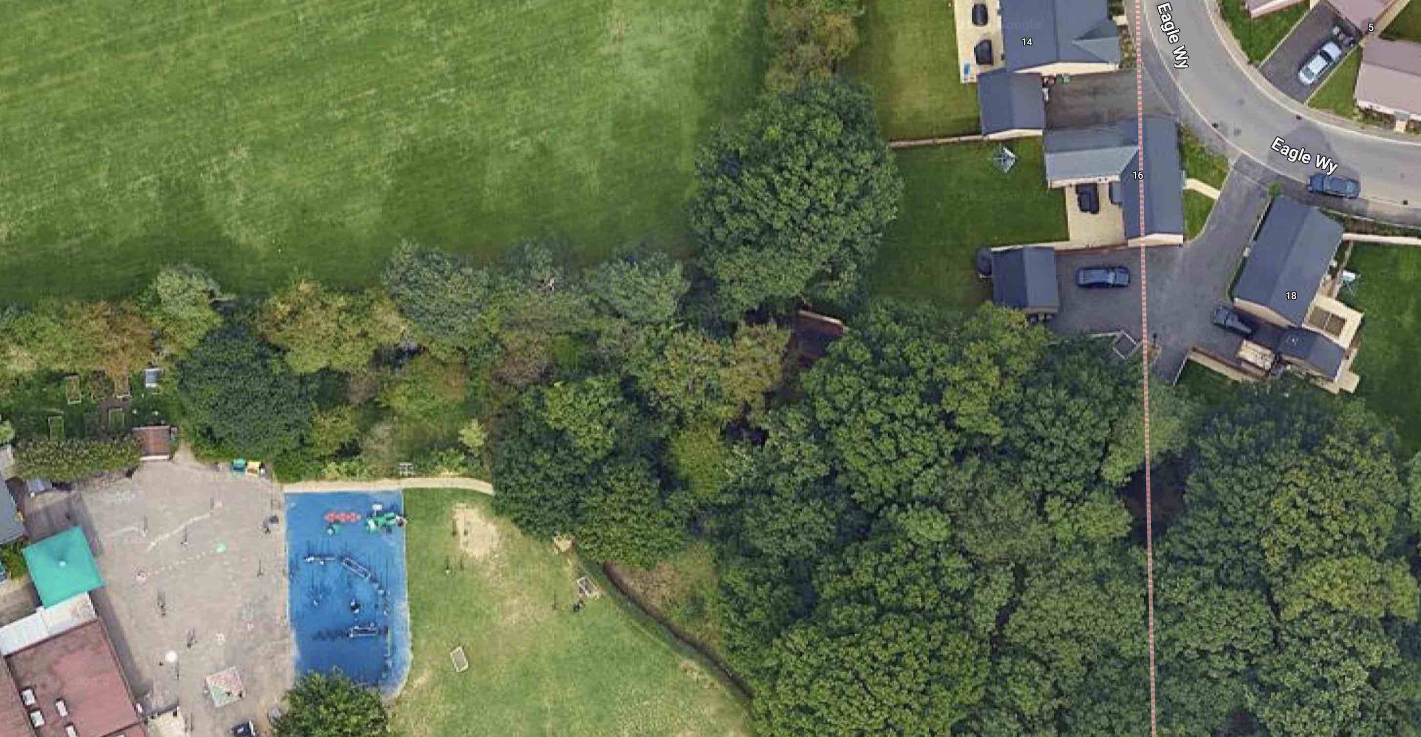
The same or similar criteria appear to be applied to smaller open spaces too.  Fleetville Rec these days is referred to as Fleetville Park, even on some maps, while Longacres is called an Open Space, Cunningham has Green Space in its title, while The Wick is just called The Wick, although maps name it Local Nature Reserve, even though a significant area serves the same function as other recreation grounds. William Bell is a Playground, while nearby is Sherwood Recreation Ground.  Why do many green spaces have such different descriptions in their titles?

Maybe there is some confusion about their functions, the expectations of their users and therefore the responsibilities of the authorities and any trusts who look after them.  Essentially, recreation grounds were created as open spaces for children or adults to breathe fresh air and engage in informal activity.  Historically they tended to be equipped only with a set of swings and the occasional cone (witch's hat)!  In more recent decades an area of hardstanding with a basketball/netball post and maybe a pair of goalposts may have appeared, or even a full multi-lined court.  A soft surfaced playdeck for young children may have been added, or sponsored, while the antithesis of activity space has occasionally arrived in the form of a youth shelter.  A store or changing room, and sometimes toilets my be provided but are far from universal.  In this feature level of open space the main maintenance issues are related to "unusual wear and tear", or vandalism.  

In the Study 'recs', as they are affectionally known, are graded on the same scale as other open spaces, so popularity, facilities and signage are often key to where they appear on the scale, even if that is not appropriate.

What is missing from the Study is the opportunity for any kind of open space, whether park, rough open space, pocket park, lane, footpath or even a forgotten piece of spare land between buildings, to appeal for what it offers towards our well being: calm, contemplation, reading,  conversation with a friend or other relaxing use of our time.  There are reasons why they are on a list but they  should not be graded uniformly with other open spaces for the provision or not of bins, benches and signage.

Next time we'll locate a number of more contemplative green spaces of value to us in our everyday lives.  In the meantime look out for them in your wanderings.


Thursday, 24 August 2023

Happy Faces

Randomly search through your collection of pictures taken by various photographers – or people who took the pictures, who may not be the same at all – and two distinct groups stand out for their propensity for happy faces.  First off are the wedding pics; by which I am not including miscellaneous shots of the reception, but the bride and groom themselves; it was their most adventurous day after all.

The second group contains teams, especially if they were winners of an immediately preceding competition, and especially if they were excitable children.  So your collection may include several of each, and the latter group may contain a press photo from the local newspaper; how long ago will be revealed by the amount of yellowing the newspaper has endured even while hidden away in a shoe box inside a darkened cupboard.

Recently I received such a photograph from Ray who appears, along with his team mates from 1967. Naturally they are all happy; why wouldn't they be, as winners of a football competition.  The details of the competition are immaterial, but just for the record the entrants were third year primary (now called year five) 6-a-side from many of the St Albans' schools.  Biggest credit usually goes to what are euphemistically called "top class teams"; in other words 11 a-side or full teams, and definitely the players who represent their school for that year.  But of course, run forward a year, in this case to 1968, and most of these six players from Wheatfields Junior School will appear once again in the "top class" team photo, having further honed their skills. There may be a copy of that time too; only time will tell.

I searched Bob Bridle and Duncan Burgoyne's book A 100 Years: a History of Schools' Football in St Albans, a remarkable reference source, though no longer in print.  Amongst the copious details for results of the Slade and Marconi trophies in 1966/67, was a little paragraph for the third year competition in that year: "Wheatfields beat Killigrew 2–0 in round one, and Oakwood by the same scoreline in round two.  In the semi-final they knocked out Skyswood by two goals to one and their final, against Windermere, ended goal-less.  Wheatfields won by virtue of gaining two corners against Windermere's one."

There is one further interesting piece of information nested in the Herts Advertiser article:

WINNERS WHEATFIELD (sic): THEY WIN SCHOOLS SIX-A-SIDE

In an entertaining tournament London Colney took the Dearman Trophy for fourth-ear teams, and Wheatfields won the Lyon Cup for third year teams in the St Albans Primary Schools six-a-side soccer competition at London Colney Primary School on Saturday.

The two long-established trophies for the "top teams" are Slade and Marconi.  Slade after a well-known St Albans business family, and Marconi naming the nationally known electronics company which started up in St Albans in 1939.

But what about Dearman and Lyon?  John Dearman was a locally known retailer who began his ironmongery business near Keyfield, London Road c1960 and then moving to a shop near Camp School in Camp Road less than a decade later.  Getting a schools trophy named after you is good publicity for later young grown-ups and their aspiring first homes.

Ronnie Lyon was another relatively new name on the map in St Albans.  He was more widely known, having acquired cheap industrial land in the immediate post-war period and turned them into  serviced factory buildings ready for leaseholders to move into and start trading on day one.  You would recognise the estates anywhere because the access road was inevitably named Lyon Way, as it is in the St Albans version between Oaklands and Smallford.

So, here we are, six smiling faces from Marshalswick in 1967: David Dobbie, Nigel Hiskett, Andy Smith, Peter Robinson at the back; and Ray Bradstreet, Stuart Carter and Malcom Evans up front!

Anyway guys: rather belatedly, congratulations on your school winning the Lyon Cup in 1967!


Sunday, 13 August 2023

Not Unique Then

 Many readers will already have some idea of the story behind the Comet Hotel at the end of Comet Way, Hatfield, and its connection with the de Havilland Aircraft Company which moved from Stag Lane to Harpsfield Hall Farm in the early 1930s.

Neo tudor in Bristol Road South, Birmingham


Solid decorated brick approach o the Oxford Road.

But there is also another story which needs to be related and that is about Comet Way itself.  This highway arrived on the scene, though  initially as a single carriageway, as one element of the national arterial road expansion following the First World War.  The road as a whole was known as the North Orbital and this section as part of the Barnet Bypass.  In order to connect the road now known as Comet Way to the Great North Road (A1) and avoid causing traffic being funnelled through old Hatfield, land was acquired from the Great Nast Hyde estate to build the road from today's Comet roundabout down to the Roehyde interchange.  

Ernest Musman's design for The Comet at Ellenbrook, Hatfield in 1936.

The restored The Comet completed in 2019.

Land left over was targeted by Benskins Watford Brewery, one of several brewery chains taking advantage of potential sites along the new highways for what were then labelled roadhouses: an amalgam of the traditional public house, restaurants serving popular fare and basic hotel accommodation.

Many chains were attracted by the comfortable Georgian-style  structures – brick and exposed beams, snug fireplaces and bold chimneys, which shouted out warmth and comfort.

However, Benskins wished to strike out in a different direction for selected sites it acquired and engaged the services of architect Ernest B Musman.  Musman's new roadhouse properties include the Berkeley Arms at Cranford, the Myles Arms at Perivale, and the Bull & Butcher at Whetstone.

The architectural style of modernism, an adaptation of the clean-cut art deco was used to good effect in the design of The Comet which Benskins opened in 1936.  Musman therefore adapted the ship bridge  concept often used for art deco frontages to the spread of an airliner, the new concept in passenger air travel.  The cockpit became a lounge, the fuselage became the restaurant, distance was placed between the saloon and public bars with shortened "wings",  and bedrooms spread out on the first floor.  A lantern and compass both adorned the roof above.  The purpose? To reflect the nearby location of de Havilland Aircraft Company's new site alongside the new highway, whose building frontages were also art deco in design.

The story all came together so well.  Especially as the traditional hanging signs in Benskin's new roadhouses were dispensed with.  Instead at The Comet stood what was thought to be a unique sculptural form, a pillar depicting outlines of eighteen different kinds of flight. Atop the pillar was a maquette version of the racing Comet used in the 1934 Air Race.  This would be visible the full length of the new highway.

But it seems the uniqueness of The Comet to its particular de Havilland  location was not quite – unique!

The Nag's Head in Bishops Stortford when new in 1934.


Recent image of the Nag's Head, the frontage looking remarkably similar to Musman's Hatfield counterpart.

The replaced entrance sign – compare with the
original in the monochrome image.

Travel a few miles north to Bishops Stortford and Benskins had used Musman in a, you might say, dress rehearsal.  Take a visit to the Nag's Head, at the town end of Dunmow Road and you might realise you have arrived at something familiar.  Now a McMullens establishment Musman created the design for Nag's Head for a Benskins opening in 1934.  The front elevation is almost a carbon copy of the Comet with its cockpit, fuselage, wings and first floor accommodation.  And where The Comet has its sculptural pillar with maquette atop, we are welcomed to Nags with a more formalised triangular pillar; although not the original it has been redesigned in similar style.

So, what was the story behind the plan for the Nag's Head that made both end up so similar?  Probably the reduced time taken – and therefore the cost – on The Comet's plans would have made it a less expensive project for Benskins.  When we discuss the story of The Comet we should also include references to the Nag's Head; after all, they have a common heritage.

Thursday, 3 August 2023

This Way, That Way

 Wherever we live we have an address with a street name and of course we find our way by navigating the network of roads in the locality.  A small number of the streets have been in existence "for ever"; often the various routes by which people down the centuries have walked or ridden themselves to nearby towns and villages. But it wasn't until the late 19th century that the names by which roads were known were identified by plates fixed at one or both ends of streets. And in a few cases the correct names had to be established, sometimes by people living nearby, as to the name by which the road was to be known.


Since the publication of the two volumes of St Albans' Own East End there has been a list of street names with brief accompanying  explanations.  But before continuing this discourse we should define our boundaries: where the East End of St Albans is and is not.  For the purposes of research for the books the city's boundary follows the Midland Railway line between London Road and the King William fiveways junction at St Albans Road.  The approximately Southern edge is London Road.  The northern border and the mainly eastern limits follow the historic St Peter's parish even though modern parish boundaries may now be at variance and of course not very obvious.  Unfortunately the listing excludes villages such as Colney Heath and London Colney, not because they were outside of the notional East End, but because they were previously published communities in their own right and therefore were not included in the research for St Albans' Own East End.  Eastwards the parish does, however, extend to parts of Hatfield north of the A1(M) as far as Hatfield Garden Village.  It is a very rough and ready enclosure which will suffice for this article.

Within that area exist 378 named roads as of 2023, although a small number of these are names which are no longer in use and have subsequently been updated or replaced. 


Road names broadly fall into one of five groups.  Historical roads tend to be those which we might have described as, for example, the road to Hatfield and which we now formalise as Hatfield Road.

The eponymous category includes the many names which appear on street plates in recognition, commemoration or celebration of someone who had a connection with the district or the nearby land.  There are many of these in St Albans, especially members from large landowning families.


Geographic location – the names of places – might be anything from a building previously on the site, to a nearby village, former field or farm name.  It is also possible that such a name has been invented for effect!

By definition themed road names come in groups; several nearby roads might have the names of trees, for example.  Celebratory names might recognise major or memorable events, as in Royal Road.

And finally we might come across names which defy categorisation, as in The Avenue, or The Cinder Track.  It is what it is! 


Careful research has provided convincing or proven results for most East End roads, lanes, closes, avenues ... but not all!

One very early Fleetville road is Eaton Road, but several leads have not brought up a likely solution.  It is definitely Eaton, not Eton. There was no obvious connection with the land owner prior to development, but of course there were a number of Eaton families living in the county and the St Albans locality.  None, so far, appears to have a useful connection.  Inevitably when a knowledgeable local resident suggests a provable connection it will suddenly become too obvious, but until then ...

A development partnership of Ekins and Giffen in the early 20th century gave us the roads on the Camp estate, all of which were named after Arthur Ekins connections with the county of his birth, Cambridgeshire.  Mr Ekins was a chemist and had a role as the county analyst.  The chosen names were Cambridge Road, College Road, Ely Road, Royston Road (which just sneaks into Hertfordshire), and Sutton Road. But what was Mr Ekins' connection with Wellington that enabled him to name one of his streets Wellington Road?


Not far away on the boundary between the land owned by Giffen and Ekins was that owned by Alfred J Nicholson, who himself named two adjacent streets to his coat factory Hedley Road and Maxwell Road after family members.  On or very near the boundary is Guildford Road; which doesn't have an obvious connection with Cambridgeshire.  On the other hand the name hasn't been discovered among the research for A J Nicholson either.  Where might the name Guildford Road have come from?

On the "estate of tree names", Beaumonts, a recent new development which replaced the site of 1950s garages, has appeared Langford Close.  If you're looking, it joins Chestnut Drive.  So no-one thought of continuing the trees theme, then!  Langford is broadly based; not obviously local enough unless someone has discovered the right information.

On the face of it Gleave, as in the infill development off Woodstock Road North, called Gleave Close, sounds similar to a medieval agricultural term, but clearly is not.  Although it could be a family name.  And that is as far as I have reached!  Incidentally, the houses were built on land once leased to the nurserymen Messrs Sear & Carter who had a shop and little nursery next to St Paul's Church and a large nursery where Notcutts is today.

Catham Close, off Drakes Drive, does have a solution – or does it? Nearby, the 1840 tithe map shows a field named Catham Wood Field.  Catham could suggest the name of someone, but was he significant enough to warrant following up?

Finally an infill development off Blenheim Road is named Sefton Close. Is this related to a community in the north-west of the country,  or perhaps a 19th century race horse – or another connection altogether?  In either case what would be the connection with the location, or St Albans more generally?

If you have a lead which could be followed up on any of the above road do feel free to post a response.


Wednesday, 12 July 2023

After 78 years


The Beaumonts estate as first laid out. Much of Beaumonts Wood has gone to provide ground for the schools and their playing fields. The broken orange lines never saw the light of day – a short stub of the extended Central Drive is now Oakwood School's entrance drive.


This map was surveyed in 1939.  The Central Drive/Oakwood Drive corner
is on the far right.  It would have been a cross-roads.  A swathe of wooded
ground has already been carved out to make the extension of Oakwood
Drive towards Sandpit Lane, which never happened. There are
other roads with no homes yet behind them. They would appear after WW2.

The final tranche of land belonging to Beaumonts Farm was offered for sale in 1929 and was acquired by holding company Watford Land. The company set out the road plan which would connect with Sandpit Lane, Beaumont Avenue and Hatfield Road, and at subsequent auctions plots were purchased by a number of mainly local house-building companies.  Two spine roads, Beechwood Avenue and Oakwood Drive, were to connect Hatfield Road with Sandpit Lane.  A third one had already existed, and had done so for centuries, Beaumont Avenue.  Beechwood Avenue had been aligned  with the agreement of the council, to connect with Marshalswick Lane as part of what was then known as the Circle Road (ring road).

Three connecting roads also appeared on the development map: Elm Drive, Central Drive and Chestnut Drive. None was completed to their finished lengths.  For the next ten years house building continued, working from Hatfield Road and the southern end of the estate, until in 1940 everything halted because of the war. Most of Beechwood and Elm had been completed. So too had the southern end of Woodland.  Hazelwood south was largely finished on one side and Oakwood had almost reached the future Central Drive.

Oakwood Drive looking towards the corner with Central Drive and in the direction of Sandpit Lane (not, of course, visible).  The (cream) house straight ahead would make such an extension impossible
today.

But restarting such a development after hostilities had finished would financially and logistically be a challenge; many pre-war housebuilding firms did not survive the interregnum, and the post-war license system limited how much building each could carry out.  In part the council came to the rescue by purchasing the swathe of ground from Woodland Drive to the school playing fields boundary.  A revised road layout was devised which took the boundary up to the playing field fence, which would then prevent Oakland Drive from continuing from the Central Drive junction as far as Sandpit Lane. Which later enabled number 51 Central Drive to be constructed in the space of the redundant road line.

The council then built a number of houses for rental in Woodland Drive and Hazelwood Drive north.

Of course, since our home area was effectively a huge building site children of the 1940s and 50s were able to take the short route from Oakwood Drive to Sandpit Lane by walking along the western side of the chain link fence erected by the County Education Department; and once the Hazelwood houses were in build it was easy enough to hop over the fence and follow the same line along the inside edge of the school field.  You could wonder how the author knows that odd fact if you like!  You could even wonder how much is known about the oak tree part way along that walked path close to where the Verulam School's pavilion is located.

Blue circle: Oakwood/Central corner. Red circle: approximate location of oak tree near Verulam School changing rooms. Yellow circle: beginning of path along Eagle Way. Green broken line: intended path
from Eagle Way to Central Drive. Green dotted lines: informal pathways worn by children in the 1950s.

Almost as soon as we had climbed over that fence we were able to nip across the field to Oaklands Wood, still there behind Oakwood School's site but now much depleted.  The woodland wasn't in any sense public; we knew that because there was a large sign fixed to a tree which informed us to KEEP OUT.  But we ventured there anyway.

I have reached this far in the post to reach the connection between the 1950s and a decision made recently...

Standing out against the sky at Oaklands Grange.

... in the 21st century and at the new housing on the edge of  land belonging to Oaklands, called Oaklands Grange.  Now that the homes are largely all out of the ground an increasing number of people have become familiar with Oaklands Grange and its access to Sandpit Lane not far from the opposite driveway from Newgates, a former mini farm, and the access drive from the Verulam School field.

To leave the Oaklands Grange development residents must walk first to Sandpit Lane – ah ha, so quite close to the old informal route youngsters walked in the 1940s and 50s; seventy-eight years or so after a certain number of those young children found their own way between Sandpit Lane and Central Drive.  If they weren't going to build the extension road, we'll find our own way.  So, an informal path was gradually worn in.   

The future path begins.

The path from Eagle Way skirts outside the boundary of Oakwood School towards
Central Drive.

Children living today at Oaklands Grange are to be given an alternative to the walk along Sandpit Lane, Beechwood Avenue and Central Drive to reach their schools.  They will be able to take a short cut.  The formal start of the path is already prepared at the southern end of Eagle Way.  Pass a few trees westwards and you will reach the former KEEP OUT sign and pass to the outside of the Oakwood School boundary, now itself wooded to reach the school entrance at Central Drive.

Two informal footpaths worn by 1950s children not trying very hard to keep out of trouble, now become part of the 2020s story of families finding their way between home and school along almost the same footpath.  There is little doubt that the child evacuees who came to be part of Beaumont Schools during the 1940s also adventured along these two routes to reach Sandpit Lane and to explore Oaklands Wood and its KEEP OUT sign.

We will look out for the official opening of the new link path, hopefully soon. 


Monday, 3 July 2023

The Little Books 4

 Well, here we are at the fourth in our series of small format photo books about St Albans, and our pondering over how much they represent the Eastern districts within the full range of pictures  in the books.  We didn't start too well with two of the earlier publications, and in the third at least we encountered a section devoted to Clarence Park if not to Fleetville or Camp.


This week's little volume, is different in that it contains a specialist collection from the St A|lbans Museums archive, where you might expect to come across many of the best composed photographic studies.  Around St Albans (ISBN0752422898) compiled by Anne Wheeler and Tony Stevens is from the series Images of England by Tempus Publishing.  Around St Albans is definitely in print, which according to the Waterstones website is priced at £12.99.  For comparison with the Abebooks website, which has been necessary for the previous little books in this blog series, there are currently 8 copies available, ranging from £3.39 to £24.18.

Around St Albans contains the largest number – 200 photos – of all the little books covered so far, and as with the previous volume, has divided the contents into fourteen small subject related sections.  The earlier two books, you will recall, were limited to mixed subject matter. In this week's little volume although Clarence Park is not included, the district of Fleetville is specific in this book but it does not include the other major eastern settlements of Camp or Marshalswick.  It is also contains a relatively small number of pictures (11), although the occasional photo appears within other subject sections. So there are occasional surprises through the book.

The first aerial is in Fleetville.  The long building lines centre right are the original printing works, 
with later additions for the hosiery mill behind. The taller block was post WW2, later taken
over by Marconi Instruments.  The surrounding houses and trades are greyed down.
COURTESY ST ALBANS MUSEUMS

The second aerial is close by the one above.  The two roads are Sutton Road (foreground), and
Hedley Road (right).  This is the early incarnation of Nicholson's coat factory. The branch railway is on the left and the first informal recreation space meets the tree line and Sutton Road.
COURTESY ST ALBANS MUSEUMS

A cottage at Colney Heath, occupied by the Bush family c1900.
COURTESY ST ALBANS MUSEUMS

There is also a much improved representation of the villages and other rural spaces than in any of the earlier books: three each from Colney Heath and Wheathampstead, one from Smallford and 3 from London Colney.  However, agricultural scenes are still exclusively from farms near St Michaels. Under Industry there are several images of Ballito, one of Marconi Instruments and one of the Co-op Dairy.  Railways feature three images, all from the bridges along London Road.  One Camp shop shows Tucketts (later to become Dearman's).

The New Camp Stores run by the Tuckett family, who also traded from near Sandfield Road,
Fleetville.  The above shop was on the corner of Camp Road and College Road. Later it would
be taken over by John Dearman. The premises is no longer retail.
COURTESY ST ALBANS MUSEUMS

The other Camp district photograph features the c1914 composed picture of soldiers, probably in training, outside Camp Elementary School.  The County Boys' School's (named Verulam School in the book although it would be another 20 years for that name to appear) new 1938 craft workshop classroom is featured, as is an outdoor shot of an early post-war athletic event.  We find an unusual triple picture of an Adult School group, although it is just before the Stanhope Road premises was opened and would have been at or near its Lattimore Road base.

In a lovely low-key touch a wedding is shown: an unnamed couple outside St Paul's Church, posing on the Hatfield Road footpath close to the current bus stop and showing the Co-operative grocery shop fascia in the background.

The third aerial in this set was taken in 1959 above Marshalswick, where the new estate was
under development.
COURTESY ST ALBANS MUSEUMS

The final days of Sander's office buildings in Camp Road are more visible in one picture as the old railway bridge has been removed leaving a remarkably open streetscape. Finally, in the section titled The Rural City is an aerial shot from 1959 of the growing new Marshalswick estate.

Leaving the picking out of East End scenes for a moment, one feature of this little book which makes it stand out is the opportunity taken to select images from collections.  This is possible because of the rich and diverse St Albans Museums archive. Alf Gentle and Arthur Melbourne Cooper, both accomplished craftsmen in their own right, each have their own chapters, as does the former National Children's Home.  In particular Cooper's little collection is a rare survivor.

The study of two young girls shows them plaiting, an early process in the making of straw
hats.  They may have been at home, or at an industrial school.
COURTESY ST ALBANS MUSEUMS

One of the stand-out photographs in the collection, which probably should have been in a Schools section but ends up as part of Industry, is the child study of two young children occupied casually in plaiting, a trade occupying the time of hundreds of grown ups and children in the late 19th and early 20th century.  And although the location is not specified it is just possible these two girls were residents of one of the eastern hamlets or isolated cottages.

While it is difficult to be specific about a few of the East End subjects or locations a more respectable 38 photographs appear in this overall collection of 200 images, with the quality of the subject work and reproduction also the best of the bunch so far.


Above photographs courtesy St Albans Museums.

Copies of this book available from St Albans Museum+Gallery at the Town Hall.

Monday, 26 June 2023

The Little Books 3

 This week's book takes a step up with the number of photographs laid out, and even selects a few leading images spread across its double pages. The title is St Albans in Old Photographs by Sam Mullins, published in 1994 (ISBN0750901209) within a series under the umbrella of Britain in Old Photographs.  As with previous books in the series we are exploring SAinOP appears not to be in print; however two copies are currently advertised for sale on Abe (www.abebooks.co.uk).


St Albans in Old Photographs not only has a more expansive  selection of images than in the previous two publications, but its division into twelve distinct sections gives more scope for presenting a larger number of themed scenes, recognisable locations, small groups and even individual St Albans' residents. Remembering that our inquiry centres on whether the Eastern districts are fairly represented in the total collection, we should first define those boundaries: any part of the city (the current District) which is east of the Midland Railway.  In the books St Albans' Own East End the historical boundary was the parish of St Peter, but if the author's brief was strictly related to the city boundary this extended to Oaklands and Hill End for the period under review.

Among the sections chosen were A Tour of St Albans, St Albans Abbey, Farming, St Albans Pageant 1907, Roman Verulamium, and Lost St Albans, the latter showing buildings no longer standing, although there are plenty of these among other sections of the book as well.

The first section is titled Market Day, including a super cover image; so the market provides a consistent connection between all three books so far surveyed.


You can almost smell the freshness of Clarence Park – fresh paint, new creosote; the pavilion in the background; the park keeper's lodge with an early sales point for refreshment.

The pavilion may be complete, but finishing groundworks are ongoing, ahead of its 1894 opening.

One section is given over to Clarence Park, so we should be able to tick off all of its contents as being East End based.  There are nine images, of which four feature the pavilion, the most impressive being the completed – and still empty – structure probably taken before the crowds set foot on the place at the very wet opening ceremony.

Of the seven pictures of farming scenes five have captions identifying the locations as St Germains and Verulam Hills, in other words Verulamium.  The two unidentified examples are also likely to be from the same collection.

A footpath has been laid along this view of Sandpit Lane, with the occasional opening onto the lane
from the south side.  On an original print can be detected a large board on posts.  The view
eastwards is from approximately Clarence Road, rising in the distance towards Hall Heath.

Rural Sandpit Lane features in the Lost St Albans section with the oft seen picture of two figures walking along the road space, ignoring  the recently laid footpath. The grounds of Marshalswick House hide on the left, with the future Spencer estate laying in wait beyond the trees on the right.

One photograph, said to have been taken in the Haymarket, London, shows two loaded carts which the caption informs us had been driven there from Butterwick Farm.

A collection of churches is included, of which St Paul's is featured while it is still scaffolded – and fortunately showing off the corner of a paved and metalled Hatfield Road and an all too rare gas street lamp.

The view of Alexandra House, Hatfield Road can be dated to between 1912 and 1914.  Fox's
chemist opened around 1912 and Barclays Bank is first listed in 1914 and may have opened
for business a short time before this.

Finally, the rather impressive Alexandra House at the corner of Hatfield Road and Clarence Road which, when first completed housed a chemist and a branch of Barclays Bank at the Crown corner.

The compiler was provided with a wide range of photographs at his disposal and few of these have appeared in other volumes, and so, as a set, the book contains an impressive collection.

But the fact remains that of 164 photographs of "old St Albans" only 12 could be confirmed as being located in the eastern districts (9 in Clarence Park, and one each from the Crown, St Pauls Church and Sandpit Lane.  A thirteenth was actually a central London view, not a Butterwick view.

While we love Verulamium, the Cathedral and the market, oh, and the city centre shops of course, rather more balance would have been helpful.  So the search is still on to find a Little Book which achieves that balance.

The sources are probably, in the main, from St Albans Museums and HALS.  If not we would be pleased to acknowledge.