Certain thoughts drift through our minds on the final day of the year – achievements realised or or not, as the case may be. But in the case of the St Albans' Own East End blog it is the realisation that new posts have been trickling through the system now for ten years, at the rate of over 30 posts a year. Which is over 300 items in total, and all about the East End of St Albans. Unfortunately the very early posts are no longer available online, but the original function was to generate interest in a couple of books about the district which had yet to be completed. Well, a decade on and work is progressing well on preparing for the second editions of those same books.
Let's talk about housing for a minute. In 1919 the city council was discussing a chronic under-supply of basic homes fit to live in; the rural council engaged with local communities to provide new homes for agricultural workers; and, slow off the ground, projects under Homes for Heroes eventually materialised, but for far fewer tenants than the target. Eventually, estates were provided at Townsend and Springfield.
In 1949 the city council was still grappling with the issue of lengthy housing waiting lists, with thousands juggling with allocated points to move themselves, hopefully, nearer a house. Local authority houses and homes for reserved occupations such as police, teachers and nurses, were created from whatever resources were available. Estates at Beaumonts, London Road and Slimmons Farm became available, augmenting the private developments from the thirties at Beaumonts, Spencer, Camp and Breakspear; and in the fifties at Marshalswick.
In 1979 further private developments had been launched at former farms and later in the grounds of former hospitals. Today, if there was an all-embracing list, with or without points, how many potential home owners and tenants would show themselves to be in need of accommodation in this city; east, west, south or north? Prices for even modest-sized homes are beyond many pockets and banks. Yet it is revealing that St Albans was one of the locations selected for a special edition of Monopoly! As a young couple, still living in a modest parental home, commented recently: "finding a house (or flat, or even a barn) is not a game." Which takes us back to 1919 – and in 1949 – because that is where many were forging out an existence, in barns, old caravans, huts and buildings awaiting demolition. Articles in the Herts Advertiser reported, with unfortunate photographs, many eviction cases. And, if we include overcrowded and multi-occupied dwellings, many are probably still there in 2019; the hidden population of St Albans.
SAOEE's New Year Greetings is for you more than anyone, though you are the residents who are most unlikely to be reading this message.

Tuesday 31 December 2019
Sunday 22 December 2019
Green Cheer
It is hoped both of the following items of environmental news will bring St Albans' residents some seasonal cheer, but of course, no-one can guarantee one or both announcements would not be considered controversial by a proportion of people living in this city. But let's look on the bright side – cup half full approach – and see them as positive opportunities.
The extensive swathe of land inside of the box between the St Albans Bypass, Smallford Lane, Hatfield Road and Colney Heath Lane these days has the name Smallford Pits. Until the 1960s it was a working farm, Butterwick, before becoming gravel workings and then infilled. There have been many proposals for future uses as industry, housing, sports stadium, and possibly other ideas, but nothing has been actioned as yet.
The County Council, which owns the site, is now set to spend money to enable access to the power grid and to allow the land to be used as a solar farm. 124 acres will accommodate enough panels to generate up to 22 Mw of energy, so that's 22 megawatts St Albans can use without burning fossil fuels, but only during the day time of course. Still, it's clean energy and it's making sensible use of land which has no current use except for horse grazing and dog walking. Tick number one from a council.
The second announcement hails from the District Council which has committed to planting 600,000 trees during the next few years. As with the solar scheme this is largely an enabling project, where cost contributions will come from other sources, but the planting land will belong to the Council.
The recent announcement also links with the decision, made public some while back, that the County Council intends to reduce its tree costs on land it owns and especially on new development projects which specify trees in their designs. The District Council is taking over responsibility from the County for the latter's tree estate along and close to the district's public highways. It is understood that the District Council will be encouraging the community to participate in the periodic seasonal tree planting projects. Tick number two from a council – and a third tick for community involvement.
 |
| Former Butterwick Farm |
 |
| COURTESY GOOD ENERGY |
 |
| New planting at Heartwood backed by mature woodland. |
The recent announcement also links with the decision, made public some while back, that the County Council intends to reduce its tree costs on land it owns and especially on new development projects which specify trees in their designs. The District Council is taking over responsibility from the County for the latter's tree estate along and close to the district's public highways. It is understood that the District Council will be encouraging the community to participate in the periodic seasonal tree planting projects. Tick number two from a council – and a third tick for community involvement.
Sunday 15 December 2019
A Collection of Names
The first edition of St Albans' Own East End Volume 2 lists the names of all streets in the East End which were in existence down to the 1960s. That is where the history told in these books concluded. However, development has not ceased and there have been many pockets of expansion since then. The street names list will be brought up to date in the next edition.
In the meantime we will focus on just a few which bring the list bang up to date, beginning our search for the meanings behind the names – and it is a search in which we can all join.
Harrier End: Most of us will refer to it as the ongoing Sandpit Lane development, or Oaklands Grange. But families are now living in the first tranche of homes to be completed. Roads in or near open country with names having a connection with the landscape might refer to Harrier as a bird of prey. On the other hand, less than a mile away was de Havilland Aircraft Company. When it merged with Hawker Siddeley and in the 1960s the combine designed and manufactured a vertical take-off aeroplane much used in the Royal Navy, the product was named the Harrier Jump Jet. Harrier End could therefore be either – or something else.
Austen Way: The development on Beaumont School's front field was marketed as Kingsbury Gardens, though at the opposite end of the city from the Kingsbury we historically know. Now the homes are complete the street plate has gone up: Austen Way. I did attempt to find out the origin from the development company and wasn't surprised to receive no reply. Now I have discovered a second plate to the west of the site, Bronte Close, and the answer is clear. So, a literary connection!
Montague Close: An access drive in Hatfield Road opposite Sutton Road is named Montague Close. The driveway originally gave a connection to a farrier's workshop and later to vans belonging to the laundry on which the new development has been created. The origin of the name used is currently unknown, so, unless there is a Shakespearian connection, your suggestions will be welcomed.
Now three roads which have been in place for some time: first Langford Close is the site of former garages which served the Chestnut Drive homes. Though a very narrow entry it does sport a street plate. Is there a connection with a Bedfordshire village, or one in Oxfordshire? Or is it perhaps the name of a person?
A small development off Windermere Avenue was named Staveley Court. This name continues the group of roads based on the Lake District. OK, so that one was easy, but finally, leading off Jersey Lane is Jodie's Court. Far from a new development the connection remains unclear. So, who, or what, was Jodie? It's over to you, and the residents of Jodie's Court may be the first to let us know.
 |
| Harrier End |
Harrier End: Most of us will refer to it as the ongoing Sandpit Lane development, or Oaklands Grange. But families are now living in the first tranche of homes to be completed. Roads in or near open country with names having a connection with the landscape might refer to Harrier as a bird of prey. On the other hand, less than a mile away was de Havilland Aircraft Company. When it merged with Hawker Siddeley and in the 1960s the combine designed and manufactured a vertical take-off aeroplane much used in the Royal Navy, the product was named the Harrier Jump Jet. Harrier End could therefore be either – or something else.
 |
| Austen Way early in the development. COURTESY STREETVIEW |
Austen Way: The development on Beaumont School's front field was marketed as Kingsbury Gardens, though at the opposite end of the city from the Kingsbury we historically know. Now the homes are complete the street plate has gone up: Austen Way. I did attempt to find out the origin from the development company and wasn't surprised to receive no reply. Now I have discovered a second plate to the west of the site, Bronte Close, and the answer is clear. So, a literary connection!
 |
| Montague Close COURTESY DANIELS |
Montague Close: An access drive in Hatfield Road opposite Sutton Road is named Montague Close. The driveway originally gave a connection to a farrier's workshop and later to vans belonging to the laundry on which the new development has been created. The origin of the name used is currently unknown, so, unless there is a Shakespearian connection, your suggestions will be welcomed.
Now three roads which have been in place for some time: first Langford Close is the site of former garages which served the Chestnut Drive homes. Though a very narrow entry it does sport a street plate. Is there a connection with a Bedfordshire village, or one in Oxfordshire? Or is it perhaps the name of a person?
A small development off Windermere Avenue was named Staveley Court. This name continues the group of roads based on the Lake District. OK, so that one was easy, but finally, leading off Jersey Lane is Jodie's Court. Far from a new development the connection remains unclear. So, who, or what, was Jodie? It's over to you, and the residents of Jodie's Court may be the first to let us know.
Friday 29 November 2019
What About Those 50 Houses?
At the top of the website's front page is this banner:
1919: Council proposed 50 houses on the corner Hatfield Road/Beaumont Avenue. Did it happen?
It would have been so easy to provide a single word answer; job done; but so much more satisfactory to explore the question a little further.
St Albans Council in 1919, shortly after the end of the First World War, didn't fully respond quickly to the call for local authorities to build huge numbers of new homes under the banner Homes for Heroes. By April, however, it had agreed to explore three sites. First, 65 homes in Camp Lane opposite Sander's nursery (presumably where Vanda Crescent is now); this did not go ahead but was later replaced by the Springfield site at the top of Cell Barnes Lane. Second, 50 homes at Townsend, which was the first development to go ahead; the scheme was formally announced in 1920.
The third location was, perhaps a surprise: 50 homes on the corner of Hatfield Road and Beaumont Avenue. This was fairly quickly crossed off the list as the city's drainage network did not extend that far at the time. However, was the choice of location just a curiosity or was there some logic at work?
We have to forget what was actually built, but later, and focus on the farmscape in 1919. Beaumonts Farm had been acquired by Oaklands in 1899 and the land on the west of Beaumont Avenue had been sold for development. That left the east side of the Avenue and the fields lining Hatfield Road to be managed as a mixed farm. Today, Beechwood Avenue and Elm Drive sets the scene. We even know how this field had been used during the war. Checks had been made to ensure farmers were making effective use of their land for cropping and one field in particular caused concern as it gave the appearance of not being cropped at all. Mr Moores, the farm manager, implied that he had more-or-less given up with that field as the local residents – meaning Fleetville at the time – regularly used it for recreational purposes, there being a gate near the junction.
So, in 1919 there was a field alongside Hatfield Road which gave the impression of being neglected and would probably prove easy to acquire by the Council. We should also remember that the Council boundaries had been extended from The Crown to Oaklands (Winches) only six years previously. This field would have been eminently suitable for a Homes for Heroes development, and if the authority had been able to muster sufficient funds there would have been space for considerably more than fifty new homes.
The field remained until sold, along with others, in 1929 and the Beaumont estate came about. The short answer is therefore no!
1919: Council proposed 50 houses on the corner Hatfield Road/Beaumont Avenue. Did it happen?
It would have been so easy to provide a single word answer; job done; but so much more satisfactory to explore the question a little further.
 |
| An early drawing for one of the four-home blocks at Townsend, Waverley Road area. HERTS ADVERTISER |
 |
| Townsend HFH in Margaret Avenue GOOGLE STREETVIEW |
 |
| Newly completed Springfield home in 1928. HERTS ADVERTISER |
We have to forget what was actually built, but later, and focus on the farmscape in 1919. Beaumonts Farm had been acquired by Oaklands in 1899 and the land on the west of Beaumont Avenue had been sold for development. That left the east side of the Avenue and the fields lining Hatfield Road to be managed as a mixed farm. Today, Beechwood Avenue and Elm Drive sets the scene. We even know how this field had been used during the war. Checks had been made to ensure farmers were making effective use of their land for cropping and one field in particular caused concern as it gave the appearance of not being cropped at all. Mr Moores, the farm manager, implied that he had more-or-less given up with that field as the local residents – meaning Fleetville at the time – regularly used it for recreational purposes, there being a gate near the junction.
 |
| Beechwood Avenue from the old pre-development field gate entrance, Hatfield Road. |
The field remained until sold, along with others, in 1929 and the Beaumont estate came about. The short answer is therefore no!
Sunday 17 November 2019
A busy week
Occasionally there is a small collection of topics which reflect what has been going on in our East End. This is such a week, so here we go!
To begin with, an account stretching back to 1929, which I probably should have noted from filed press reports from the time: a young woman of 18 had travelled from Kent to take up employment at Ballito Hosiery Mill, in the year it had greatly expanded, just four years after opening in Fleetville. She had been fortunate in finding lodgings with relatives at Smallford, and had got to know a young man, possibly another Ballito employee. An inquest was held after the woman was deemed to have taken her own life after contact with a train near her relatives' home. There are many gaps in the account, which was passed on by a member of the Smallford & Albans Way Heritage Group. It seems that a train does not have to be travelling fast to have a devastating effect on the life of a person whose mental condition may already have been frail. We might for a moment reflect on what trauma she might have experienced if she had felt there was no-one she could talk with.
Excited families on Friday last made their way to the one of the last sections of the 400-mile route from Holyhead of Children In Need's Rickshaw Challenge. The route through "our patch", having left Sandridge, took in Marshalswick Lane, Beechwood Avenue and Ashley Road/Drakes Drive, then London Colney on its way to the BBC Studios at Boreham Wood. One small (but exhausting) segment in achieving the sum of around £47 million for the charity. The young people who participated made us all feel good.
Ever since the closure and sale of the former de Havilland site between Smallford and Harpsfield, the development plan, now very much evident in the university and business district, also allocated a substantial zone for the Ellenbrook Fields Country Park. Yet nothing more had been heard on the matter, until another issue intervened – the proposal to quarry the site for gravel. Both Oak and Beech farms had already been trawled; so had Smallford and a substantial swathe between London Colney and Roe Hyde. Residents are now bracing themselves and are not looking forward to further years of disruption, dust and deployment of lorry fleets. A demonstration against quarrying was held on the Fields last weekend, one major element of which would be the effect on groundwater supplies. Bearing in mind that one of only two remaining streams flowing southwards into the river Colne, the Ellen Brook flows through part of the Fields and contamination from this stream would surely also affect the Colne.
Highfield Park Trust held the latest of its annual History Evenings on Friday evening; always a friendly occasion where new friends and acquaintances are regularly made. This year the focus was on the role of the two former mental hospitals, Hill End and Cell Barnes, in the the period 1939 to 1961, when the major teaching hospital, St Bartholomews (Barts) was in residence. The Trust is acquiring an increasing documentary archive on the life of Hill End and Cell Barnes, and this includes a number of transcribed conversations with members of former staff and families of residents whose work or treatment brought them in contact with the Hill End/Cell Barnes campus,
now a new residential development and park.
Finally, the residential development which also serves as a new access road to Beaumont School, was, readers will recall, named Kingsbury Gardens. This name appeared rather odd, given that Kingsbury is associated with St Michael's rather than Oaklands. We now notice from the street place recently installed, that the road is called Austen Way, which presumably applies to all three of the linked streets. Which only leaves the inevitable question about the relevance of the name Austen. Churchill Homes has been asked but thus far there has been no response.
To begin with, an account stretching back to 1929, which I probably should have noted from filed press reports from the time: a young woman of 18 had travelled from Kent to take up employment at Ballito Hosiery Mill, in the year it had greatly expanded, just four years after opening in Fleetville. She had been fortunate in finding lodgings with relatives at Smallford, and had got to know a young man, possibly another Ballito employee. An inquest was held after the woman was deemed to have taken her own life after contact with a train near her relatives' home. There are many gaps in the account, which was passed on by a member of the Smallford & Albans Way Heritage Group. It seems that a train does not have to be travelling fast to have a devastating effect on the life of a person whose mental condition may already have been frail. We might for a moment reflect on what trauma she might have experienced if she had felt there was no-one she could talk with.
 |
| Ponded section of the Ellen Brook at Ellenbrook Fields |
Excited families on Friday last made their way to the one of the last sections of the 400-mile route from Holyhead of Children In Need's Rickshaw Challenge. The route through "our patch", having left Sandridge, took in Marshalswick Lane, Beechwood Avenue and Ashley Road/Drakes Drive, then London Colney on its way to the BBC Studios at Boreham Wood. One small (but exhausting) segment in achieving the sum of around £47 million for the charity. The young people who participated made us all feel good.
 |
| Boggy Mead Spring is the other north-south stream |
Highfield Park Trust held the latest of its annual History Evenings on Friday evening; always a friendly occasion where new friends and acquaintances are regularly made. This year the focus was on the role of the two former mental hospitals, Hill End and Cell Barnes, in the the period 1939 to 1961, when the major teaching hospital, St Bartholomews (Barts) was in residence. The Trust is acquiring an increasing documentary archive on the life of Hill End and Cell Barnes, and this includes a number of transcribed conversations with members of former staff and families of residents whose work or treatment brought them in contact with the Hill End/Cell Barnes campus,
 |
| Staff drama group at Barts in Herts during the 1950s |
now a new residential development and park.
Finally, the residential development which also serves as a new access road to Beaumont School, was, readers will recall, named Kingsbury Gardens. This name appeared rather odd, given that Kingsbury is associated with St Michael's rather than Oaklands. We now notice from the street place recently installed, that the road is called Austen Way, which presumably applies to all three of the linked streets. Which only leaves the inevitable question about the relevance of the name Austen. Churchill Homes has been asked but thus far there has been no response.
Saturday 2 November 2019
Contrasting tracks
Most of our streets came about during the period of expansion and utilisation of former fields into residential or mixed development. Before Kingshill Avenue there was a field sloping downwards towards the former Marshalswick Farm. Royston Road and its neighbouring streets were carved out of a large field where cattle had grazed; and Cavendish Road, though there may have been a footpath of sorts, was created from an orchard or a tree nursery or a small crop field, depending on time.
Although there are minor roads which were formerly footpaths crossing the countryside, and roads linking towns which have existed for several centuries, it is rare to come across a road with a life stretching back into antiquity, probably part of an ancient network of trackways which traversed the region.
Part of one such route is now Beaumont Avenue and forms an attractive residential road linking Sandpit Lane and Hatfield Road. Along this road was a minor spur leading to Beaumonts Farm. The spur today is part private (Farm Road) and part adopted, absorbed by the residential estate as Central Drive.
Remove the homes which line each side of the Avenue, all but three of which arrived since 1899, and you are left with the remains of a double stand of fine trees.
 The track which wandered through the former manor estate had extended through wooded land of uncertain age north of Sandpit Lane. Today we know this as The Wick. Also part of Beaumonts Farm was a continuation of the track towards Hill End. Now Ashey Road, it is a mix of early 1930s semi-detached homes, a post-war industrial estate and the green acres which are now Highfield Park, formerly Hill End Hospital. How this section of the track contrasted with the Avenue: it had been dug for the clay and was home to a brickworks as a result; and with the exception of isolated groups of trees did not appear to have been treelined.
One further difference: the southern section, though a track snaking through the farm, was a permissive route for traffic other than that which was farm business. The Avenue, on the other hand, had always been considered private (whether legally so is another matter) and gates were installed at both the Sandpit Lane and Hatfield Road ends.
Today's Alban Way still intersects Ashley Road and demonstrates a further difference between the two sections. But before feeling too satisfied that the avenue escaped the smoke and steam of railway tracks, it was a close call. The Midland Railway's early iteration proposed a route which would have clipped the northern end of Beaumont Avenue and crossed in front of the former Marshalswick House. Although Thomas Kinder, owner of Beaumonts, had not been found to have objected to the compulsory purchase of a small portion of his land, the Marten family certainly did, and as a result Beaumont Avenue retained its rural and ancient landscape. No railway crossing the Avenue. Same track, but quite a contrast.
Although there are minor roads which were formerly footpaths crossing the countryside, and roads linking towns which have existed for several centuries, it is rare to come across a road with a life stretching back into antiquity, probably part of an ancient network of trackways which traversed the region.
 |
| Pre-development Beaumont Avenue at the Hatfield Road end. COURTESY ANDY LAWRENCE |
Remove the homes which line each side of the Avenue, all but three of which arrived since 1899, and you are left with the remains of a double stand of fine trees.

One further difference: the southern section, though a track snaking through the farm, was a permissive route for traffic other than that which was farm business. The Avenue, on the other hand, had always been considered private (whether legally so is another matter) and gates were installed at both the Sandpit Lane and Hatfield Road ends.
 |
| The former BT building next to the railway, now Alban Away, Today part of an industrial estate and earlier a brick works and rubbish tip. |
Sunday 20 October 2019
It might have been Richmond
Fifty years is a long time ago; if you lived in our East End in 1970 you would no doubt have been disappointed to learn of the recent closure of Ballito Hosiery Mills. But the excitement surrounding its arrival on the Fleetville scene stretches back to 1925, over ninety years ago.
Ballito was a major source of employment in the period when the east end of St Albans was still growing; it occupied a building where many of us today carry out our shopping: Morrison's. At the time of its arrival the mill was as if the company was a new-start operation – lucky Fleetville.
The name Ballito may have been a new brand name (from Ballington Hosiery Mill, the manufacturer's initial name), but the company from which it developed had a long pedigree, more recently in the UK where silk stockings were imported by two New Yorkers, Alexander and Charles Kotzin, at premises in the City of London. To secure the success of their enterprise the Kotzins had a close business relationship with the cotton mills of Edward Gould Richmond in the cotton belt city of Chattanooga, Tennessee.
One of his mills still turned out finished cotton stockings in the early years of the twentieth century, and when silk became fashionable the company built a new mill specifically for the new product. Cotton costs had been kept low partly as a result of the plantation system, originally based on slavery, and then on a flexible arrangement of employment in the mills which often made use of children who were, the company said, "just helping out".
 There was little doubt about the success of the new Ballington silk stockings over here in the UK, but before long the government took the decision to add import tariffs on to a range of silk products, partly to raise funds for the Treasury and to protect the emerging home market. The Richmond company's response was to allocate substantial funds for building a brand new mill near London in order to avoid the tariffs.
Well, someone saved some money, because the Kotzins discovered an empty former printing factory in Hatfield Road, Fleetville, and their only major task was to import the machinery. Having brought over skilled operators and trained new employees Ballington Hosiery Mill, Fleetville was under way and quickly expanded.
Ballito may well be associated with Fleetville, but it was not, strictly a British enterprise; just a Tennessee business using its financial clout to avoid its products being too expensive when imported to the UK. It's the way international trade often works.
There are still many families living in and around St Albans whose relatives once worked at the Ballito. The local history group, Fleetville Diaries, is currently working on a project which includes recollections from former employees, as well as the manufacturing background to the manufacture of silk and nylon hose, the competition which Ballito faced and the success of its marketing.
 |
| Edward Gould Richmond COURTESY CHATTANOOGA PUBLIC LIBRARY |
The name Ballito may have been a new brand name (from Ballington Hosiery Mill, the manufacturer's initial name), but the company from which it developed had a long pedigree, more recently in the UK where silk stockings were imported by two New Yorkers, Alexander and Charles Kotzin, at premises in the City of London. To secure the success of their enterprise the Kotzins had a close business relationship with the cotton mills of Edward Gould Richmond in the cotton belt city of Chattanooga, Tennessee.
One of his mills still turned out finished cotton stockings in the early years of the twentieth century, and when silk became fashionable the company built a new mill specifically for the new product. Cotton costs had been kept low partly as a result of the plantation system, originally based on slavery, and then on a flexible arrangement of employment in the mills which often made use of children who were, the company said, "just helping out".
 There was little doubt about the success of the new Ballington silk stockings over here in the UK, but before long the government took the decision to add import tariffs on to a range of silk products, partly to raise funds for the Treasury and to protect the emerging home market. The Richmond company's response was to allocate substantial funds for building a brand new mill near London in order to avoid the tariffs.
Well, someone saved some money, because the Kotzins discovered an empty former printing factory in Hatfield Road, Fleetville, and their only major task was to import the machinery. Having brought over skilled operators and trained new employees Ballington Hosiery Mill, Fleetville was under way and quickly expanded.
 |
| Ballito advertising in the 1920s |
There are still many families living in and around St Albans whose relatives once worked at the Ballito. The local history group, Fleetville Diaries, is currently working on a project which includes recollections from former employees, as well as the manufacturing background to the manufacture of silk and nylon hose, the competition which Ballito faced and the success of its marketing.
Monday 7 October 2019
New homes everywhere
We have become used to ticking off the new housing developments we come across in our local travels, not to mention those which are proposed as private enterprises or will result from district plans, the largest for large estates in the vicinities of Redbourn and Tyttenhanger.
But lest we imagine this is a modern phenomenon alone, the demand for homes in huge swathes of Middlesex between the two wars, and resulting from families escaping the privations of poor housing in London, largely created the modern outer boroughs of the metropolis. And it touched St Albans too in a small way, with the typical semi-detached estates, the largest of which was primed to grow from Marshalswick Farm.
 As a result of such frenetic activity there developed a super-charged energy in the formation and expansion of house building firms, most of which had previously been small family enterprises of fewer than a dozen employees. Gone were the days when builders offered bids on a few plots on a field development sold off by a farmer. Construction companies sought whole farms which their owners wish to dispose of; the farm name living on in the marketing, display advertisements and show home welcome days – the flag poles and fully-furnished show homes had their genesis in the late 1920s. Buses and taxis were even laid on to woo prospective purchasers, then a novel method of acquisition for ordinary families.
In 1938 news came through that Marshalswick Farm had been purchased by the north west London building company of T F Nash. Already a well-known company for its many well laid out estates to its name, TFN was not afraid of programming in excess of two thousand dwellings, including small numbers of detached properties in key entry locations to an estate, and was an early adopter of both cavity wall construction and built-in extras, garage-width sideways and garage-included homes, all with generous gardens. As for the designs, the front elevations are certainly distinctive. In Harrow the company even developed blocks of flats with a modernist curved-end balconies. Throughout the 1930s it was completing up to one thousand homes a year.
St Albans was one of the company's rare forays beyond north-west London. There was therefore a possibility that, had the war not intervened, Nash may have spread its building wings even further. As it was, the firm joined other similar enterprises in bidding for government infrastructure projects after domestic building ceased. It was not until 1954 until building controls finally disappeared, but it seems that Nash had already decided to call it a day as a house builder in its own right. Stocks of materials and equipment had been auctioned and sites sold. Other builder-developers re-launched ready to take on the 1950s housing expansion; at Marshalswick it was McGlashan & Co. Its office was at The Quadrant.

If you live, or have lived, in a T F Nash home you will usually know, and there are people out there who still search for the company's original brochures which set out the elevations and plans of a handful of designs in which it specialised, including their tapered rooflines, porches and shutters. Most have now been altered, and few still sport the shutters, but recognising a Nash home is not always a challenge.
The Nash family may not have lived in St Albans, but it is a name which St Albans has taken to its heart; people just know where the Nash homes are.
But lest we imagine this is a modern phenomenon alone, the demand for homes in huge swathes of Middlesex between the two wars, and resulting from families escaping the privations of poor housing in London, largely created the modern outer boroughs of the metropolis. And it touched St Albans too in a small way, with the typical semi-detached estates, the largest of which was primed to grow from Marshalswick Farm.
 As a result of such frenetic activity there developed a super-charged energy in the formation and expansion of house building firms, most of which had previously been small family enterprises of fewer than a dozen employees. Gone were the days when builders offered bids on a few plots on a field development sold off by a farmer. Construction companies sought whole farms which their owners wish to dispose of; the farm name living on in the marketing, display advertisements and show home welcome days – the flag poles and fully-furnished show homes had their genesis in the late 1920s. Buses and taxis were even laid on to woo prospective purchasers, then a novel method of acquisition for ordinary families.
 |
| BRITISH NEWSPAPER ARCHIVE |
In 1938 news came through that Marshalswick Farm had been purchased by the north west London building company of T F Nash. Already a well-known company for its many well laid out estates to its name, TFN was not afraid of programming in excess of two thousand dwellings, including small numbers of detached properties in key entry locations to an estate, and was an early adopter of both cavity wall construction and built-in extras, garage-width sideways and garage-included homes, all with generous gardens. As for the designs, the front elevations are certainly distinctive. In Harrow the company even developed blocks of flats with a modernist curved-end balconies. Throughout the 1930s it was completing up to one thousand homes a year.
 |
| ST ALBANS MUSEUMS |
St Albans was one of the company's rare forays beyond north-west London. There was therefore a possibility that, had the war not intervened, Nash may have spread its building wings even further. As it was, the firm joined other similar enterprises in bidding for government infrastructure projects after domestic building ceased. It was not until 1954 until building controls finally disappeared, but it seems that Nash had already decided to call it a day as a house builder in its own right. Stocks of materials and equipment had been auctioned and sites sold. Other builder-developers re-launched ready to take on the 1950s housing expansion; at Marshalswick it was McGlashan & Co. Its office was at The Quadrant.

If you live, or have lived, in a T F Nash home you will usually know, and there are people out there who still search for the company's original brochures which set out the elevations and plans of a handful of designs in which it specialised, including their tapered rooflines, porches and shutters. Most have now been altered, and few still sport the shutters, but recognising a Nash home is not always a challenge.
The Nash family may not have lived in St Albans, but it is a name which St Albans has taken to its heart; people just know where the Nash homes are.
Thursday 26 September 2019
Cunningham Avenue
As with many areas of St Albans their boundaries are difficult to fix, and the limits of St Albans' Own East End have always been considered flexible. But stand in the vicinity of the former Cunningham Hill Farm and walk south-westwards, down the sweep of the open space that was home to many territorial camps in centuries past, we encounter an allotment garden few of us are probably aware of. Faded green railings separate us from a quiet road of homes which lead us to the busy London Road.
 This is Cunningham Avenue which, before the 1920s was not even a farm track, unlike its immediate neighbour Cunningham Hill Road which had enabled an access to early agricultural shows. The lower slopes of Cunningham Hill Farm were still being farmed, and there is an echo of former use in the allotments as a large swathe of sloping ground was in use during the First World War as emergency allotment gardens.
 Building companies, the 1920s versions of which were minnows compared with today's combines, are constantly searching for new opportunities to continue their operations, and a connection seemed to have been made between the land owner, Earl Verulam, and a well-known builder and brick maker at the time, William Bennett. The result was the acquisition of a parcel of land which became Cunningham Avenue and its attractive homes, all built in the 1920s and with no evidence of later infilling or unsympathetic adaptations or re-building.
 The fact that the road is a cut-de-sac may lead us to suggest fewer local people will have explored the road than would be the case if there were onward connections for vehicles. But it does make a fruitful circular stroll from the farm, walking along the avenue, the short stretch of London Road and up Cunningham Hill Road returning to the former farm at Cell Barnes Lane.
Whether Bennett constructed each house for a specific owner is uncertain, but it is clear that, although there are features or designs common to many of the homes, each has its distinctive face to the road. Red brick, tile-covered porches, gable timber facings and other embellishments were incorporated into almost all of the dwellings. The garages, many of which were probably added later, have been designed to complement the design of the main structure. The front gardens remain planted and few have been opened to the street by boundary wall removal and covered in tarmac or blocks.

It therefore seems likely a number of covenants remain in place and the road does benefit from being within a Conservation Area. Cunningham Avenue is one of this city's delights.
 This is Cunningham Avenue which, before the 1920s was not even a farm track, unlike its immediate neighbour Cunningham Hill Road which had enabled an access to early agricultural shows. The lower slopes of Cunningham Hill Farm were still being farmed, and there is an echo of former use in the allotments as a large swathe of sloping ground was in use during the First World War as emergency allotment gardens.
  Building companies, the 1920s versions of which were minnows compared with today's combines, are constantly searching for new opportunities to continue their operations, and a connection seemed to have been made between the land owner, Earl Verulam, and a well-known builder and brick maker at the time, William Bennett. The result was the acquisition of a parcel of land which became Cunningham Avenue and its attractive homes, all built in the 1920s and with no evidence of later infilling or unsympathetic adaptations or re-building.
  The fact that the road is a cut-de-sac may lead us to suggest fewer local people will have explored the road than would be the case if there were onward connections for vehicles. But it does make a fruitful circular stroll from the farm, walking along the avenue, the short stretch of London Road and up Cunningham Hill Road returning to the former farm at Cell Barnes Lane.
Whether Bennett constructed each house for a specific owner is uncertain, but it is clear that, although there are features or designs common to many of the homes, each has its distinctive face to the road. Red brick, tile-covered porches, gable timber facings and other embellishments were incorporated into almost all of the dwellings. The garages, many of which were probably added later, have been designed to complement the design of the main structure. The front gardens remain planted and few have been opened to the street by boundary wall removal and covered in tarmac or blocks.

It therefore seems likely a number of covenants remain in place and the road does benefit from being within a Conservation Area. Cunningham Avenue is one of this city's delights.
Sunday 15 September 2019
Engaging With Our Locality
Whenever families, individuals, classes at school and visitors to the district, are able to share in some of the history of their home district, the experience is always positive. More than that, what we discover is quite joyous.
Heritage Open Days have proved the point once more, although other casual meetings throughout the year have a similar effect. September and October is also the period of time in the school curriculum when children explore their home patch, both the school itself and the shops and homes, where we and our friends live and what we can buy at the shops. It is therefore a delight to meet the children as they find out how the school day was conducted, how children behaved and the playground games they may have played fifty or a hundred years ago.
Throughout the year members of Fleetville Diaries carry out deeper explorations in the form of projects. St Albans had been the home of Frederick Sander and his renowned orchid nurseries in Camp Road, and this formed the basis of a major project last year. Its culmination was to share our findings in a glorious celebration with members of the Sander and Moon families today (Henry Moon turned Sander's orchids into exquisite watercolours).
This year the organisation has taken Beaumont Avenue as its next subject in the series Right Up Our Street; and to focus on the former hosiery mill, Ballito, which grew on the site now occupied by Morrison's, where thousands of local men and women came to work, both in peacetime and war. Although largely based on recollections it has been important to understand how the factory came to Fleetville in the first place.
Heritage Open Day on Saturday 14th September was an appropriate occasion to bring people together, to view three exhibitions and chat with the project leaders, to do so in a building (Fleetville Community Centre) first erected in 1942 as a nursery for the young children of women encouraged to work at the Ballito works that had been turned over to making shell casings for the war effort.
It comes as a surprise to many that competitive circumstances dictated the original Fleet Ville did not realise its full potential and which may otherwise have become a good deal larger. The fact that it did not enabled one of this city's major benefactors, Charles Woollam, to acquire the field left over for the recreation and enjoyment of the people of Fleetville in the form of the Rec, or as many people refer to it these days, Fleetville Park.
We then take a short guided walk around early roads; are amazed that Fleetville had a unique cinema – where no-one was fortunate in watching a film there; stood on the spot where several WW2 spies were charged, discover the homes built for the factory employees in one road and those built for its managers in another; and the function of The Alley which most Fleetville folk claim never to have walked along. There are parts of Fleetville, too, which are more ancient than the Cathedral, and a stream to cross without getting our feet wet!
People love to ask questions and are often amazed by the answers; almost always a conversation ensues. We are all part of a community and feel a personal responsibility to learn more about it. And it matters not whether you are a 9-year-old who has already made sense of where he lives, or an adult who has lived here for three times as long and come to realise it's no longer sufficient to take local history for granted.
One way or another we all yearn to become more involved.
Heritage Open Days have proved the point once more, although other casual meetings throughout the year have a similar effect. September and October is also the period of time in the school curriculum when children explore their home patch, both the school itself and the shops and homes, where we and our friends live and what we can buy at the shops. It is therefore a delight to meet the children as they find out how the school day was conducted, how children behaved and the playground games they may have played fifty or a hundred years ago.
 |
| Fleetville School playground in the 1930s. |
Throughout the year members of Fleetville Diaries carry out deeper explorations in the form of projects. St Albans had been the home of Frederick Sander and his renowned orchid nurseries in Camp Road, and this formed the basis of a major project last year. Its culmination was to share our findings in a glorious celebration with members of the Sander and Moon families today (Henry Moon turned Sander's orchids into exquisite watercolours).
This year the organisation has taken Beaumont Avenue as its next subject in the series Right Up Our Street; and to focus on the former hosiery mill, Ballito, which grew on the site now occupied by Morrison's, where thousands of local men and women came to work, both in peacetime and war. Although largely based on recollections it has been important to understand how the factory came to Fleetville in the first place.
Heritage Open Day on Saturday 14th September was an appropriate occasion to bring people together, to view three exhibitions and chat with the project leaders, to do so in a building (Fleetville Community Centre) first erected in 1942 as a nursery for the young children of women encouraged to work at the Ballito works that had been turned over to making shell casings for the war effort.
 |
| Factory managers' houses in Woodstock Road south |
 |
| Summer view of The Alley. |
People love to ask questions and are often amazed by the answers; almost always a conversation ensues. We are all part of a community and feel a personal responsibility to learn more about it. And it matters not whether you are a 9-year-old who has already made sense of where he lives, or an adult who has lived here for three times as long and come to realise it's no longer sufficient to take local history for granted.
One way or another we all yearn to become more involved.
Saturday 7 September 2019
Does the shoehorn actually work?
There appear to be two related definitions of the term shoehorn: it is a curved tool to help ease our feet into a tight-fitting shoe, probably an early indicator that a larger shoe size might be appropriate. Used as a verb, it can also describe forcing something into a space which is really too small.
The north side of Hatfield Road, when first laid out, was a mix of small houses and then increasingly shops. Living accommodation for the shop owners was in the form of an upstairs flat; house occupiers had a tiny front garden, and both groups enjoyed a small private rear garden.
In time the rear gardens were lost to rear extensions, preparation buildings and stores. Where possible vehicle access was squeezed in from the side roads. Even in a nearby residential road a corner property owner has foregone a rear garden in favour of building three accommodations. Recently, it was revealed that a property in Hatfield Road undergoing alterations was about to add a similar number of one bed accommodations on the first floor, shoe-horned into space too awkward and inadequate for the purpose. And our residential districts are littered with examples of a jarring streetscape created through unsympathetic and over-sized extensions intended to overfill the plot.
This week St Albans celebrated the publication of a delightful little book about one of the district's foremost architects, Percival Cherry Blow (1873 to 1939). The book launch was held in one building which he had designed – Thomas Oakley's grocery, now Waterstone's – and followed up with a meal for some at another of his buildings, Ryder's Exhibition Hall, now Cafe Rouge.
While most of Blow's residential buildings were substantial in size and on good-sized plots, it appears that the architect was as concerned about how the proposed dwelling would sit in the street scene, and so space was as important as the physical structure.
One suspects that if Blow had been called back to add something to one of his houses he would have given it the same meticulous attention as the original, and would know the limit of what was aesthetically possible on any plot.
In the eastern districts of the city there are examples of his domestic work in Brampton, Blandford and Stanhope roads, and a range of semi-detached and detached houses in Clarence Road. If such detailing attention is paid to the building elevations themselves it would seem natural to apply the same attention to the street boundaries. Of course, today this is difficult to achieve as the imperative seems to be to get cars off the road at any cost, a requirement not foreseeable in the period when Blow was practising his profession.
All of us would benefit from a read of the new book, St Albans' Architect Percival Blow, published by St Albans & Hertfordshire Architectural & Archaeological Society. As we do so we will discover so many more buildings Percival Cherry Blow was commissioned to design; our streetscape is the richer for his endeavour.
The north side of Hatfield Road, when first laid out, was a mix of small houses and then increasingly shops. Living accommodation for the shop owners was in the form of an upstairs flat; house occupiers had a tiny front garden, and both groups enjoyed a small private rear garden.
In time the rear gardens were lost to rear extensions, preparation buildings and stores. Where possible vehicle access was squeezed in from the side roads. Even in a nearby residential road a corner property owner has foregone a rear garden in favour of building three accommodations. Recently, it was revealed that a property in Hatfield Road undergoing alterations was about to add a similar number of one bed accommodations on the first floor, shoe-horned into space too awkward and inadequate for the purpose. And our residential districts are littered with examples of a jarring streetscape created through unsympathetic and over-sized extensions intended to overfill the plot.
 |
| A variety of well-proportioned homes form a backdrop to the open spaces of Clarence Park. |
 |
| A Percival Blow designed house in Clarence Road. |
While most of Blow's residential buildings were substantial in size and on good-sized plots, it appears that the architect was as concerned about how the proposed dwelling would sit in the street scene, and so space was as important as the physical structure.
One suspects that if Blow had been called back to add something to one of his houses he would have given it the same meticulous attention as the original, and would know the limit of what was aesthetically possible on any plot.
 |
| Elements of the previous building on the site are captured in the red brick Rats' Castle public house in Fleetville, designed by Percival Cherry Blow. |
 |
| SAHAAS |
Saturday 24 August 2019
Yes, But Is It safe?
The city has many alleys, examples of former countryside public footpaths. Some are well trodden; others come as a complete surprise when discovered. They exist because they were rural community ways of getting about. When a town encroached on the countryside, homes, gardens and residential streets had to be accommodated round the public routes already present. Most are unnamed, such as the former track between Camp Road east and Ashley Road, between Breakspear Avenue and Vanda Crescent, or between Woodstock Road south and Beaumont Avenue. Occasionally, as in the path between Marshals Drive and Marshalswick Lane, we find a name, Wickway in this case.

It is rare to find such an urban alley which does not have street lighting. Sure, these units are not always appropriate for the task they are required to serve – very narrow paths between gardens, and often with dog-legs and blind corners – but at least there is lighting.
A form of alley, in that it was a farm lane which failed to become a public road, remains unadopted. It is Farm Road, between Beechwood and Beaumont avenues. The responsibility for adding lighting is that of the owners of the formerly-named muddy alley, and presumably they feel it is unecessary, although, from memory, I think one householder has fitted a lighting column.
A well-known and lengthy track, Jersey Lane, which provided a link between the drive serving the old Marshals Wick House and one of its farms, had for centuries been unlit, except by the moon; it led to open country. Nowadays it is a recognised walking and cycling route passing through Jersey Farm residential area, and because we expect to remain out and about on occasions during the night-time hours it is equipped with street lighting, especially useful given the extent of tree cover.
Another well-used walking and cycling route, one which does not have a history in the same way as Jersey Lane, it being a former branch railway, is Alban Way. This delightful and well-used route is a hybrid, being neither between the houses, nor beckoning towards the countryside. Instead it serves as a kind of bypass around parts of the south and east of St Albans, parallels Hatfield Road in the unbuilt distance between Colney Heath Lane and Ellenbrook, before carving its way past the Hatfield residential areas towards its old centre.
Alban Way may be one of the busiest tracks of its type in the district and is certainly enjoyed. But there are users who do feel unsafe; their experiences of walking along it tells them so. There are others who presume it to be unsafe at times because others have told them so. It does not help that the local press describes the Way as "the notorious crime-ridden pathway," even though anyone who has been a victim of verbal or physical attack will likely concur with the newspaper's headline sentiment. There will undoubtedly be statistics to demonstrate the frequency and severity of incidents – it is probably for the newspaper to justify the accuracy of the wording used.
However, it seems a precedent exists for whether or not tracks such as these are, or should be, lit. Closed circuit television is another matter, but once the principle has been established, we also have to justify the spending of required funds on the basis of need and whether other paths have been similarly funded. Where we go from here is another matter, but it would be a shame if we are genuinely put off from making use of this gem of an open space because we feel uneasy about being there.

It is rare to find such an urban alley which does not have street lighting. Sure, these units are not always appropriate for the task they are required to serve – very narrow paths between gardens, and often with dog-legs and blind corners – but at least there is lighting.
 |
| Farm Road, formerly "Muddy Alley" |
A well-known and lengthy track, Jersey Lane, which provided a link between the drive serving the old Marshals Wick House and one of its farms, had for centuries been unlit, except by the moon; it led to open country. Nowadays it is a recognised walking and cycling route passing through Jersey Farm residential area, and because we expect to remain out and about on occasions during the night-time hours it is equipped with street lighting, especially useful given the extent of tree cover.
 |
| Jersey Lane |
Alban Way may be one of the busiest tracks of its type in the district and is certainly enjoyed. But there are users who do feel unsafe; their experiences of walking along it tells them so. There are others who presume it to be unsafe at times because others have told them so. It does not help that the local press describes the Way as "the notorious crime-ridden pathway," even though anyone who has been a victim of verbal or physical attack will likely concur with the newspaper's headline sentiment. There will undoubtedly be statistics to demonstrate the frequency and severity of incidents – it is probably for the newspaper to justify the accuracy of the wording used.
 |
| Alban Way east |
Saturday 10 August 2019
Idyllic Dell
The Sandpit Lane boundary of the former St Peter's Farm remained much as it had done for centuries until the sale of the farm in the 1890s. One imagines a hedge beside the lane between what today is Clarence Road and Woodstock Road north. There were fields for grazing cattle, but one little area was always fenced against cattle intrusion and as early as the 1841 tithe map this pocket-sized copse was named The Dell, an apt label given that it was a depression in the landscape. Today it is a fully mature circular area of mixed woodland.
Might it have been a growing medieval pit for sand extraction? Or – and this will surely be on your mind – the result of a sink hole? Whatever its cause, once trees had begun to grow a distinct ecosystem thrived. There are sporadic reports that access by the public might have been granted to appreciate what had clearly been acknowledged as a very special environment.
Following the sale of the farm it did not take long before Thomas Grimwood purchased a substantial plot of land between the road and The Dell to build himself a house, appropriately named The Dell. Whether or not Mr Grimwood realised at the time this was the one location along Sandpit Lane where the Wastes were absent with no additional permissions required to gain access to his plot of land. The plot was in a commanding position right on the edge of the heath.
Before the 1930s Sear & Carter used the lower part of the plot beyond the house and gardens as one of their trial grounds supporting the Ninefields Nursery, now St Paul's Place.
 Before and after the First World War others constructed their homes along this part of the lane. Mr Grimwood sold The Dell to Mr Fletcher, and he in turn passed it onto Mr Sykes.
Housing had crept closer to The Dell in the 1930s, but not from the lane. Jennings Road and Churchill Road had been laid out, and eventually the rear gardens of a few of the resulting homes touched the edge of The Dell from the south and west.
But something different occurred in 1965. The Dell and The Dell became a development opportunity. Michael Meacher & Partners, architects, and Watford's Kebbell Developments produced plans for groups of flats and houses on the site. There was never any intention to develop The Dell itself or its approaches. This may have been for the laudable reason of open space protection in an environmentally special part of the site, but it was also convenient that The Dell was somewhat below the level of the district's sewer and drainage network, with the practicalities of making homes work in those part of the site difficult, if not impossible.

A later phase consisted of two ranges of two-storey homes, although three storey houses had been originally planned. So the three-bed flats fronting the lane are the only three storey accommodations.
The two open areas are the treescape which can be seen along Sandpit Lane, and The Dell itself, although buildings press hard against its boundary.
Naturally, many nearby residents formally objected to the development scheme. Perhaps they imagined something hideous, noisy, unsightly or unsuitable for the location. Certainly the site, as with almost everywhere else in this part of the city, is far more intensively used than when Mr Grimwood was in residence, The Dell is in tact, and therefore the habitat enjoyed. by birds and mammals. Just as in the centuries when it was part of a farm.

Monday 29 July 2019
Right of Way
A few followers of St Albans' Own East End may recall reading of an application to St Albans Council around 1900 to divert part of the footpath between Princes Road (Woodstock Road South) and Brampton Road so that homes could be built in Burnham Road. This was agreed to since walkers would have a network of paths they could use on the new road network.
T F Nash, the company which developed Marshalswick Estate, encountered a similar problem, imposing a new road network on an existing network of public footpaths and tracks, which is why gaps between homes have produced St Mary's Walk and an un-named path between Pondfield Crescent and Queen's Crescent, which had previously been part of the edge of Chandlers Grove. The narrow band of woodland accommodating a right of way footpath is also preserved parallel to Chiltern Road before it forms the boundary between Malvern Close and Sandringham School.
So, it is unsurprising that a public right of way issue has arisen once more on the site of Sandringham School. For the roots of the story we must wind the clock back to the days before the school existed and a network of paths linked the farms and other rural habitations on the substantial Marten estate focusing on the former Marshals Wick House. One such path linked St Albans Road, Sandridge at St Helier Road and Jersey Farm; another branched southwards towards the House from Sirdane, a dwelling seemingly in the middle of nowhere but which came to be at the T junction of these two paths.
When the County Council purchased land for the Marshalswick Boys' School it clearly understood the problem as the north-south footpath, which had been allowed for by Nash on the south side of The Ridgeway, becoming St Mary's Walk, intersected the new school site. The path was therefore diverted west-east along the northern boundary of the school before joining the path mentioned above near Malvern Close. Walkers could then use The Ridgeway and pick up the St Mary's Walk path.
Later, when Sandringham Crescent was driven through, the County acquired more land for the school (only half of the school had been constructed in 1959 due to a restriction of cost availability), it had neglected to adjust the footpath to the new boundary further north. Hence today's problem as the school plans for new facilities on the north side of its site.
But it does pose an interesting question. What does the current path through the school grounds provide which the alternative – the original west-east extension of Helier Road towards Chiltern Road – does not? One seems to be a duplication of the other for a few hundred metres. If you were going to choose which path to follow, surely you would walk the path on the north side of Sandringham Crescent, where there are alternatives within Jersey Farm Woodland Park. What would be the benefit of using the straight-line path along an educational establishment's boundary – or rather inside it – other than because the law allows us to. Which is not a very strong argument on its own for so short a distance.
Of course, a precedent had already been set at the site of Samuel Ryder Academy, formerly Francis Bacon School, where extensions to the original boundary enveloped the lower end of Hill End Lane on its way to London Road. At one time it had been a traffic route, but the lane had been allowed to "re-wild" along its edges and became a footpath, but as this passed inside the boundary of the school a risk was perceived to exist. The authority therefore stopped up the path and authorised a diversion via Drakes Drive. Drakes Drive had, after all, been constructed to replace Hill End Lane.
 |
| A current footpath through what remains of Chandlers Grove wood |
 |
| Path between homes from Pondfield Crescent and Queen's Crescent |
When the County Council purchased land for the Marshalswick Boys' School it clearly understood the problem as the north-south footpath, which had been allowed for by Nash on the south side of The Ridgeway, becoming St Mary's Walk, intersected the new school site. The path was therefore diverted west-east along the northern boundary of the school before joining the path mentioned above near Malvern Close. Walkers could then use The Ridgeway and pick up the St Mary's Walk path.
Later, when Sandringham Crescent was driven through, the County acquired more land for the school (only half of the school had been constructed in 1959 due to a restriction of cost availability), it had neglected to adjust the footpath to the new boundary further north. Hence today's problem as the school plans for new facilities on the north side of its site.
 |
| Marshalswick Boys' School when new, fronting The Ridgeway. The newly-posted fence forms the northern boundary of the school and the diverted footpath. Previously the path had followed a route from the house known as Sirdane (background left) towards The Ridgeway (foreground left). The future Chiltern Road is the neck of woodland to the right of the playgrounds. Sandringham Crescent, also in the future, will cross the light coloured field northof the original school boundary. PHOTO COURTESY ANDY LAWRENCE. |
Of course, a precedent had already been set at the site of Samuel Ryder Academy, formerly Francis Bacon School, where extensions to the original boundary enveloped the lower end of Hill End Lane on its way to London Road. At one time it had been a traffic route, but the lane had been allowed to "re-wild" along its edges and became a footpath, but as this passed inside the boundary of the school a risk was perceived to exist. The authority therefore stopped up the path and authorised a diversion via Drakes Drive. Drakes Drive had, after all, been constructed to replace Hill End Lane.
Thursday 25 July 2019
The Orchid King
It is possible that you have joined one of the groups attending Hatfield Road Cemetery on one of the popular Laid to Rest story walks, organised by the local history group Fleetville Diaries. If so you will have seen, because we have told the story of the families Sander and Moon, a rather forlorn and overgrown family plot. Brambles and Buddleia are not really representative of one of the country's foremost orchid hybridisers of the 19th century!
If you now take a walk in the cemetery you will discover an impressive plot; the offending brambles and other invasive plants have been coaxed out of the ground, the granite stonework has been cleaned, restored and re-set, fresh topsoil and weed inhibiting matting laid – and there is now fresh green grass growing inside the kerbing. The grave is along a curved path from the main avenue opposite the chapel, leading towards the Cemetery Manager's office.
The work was undertaken by a team from Fleetville Diaries, having become temporary guardians under the Adopt-a-Grave process, and of course with the full blessing of today's members of the Sander and Moon families. J J Burgess carried out much of the stonework.
Frederick Sander, informally known as the Orchid King, had his nurseries in Camp Road from the 1880s, and in-law and artist Henry Moon produced slightly under two hundred stunning paintings of orchids. So, there are members of both families buried in the plot. The full story of the Orchid King can be found on the Frederick Sander & Henry Moon Tribute section of www.fleetvillediaries.org During the course of the project it was discovered that Moon had also undertaken similar paintings for Peter Barr, a daffodil hybridiser in Streatham. Peter, rather appropriately, had been known as the Daffodil King. So representatives of Barr's Streatham research group also joined the Tribute Day.
On a very hot day this week Fleetville Diaries invited some eighty guests, including the current generations of the Sander and Moon families to a special Tribute Day, firstly around the grave in Hatfield Road Cemetery, and then to refreshments and an exhibition at St Paul's Church. This was an occasion for some members of these two impressive families to meet each other for the very first time, and it is clear that they were overwhelmed by the recognition bestowed on them by the occasion.
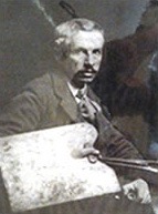 |
| Henry G Moon, artist |
 |
| Orchid Laelia Goldiana |
Frederick Sander, informally known as the Orchid King, had his nurseries in Camp Road from the 1880s, and in-law and artist Henry Moon produced slightly under two hundred stunning paintings of orchids. So, there are members of both families buried in the plot. The full story of the Orchid King can be found on the Frederick Sander & Henry Moon Tribute section of www.fleetvillediaries.org During the course of the project it was discovered that Moon had also undertaken similar paintings for Peter Barr, a daffodil hybridiser in Streatham. Peter, rather appropriately, had been known as the Daffodil King. So representatives of Barr's Streatham research group also joined the Tribute Day.
 |
| Before the restoration project began |
On a very hot day this week Fleetville Diaries invited some eighty guests, including the current generations of the Sander and Moon families to a special Tribute Day, firstly around the grave in Hatfield Road Cemetery, and then to refreshments and an exhibition at St Paul's Church. This was an occasion for some members of these two impressive families to meet each other for the very first time, and it is clear that they were overwhelmed by the recognition bestowed on them by the occasion.
 |
| The project on completion |
Subscribe to:
Posts (Atom)